

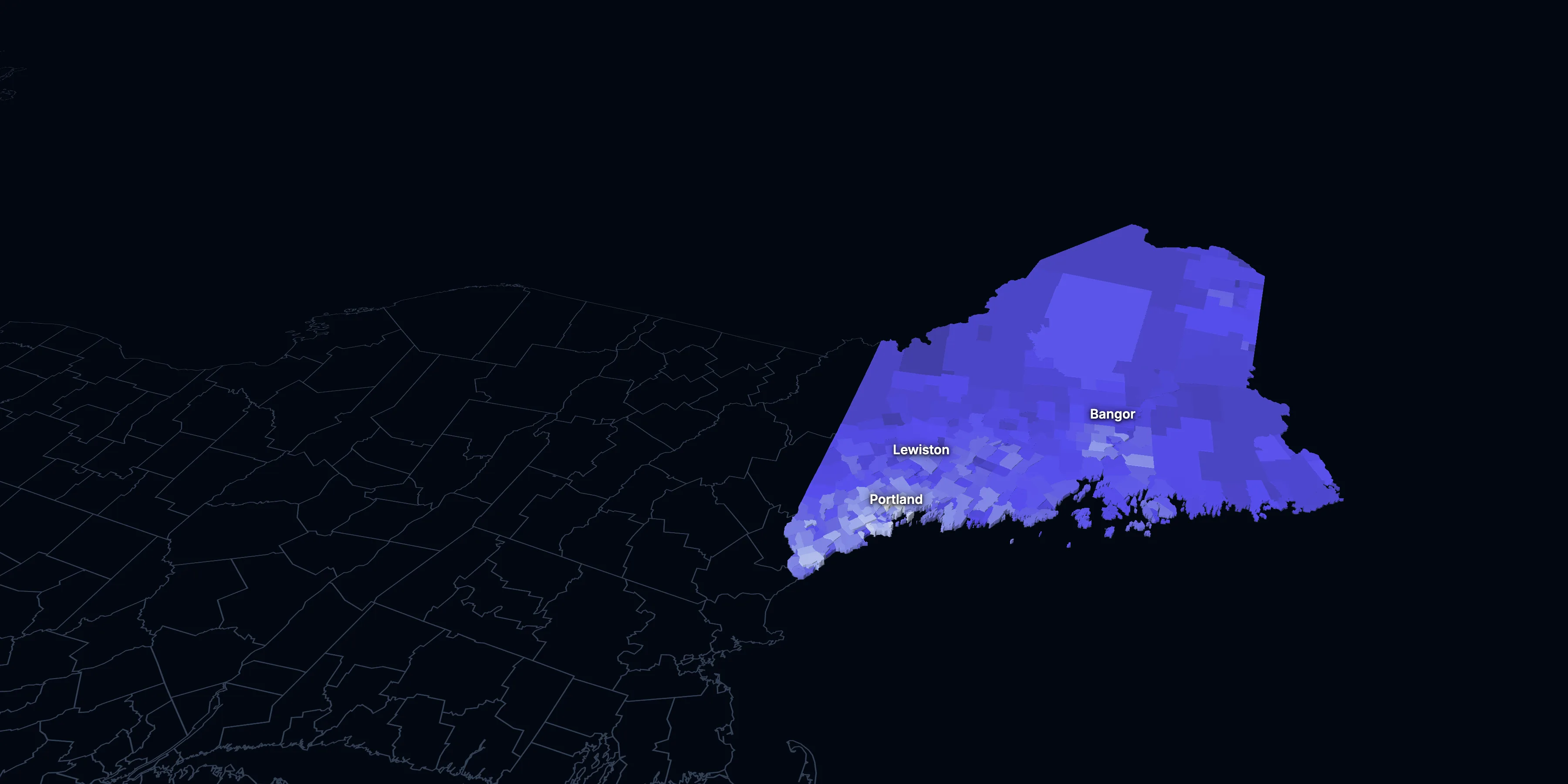
Maine: Population, demographics and census data
Home to 1,414,874 people, the 42nd largest of the 50 states and DC. It grew 6.4% between 2015 and 2025.
- Population
- 1.41M. Census Bureau estimate · Rank 42 of the 50 states and DC
- Median household income
- $81,760 ±$1,561. US $84,780
- Median age
- 45.1 ±0.2. US 39.5
ACS 2025 1-year estimates, U.S. Census Bureau
Taller, lighter tracts have higher household incomes
About Maine
Maine’s median household income is $81,760 (±$1,561), lower than the US ($84,780), and its median age is 45.1 (±0.2), according to the ACS 2025 1-year estimates. Its largest city is Portland.
± is each figure’s margin of error, at 90% confidence, and † marks one too uncertain to lean on. Under each percentage in the tables is the number it counts. How the margins are worked out.
FIPS code 23
Highlights
What stands out in Maine
The numbers where Maine sits furthest from the nation, or past a recognized policy benchmark.
Past a policy benchmark
31.6%
HighHomes built before 1960
That’s higher than the US (24.0%). Older homes carry more lead-paint risk: the EPA found lead paint in 69% of homes built from 1940 to 1959.
+7 points
ElevatedRent growth ahead of income
After inflation, rent grew 22% from 2015 to 2025, and household income 16%. The dots show rent growth.
Furthest from the national picture
24.7%
Highest among states65 and over
That’s higher than the US (19.0%). It’s the highest of the 50 states and DC.
45.1
Highest among statesMedian age
That’s higher than the US (39.5). It’s the highest of the 50 states and DC.
17.0%
2nd lowest among statesUnder 18
That’s lower than the US (21.0%). It’s the 2nd lowest of the 50 states and DC.
2.21
2nd lowest among statesPeople per household
That’s lower than the US (2.49). It’s the 2nd lowest of the 50 states and DC.
2015 to 2025
How Maine changed in ten years
The state added 85,546 people. It got older, more foreign-born and better educated, and poverty fell 3.4 points.
Population, change since 2015
+6.4% in the state and +6.3% in the US.
Source: ACS 1-year, 2015 to 2025, table A00001.
Show data
| Maine | United States | |
|---|---|---|
| 2015 | 0.0% | 0.0% |
| 2016 | +0.2% | +0.5% |
| 2017 | +0.5% | +1.3% |
| 2018 | +0.7% | +1.8% |
| 2019 | +1.1% | +2.1% |
| 2021 | +3.2% | +3.3% |
| 2022 | +4.2% | +3.7% |
| 2023 | +5.0% | +4.2% |
| 2024 | +5.7% | +5.8% |
| 2025 | +6.4% | +6.3% |
Embed
Median household income, in 2025 dollars
+15.9% in the state and +10.9% in the US.
Source: ACS 1-year, 2015 to 2025, table A14006.
Show data
| Maine | United States | |
|---|---|---|
| 2015 | $70,548 | $76,413 |
| 2016 | $71,793 | $77,931 |
| 2017 | $74,516 | $79,891 |
| 2018 | $71,871 | $80,059 |
| 2019 | $74,809 | $83,427 |
| 2021 | $77,591 | $83,521 |
| 2022 | $77,037 | $82,811 |
| 2023 | $78,443 | $82,683 |
| 2024 | $79,004 | $84,339 |
| 2025 | $81,760 | $84,780 |
Embed
Living in poverty
−3.4 points in the state and −3.0 points in the US.
Source: ACS 1-year, 2015 to 2025, table A13004.
Show data
| Maine | United States | |
|---|---|---|
| 2015 | 13.4% | 14.7% |
| 2016 | 12.5% | 14.0% |
| 2017 | 11.1% | 13.4% |
| 2018 | 11.6% | 13.1% |
| 2019 | 10.9% | 12.3% |
| 2021 | 11.5% | 12.8% |
| 2022 | 10.8% | 12.6% |
| 2023 | 10.4% | 12.5% |
| 2024 | 10.6% | 12.1% |
| 2025 | 9.9% | 11.8% |
Embed
Bachelor’s degree or more
+8.5 points in the state and +6.7 points in the US.
Source: ACS 1-year, 2015 to 2025, table A12001.
Show data
| Maine | United States | |
|---|---|---|
| 2015 | 30.1% | 30.6% |
| 2016 | 30.1% | 31.3% |
| 2017 | 32.1% | 32.0% |
| 2018 | 31.5% | 32.6% |
| 2019 | 33.2% | 33.1% |
| 2021 | 36.0% | 35.0% |
| 2022 | 36.1% | 35.7% |
| 2023 | 37.0% | 36.2% |
| 2024 | 37.1% | 36.8% |
| 2025 | 38.6% | 37.4% |
Embed
Median gross rent, in 2025 dollars
+22.5% in the state and +18.5% in the US.
Source: ACS 1-year, 2015 to 2025, table A18009.
Show data
| Maine | United States | |
|---|---|---|
| 2015 | $1,085 | $1,314 |
| 2016 | $1,078 | $1,327 |
| 2017 | $1,067 | $1,340 |
| 2018 | $1,084 | $1,368 |
| 2019 | $1,105 | $1,393 |
| 2021 | $1,132 | $1,427 |
| 2022 | $1,144 | $1,440 |
| 2023 | $1,265 | $1,496 |
| 2024 | $1,251 | $1,537 |
| 2025 | $1,329 | $1,557 |
Embed
Median home value, in 2025 dollars
+49.9% in the state and +39.3% in the US.
Source: ACS 1-year, 2015 to 2025, table A10036.
Show data
| Maine | United States | |
|---|---|---|
| 2015 | $247,015 | $266,469 |
| 2016 | $249,821 | $277,278 |
| 2017 | $253,168 | $288,124 |
| 2018 | $255,287 | $296,908 |
| 2019 | $254,552 | $305,336 |
| 2021 | $302,015 | $337,116 |
| 2022 | $321,916 | $355,481 |
| 2023 | $330,547 | $361,931 |
| 2024 | $353,358 | $372,685 |
| 2025 | $370,300 | $371,100 |
Embed
ACS 1-year estimates. The dotted stretch of each line spans 2020, when the Census Bureau released no standard 1-year estimates. Dollar values are in 2025 dollars.
| Indicator | 2015 | 2025 | Change |
|---|---|---|---|
| Population | 1,329,328 | 1,414,874 | +6.4% |
| Median age | 44.6 | 45.1 | +0.5 years |
| 65 and over | 18.8% | 24.7% | +5.8 points |
| Born outside the US | 3.4% | 4.7% | +1.4 points |
| Hispanic or Latino | 1.5% | 2.7% | +1.2 points |
| Median household income | $70,548 | $81,760 | +15.9% |
| Living in poverty | 13.4% | 9.9% | −3.4 points |
| Bachelor’s degree or more | 30.1% | 38.6% | +8.5 points |
| Households that rent | 29.0% | 26.0% | −3.0 points |
| Median gross rent | $1,085 | $1,329 | +22.5% |
| Median home value | $247,015 | $370,300 | +49.9% |
407 census tracts
Maine, tract by tract
State averages hide a lot. These census tracts are the closest the census comes to neighborhoods.
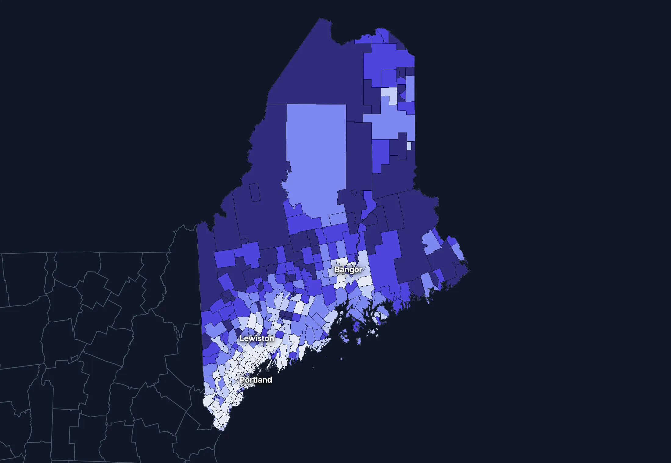
Where the state’s average misleads
Each tick is one census tract, and the dark line marks the state. Hover over a tick or tap it to see the tract.
Poverty
81 of 400 tracts are at least 1.5 times the state’s overall 10.7%, and 89 are at two-thirds of it or less.
Highest: Tract 204.02, 43.1%. Lowest: Tract 200.01, 1.3%.
Renters paying 30% or more of income
19 of 385 tracts are at least 1.5 times the state’s overall 44.1%, and 105 are at two-thirds of it or less.
Highest: Tract 360.04, 88.8%. Lowest: Tract 42.01, 0.0%.
Adults with a bachelor’s degree
50 of 400 tracts are at least 1.5 times the state’s overall 36.2%, and 120 are at two-thirds of it or less.
Highest: Tract 37.01, 80.7%. Lowest: Tract 265, 8.7%.
Median household income
36 of 399 tracts are at least 1.5 times the typical tract’s $72,083, and 32 are at two-thirds of it or less.
Highest: Tract 25.03, $195,781. Lowest: Tract 2, $24,353.
American Community Survey 2020–2024 5-year estimates, by census tract. Income is capped at $250,000+ by the Census Bureau.
People
Who lives in Maine
Its median age of 45.1 is higher than the US (39.5). 4.7% of residents were born outside the US, and 6.3% speak a language other than English at home.
Age
Source: ACS 2025 1-year, table A01001.
Show data
| Maine | United States | |
|---|---|---|
| Under 18 | 17.0% ±0.4% , number 240,847 ±5,727 | 21.0% ±<0.1% , number 71,689,151 ±111,800 |
| 18 to 24 | 7.9% ±0.3% , number 111,434 ±4,454 | 9.3% ±<0.1% , number 31,716,680 ±98,660 |
| 25 to 34 | 12.1% ±0.2% , number 170,592 ±3,105 | 13.6% ±<0.1% , number 46,357,354 ±55,690 |
| 35 to 44 | 13.0% ±0.4% , number 183,407 ±5,908 | 13.4% ±<0.1% , number 45,746,189 ±105,700 |
| 45 to 54 | 11.6% ±0.2% , number 163,453 ±2,811 | 11.8% ±<0.1% , number 40,257,563 ±53,540 |
| 55 to 64 | 13.8% ±0.4% , number 195,745 ±6,151 | 12.1% ±<0.1% , number 41,242,904 ±104,700 |
| 65 to 74 | 14.1% ±0.4% , number 199,493 ±5,451 | 10.8% ±<0.1% , number 36,895,650 ±91,520 |
| 75 and over | 10.6% ±0.3% , number 149,903 ±4,860 | 8.2% ±<0.1% , number 27,879,368 ±78,140 |
Embed
Race and ethnicity
Source: ACS 2025 1-year, table A04001.
Show data
| Maine | United States | |
|---|---|---|
| White, not Hispanic | 87.2% ±0.4% , number 1,233,474 ±5,262 | 55.0% ±<0.1% , number 187,959,031 ±58,340 |
| Hispanic or Latino | 2.7% ±0.1% , number 38,365 ±950 | 20.5% ±<0.1% , number 69,975,516 ±13,270 |
| Black, not Hispanic | 2.4% ±0.2% , number 34,569 ±2,476 | 11.7% ±<0.1% , number 40,096,453 ±106,200 |
| Asian, not Hispanic | 1.4% ±0.1% , number 19,206 ±1,932 | 6.5% ±<0.1% , number 22,096,709 ±58,340 |
| Other or multiracial | 6.3% ±0.5% , number 89,260 ±6,432 | 6.3% ±<0.1% , number 21,657,150 ±150,100 |
Embed
Language spoken at home
Source: ACS 2025 1-year, table C16001.
Show data
| Maine | United States | |
|---|---|---|
| English only | 93.7% ±0.4% , number 1,271,122 ±5,751 | 77.1% ±0.1% , number 249,390,588 ±275,300 |
| Spanish | 1.2% ±0.2% , number 15,970 ±2,586 | 13.9% ±0.1% , number 44,921,985 ±177,800 |
| Other Indo-European | 3.3% ±0.4% , number 44,838 ±4,946 | 4.0% ±<0.1% , number 12,862,980 ±113,500 |
| Asian and Pacific Island | 0.8% ±0.2% , number 11,147 ±2,618 | 3.8% ±<0.1% , number 12,288,841 ±99,740 |
| Arabic and other | 1.0% ±0.3% , number 13,921 ±3,771 | 1.3% ±<0.1% , number 4,116,949 ±71,480 |
Embed
Marital status
Source: ACS 2025 1-year, table A11001.
Show data
| Maine | United States | |
|---|---|---|
| Now married | 51.3% ±0.9% , number 626,633 ±10,960 | 47.9% ±0.1% , number 135,567,564 ±223,300 |
| Never married | 30.3% ±0.7% , number 369,569 ±8,312 | 34.8% ±0.1% , number 98,647,238 ±152,600 |
| Divorced | 12.2% ±0.5% , number 148,984 ±6,368 | 10.2% ±<0.1% , number 28,879,967 ±112,900 |
| Widowed | 5.6% ±0.3% , number 68,036 ±3,797 | 5.5% ±<0.1% , number 15,599,094 ±69,430 |
| Separated | 0.7% ±0.1% , number 8,075 ±1,263 | 1.6% ±<0.1% , number 4,441,399 ±49,160 |
Embed
Where people lived a year ago
Source: ACS 2025 1-year, table A08001.
Show data
| Maine | United States | |
|---|---|---|
| Same home | 89.4% ±0.6% , number 1,254,740 ±8,813 | 88.4% ±0.1% , number 298,889,697 ±214,800 |
| Same county | 4.8% ±0.5% , number 66,781 ±7,140 | 6.0% ±<0.1% , number 20,202,671 ±166,300 |
| Another county in the state | 2.6% ±0.3% , number 36,905 ±4,661 | 3.0% ±<0.1% , number 10,168,097 ±89,190 |
| Another state | 2.8% ±0.3% , number 39,199 ±4,634 | 2.1% ±<0.1% , number 7,025,589 ±81,660 |
| Another country | 0.4% ±0.1% , number 5,914 ±1,971 | 0.6% ±<0.1% , number 1,984,943 ±47,210 |
Embed
Top countries of birth, among those born abroad
Source: ACS 2020–2024 5-year, table A07001.
Show data
| Maine | |
|---|---|
| Canada | 18.2% , number 10,273 |
| Middle Africa | 7.5% , number 4,256 |
| China, Excluding Hong Kong and Taiwan | 4.5% , number 2,534 |
| Germany | 3.7% , number 2,078 |
| Philippines | 3.5% , number 1,962 |
| England | 3.2% , number 1,793 |
Embed
All the numbers
| Indicator | Maine | US | Rank among states* | Table |
|---|---|---|---|---|
| Population | 1,414,874 | 341,784,859 | 42nd | A00001 |
| People per square mile | 46 | 97 | 39th | A00002 |
| Land area (square miles) | 30,845 | – | – | A00002 |
| Median age | 45.1 ±0.2 | 39.5 ±0.1 | 1st | A01004 |
| Under 18 | 17.0% ±0.4% , number 240,847 ±5,727 | 21.0% ±<0.1% , number 71,689,151 ±111,800 | 50th | B02002 |
| 65 and over | 24.7% ±0.5% , number 349,396 ±7,303 | 19.0% ±<0.1% , number 64,775,018 ±120,300 | 1st | B02002 |
| Born outside the US | 4.7% ±0.3% , number 67,070 ±4,772 | 14.7% ±0.1% , number 50,409,320 ±204,800 | 45th | A06001 |
| Speak a language other than English at home | 6.3% ±0.4% , number 85,876 ±7,227 | 22.9% ±0.1% , number 74,190,755 ±244,000 | 47th | C16001 |
| Veterans (adults) | 7.6% ±0.4% , number 89,159 ±4,573 | 5.9% ±<0.1% , number 15,746,228 ±85,320 | 5th | A16002 |
| Living with a disability | 15.7% ±0.5% , number 219,424 ±7,639 | 13.7% ±<0.1% , number 46,271,455 ±126,000 | 9th | B18101 |
| Women 15–50 who had a baby in the past year | 4.4% ±0.7% , number 13,449 ±2,260 | 5.0% ±0.1% , number 4,016,759 ±44,040 | 46th | B13002 |
| Lived in the same home a year ago | 89.4% ±0.6% , number 1,254,740 ±8,813 | 88.4% ±0.1% , number 298,889,697 ±214,800 | 4th | A08001 |
| White, not Hispanic | 87.2% ±0.4% , number 1,233,474 ±5,262 | 55.0% ±<0.1% , number 187,959,031 ±58,340 | 2nd | A04001 |
| Hispanic or Latino | 2.7% ±0.1% , number 38,365 ±950 | 20.5% ±<0.1% , number 69,975,516 ±13,270 | 50th | A04001 |
| Black, not Hispanic | 2.4% ±0.2% , number 34,569 ±2,476 | 11.7% ±<0.1% , number 40,096,453 ±106,200 | 44th | A04001 |
| Asian, not Hispanic | 1.4% ±0.1% , number 19,206 ±1,932 | 6.5% ±<0.1% , number 22,096,709 ±58,340 | 47th | A04001 |
*1 is the highest. Population is ranked among all states, and the rest among those of 1,000 people or more, whose figures can be ranked. Ranks use 5-year estimates, the only ones covering every state, so they can differ slightly from the figures here.
Income and work
Lower incomes than the US
The median household income is $81,760, lower than the US ($84,780). 9.9% of people live in poverty, and 6.8% have no health insurance, lower than the US (8.4%).
Household income
Source: ACS 2025 1-year, table A14001.
Show data
| Maine | United States | |
|---|---|---|
| Under $25,000 | 13.9% ±0.8% , number 86,052 ±5,273 | 14.0% ±0.1% , number 18,727,548 ±88,990 |
| $25,000 to $49,999 | 15.7% ±0.9% , number 97,476 ±5,923 | 15.4% ±0.1% , number 20,665,585 ±101,400 |
| $50,000 to $74,999 | 16.3% ±0.9% , number 101,181 ±5,475 | 15.3% ±0.1% , number 20,513,565 ±88,500 |
| $75,000 to $99,999 | 13.6% ±0.7% , number 84,185 ±4,589 | 12.5% ±0.1% , number 16,814,245 ±87,520 |
| $100,000 to $149,999 | 19.0% ±0.9% , number 117,874 ±5,737 | 17.9% ±0.1% , number 24,018,984 ±99,670 |
| $150,000 to $199,999 | 10.0% ±0.6% , number 62,229 ±4,005 | 10.1% ±0.1% , number 13,521,827 ±70,660 |
| $200,000 or more | 11.6% ±0.6% , number 71,762 ±3,805 | 14.8% ±0.1% , number 19,801,668 ±84,120 |
Embed
What residents do for work
Source: ACS 2025 1-year, table A17004.
Show data
| Maine | United States | |
|---|---|---|
| Education and health care | 27.6% ±0.9% , number 196,178 ±7,017 | 24.4% ±0.1% , number 40,862,193 ±140,800 |
| Retail trade | 12.7% ±0.8% , number 90,510 ±5,506 | 10.6% ±0.1% , number 17,781,181 ±96,660 |
| Professional and business services | 11.3% ±0.6% , number 80,473 ±4,159 | 12.8% ±0.1% , number 21,375,231 ±87,110 |
| Manufacturing | 8.9% ±0.6% , number 63,414 ±4,496 | 9.6% ±0.1% , number 16,064,394 ±91,270 |
| Arts, food and lodging | 7.8% ±0.6% , number 55,151 ±4,255 | 8.9% ±0.1% , number 14,811,502 ±87,840 |
| Construction | 7.7% ±0.7% , number 54,936 ±5,007 | 6.7% ±<0.1% , number 11,254,981 ±79,620 |
| Finance, insurance and real estate | 6.2% ±0.6% , number 44,347 ±4,200 | 6.6% ±<0.1% , number 11,025,569 ±68,570 |
| Public administration | 4.7% ±0.5% , number 33,317 ±3,625 | 4.7% ±<0.1% , number 7,944,601 ±69,540 |
Embed
Where workers come from and go
Maine has 616,214 jobs and 632,130 employed residents. 20,412 people commute in to work and 36,328 commute out, while 595,802 both live and work here. The most commuters come from New Hampshire.
Most commuters come from
- New Hampshire: 10,746
- Massachusetts: 4,088
- New York: 994
Most residents commute to
- New Hampshire: 20,571
- Massachusetts: 8,398
- New York: 1,691
Show data
| Maine | |
|---|---|
| Live and work here | 595,802 |
| Work here, live elsewhere | 20,412 |
| Live here, work elsewhere | 36,328 |
Embed
All the numbers
| Indicator | Maine | US | Rank among states* | Table |
|---|---|---|---|---|
| Median household income | $81,760 ±$1,561 | $84,780 ±$215 | 33rd | A14006 |
| Income per person | $47,895 ±$1,006 | $47,171 ±$115 | 21st | A14024 |
| Income inequality (Gini index) | 0.458 ±0.009 | 0.482 ±0.001 | 38th | A14028 |
| Living in poverty | 9.9% ±0.6% , number 135,814 ±8,045 | 11.8% ±0.1% , number 39,264,183 ±277,400 | 33rd | A13004 |
| Unemployment rate | 3.3% ±0.4% , number 24,154 ±3,047 | 4.9% ±<0.1% , number 8,574,594 ±64,350 | 40th | A17005 |
| No health insurance | 6.8% ±0.5% , number 94,839 ±6,503 | 8.4% ±<0.1% , number 28,323,306 ±152,000 | 35th | A20001 |
*1 is the highest. Population is ranked among all states, and the rest among those of 1,000 people or more, whose figures can be ranked. Ranks use 5-year estimates, the only ones covering every state, so they can differ slightly from the figures here.
Education
College degrees close to the US
38.6% of adults 25 and over have a bachelor’s degree or more, higher than the US (37.4%).
Highest level of education
Source: ACS 2025 1-year, table A12001.
Show data
| Maine | United States | |
|---|---|---|
| Less than high school | 5.0% ±0.4% , number 52,917 ±4,054 | 9.4% ±0.1% , number 22,321,002 ±120,500 |
| High school only | 27.9% ±0.8% , number 296,786 ±8,493 | 25.6% ±0.1% , number 61,096,726 ±203,400 |
| Some college | 28.5% ±0.9% , number 302,775 ±9,856 | 27.7% ±0.1% , number 65,920,977 ±173,500 |
| Bachelor’s degree | 23.8% ±0.8% , number 253,013 ±9,037 | 22.3% ±0.1% , number 53,224,312 ±196,700 |
| Graduate degree | 14.8% ±0.7% , number 157,102 ±7,133 | 15.0% ±0.1% , number 35,816,011 ±159,400 |
Embed
All the numbers
| Indicator | Maine | US | Rank among states* | Table |
|---|---|---|---|---|
| Bachelor’s degree or more | 38.6% ±1.1% , number 410,115 ±11,510 | 37.4% ±0.1% , number 89,040,323 ±253,200 | 18th | A12001 |
| High school graduate or more | 95.0% ±1.6% , number 1,009,676 ±17,370 | 90.6% ±0.2% , number 216,058,026 ±368,200 | 2nd | A12001 |
*1 is the highest. Population is ranked among all states, and the rest among those of 1,000 people or more, whose figures can be ranked. Ranks use 5-year estimates, the only ones covering every state, so they can differ slightly from the figures here.
Housing
Home values outran incomes
26.0% of households rent, lower than the US (34.7%). The median home is worth $370,300 and the median rent is $1,329. After inflation, home values rose 50% from 2015 to 2025, while household income rose 16%.
Housing costs and income, 2015 to 2025, after inflation
Source: ACS 1-year, table A10036, A18009, A14006.
Show data
| Maine | United States | |
|---|---|---|
| Median home value | +49.9% | +39.3% |
| Median rent | +22.5% | +18.5% |
| Median household income | +15.9% | +10.9% |
Embed
Types of homes
Source: ACS 2025 1-year, table A10032.
Show data
| Maine | United States | |
|---|---|---|
| Single-family, detached | 69.0% ±0.9% , number 532,025 ±6,867 | 60.9% ±0.1% , number 90,335,844 ±173,300 |
| Single-family, attached | 2.9% ±0.4% , number 22,626 ±2,941 | 6.4% ±<0.1% , number 9,527,703 ±51,230 |
| 2 to 4 units | 10.4% ±0.7% , number 80,054 ±5,279 | 7.5% ±0.1% , number 11,109,005 ±75,790 |
| 5 to 19 units | 6.1% ±0.6% , number 46,708 ±4,650 | 8.7% ±0.1% , number 12,829,882 ±97,590 |
| 20 or more units | 4.0% ±0.5% , number 30,960 ±3,575 | 11.1% ±0.1% , number 16,381,450 ±92,310 |
| Mobile homes and other | 7.7% ±0.5% , number 59,114 ±3,751 | 5.4% ±<0.1% , number 8,045,083 ±53,680 |
Embed
When homes were built
Source: ACS 2025 1-year, table A10055.
Show data
| Maine | United States | |
|---|---|---|
| 2010 or later | 11.3% ±0.7% , number 69,893 ±4,707 | 15.1% ±0.1% , number 20,257,912 ±101,300 |
| 2000 to 2009 | 11.6% ±0.6% , number 71,832 ±3,990 | 13.8% ±0.1% , number 18,535,840 ±92,260 |
| 1980 to 1999 | 25.1% ±1.1% , number 155,595 ±6,819 | 24.1% ±0.1% , number 32,332,570 ±118,900 |
| 1960 to 1979 | 20.5% ±0.9% , number 127,132 ±5,874 | 22.9% ±0.1% , number 30,726,302 ±110,000 |
| Before 1960 | 31.6% ±1.2% , number 196,307 ±7,661 | 24.0% ±0.1% , number 32,210,798 ±121,500 |
Embed
All the numbers
| Indicator | Maine | US | Rank among states* | Table |
|---|---|---|---|---|
| Housing units | 771,487 | – | – | A10001 |
| Households | 620,759 ±6,210 | – | – | A10008 |
| People per household | 2.21 ±0.02 | 2.49 ±0.01 | 50th | A10003 |
| Households that rent | 26.0% ±1.0% , number 161,595 ±6,686 | 34.7% ±0.1% , number 46,551,688 ±193,200 | 50th | A10060 |
| Vacant homes | 19.5% ±0.8% , number 150,728 ±6,265 | 9.6% ±0.1% , number 14,165,545 ±137,100 | 1st | A10047, A10060 |
| Median gross rent | $1,329 ±$43 | $1,557 ±$4 | 31st | A18009 |
| Median home value | $370,300 ±$5,877 | $371,100 ±$646 | 27th | A10036 |
| Renters paying 30% or more of income | 45.2% ±3.1% , number 73,048 ±5,844 | 48.3% ±0.2% , number 22,486,693 ±122,100 | 33rd | A18002 |
| Owners paying 30% or more of income | 22.8% ±1.1% , number 104,752 ±5,427 | 24.2% ±0.1% , number 21,201,943 ±93,050 | 21st | A10040 |
| Homes built before 1960 | 31.6% ±1.2% , number 196,307 ±7,661 | 24.0% ±0.1% , number 32,210,798 ±121,500 | 14th | A10055 |
*1 is the highest. Population is ranked among all states, and the rest among those of 1,000 people or more, whose figures can be ranked. Ranks use 5-year estimates, the only ones covering every state, so they can differ slightly from the figures here.
Getting around
A driving state with short commutes
71.9% of workers drive alone and 13.7% work from home. 34.0% of those who travel to work spend 30 minutes or more getting there, and 7.2% of households have no vehicle.
How people get to work
Source: ACS 2025 1-year, table A09005.
Show data
| Maine | United States | |
|---|---|---|
| Drive alone | 71.9% ±1.0% , number 503,705 ±9,212 | 69.8% ±0.1% , number 115,297,377 ±192,900 |
| Carpool | 8.5% ±0.7% , number 59,534 ±4,628 | 8.9% ±0.1% , number 14,712,170 ±97,240 |
| Public transit | 1.1% ±0.3% , number 7,660 ±1,926 | 4.3% ±<0.1% , number 7,100,386 ±63,330 |
| Walk | 3.4% ±0.5% , number 23,471 ±3,177 | 2.4% ±<0.1% , number 4,016,469 ±41,070 |
| Work from home | 13.7% ±0.8% , number 96,215 ±5,487 | 12.9% ±0.1% , number 21,288,393 ±105,700 |
| Other | 1.4% ±0.3% , number 9,787 ±1,897 | 1.7% ±<0.1% , number 2,799,658 ±41,510 |
Embed
Time spent getting to work
Source: ACS 2025 1-year, table B09001.
Show data
| Maine | United States | |
|---|---|---|
| Under 10 minutes | 17.5% ±1.1% , number 105,560 ±7,141 | 12.0% ±0.1% , number 17,199,225 ±93,440 |
| 10 to 19 minutes | 28.1% ±1.2% , number 170,043 ±7,924 | 27.8% ±0.1% , number 40,059,540 ±137,700 |
| 20 to 29 minutes | 20.4% ±1.0% , number 123,434 ±6,407 | 21.0% ±0.1% , number 30,221,743 ±111,100 |
| 30 to 39 minutes | 15.2% ±0.8% , number 91,999 ±5,281 | 17.1% ±0.1% , number 24,659,138 ±103,800 |
| 40 to 59 minutes | 11.3% ±0.8% , number 67,997 ±5,196 | 12.6% ±0.1% , number 18,104,709 ±97,070 |
| 60 minutes or more | 7.5% ±0.6% , number 45,124 ±3,559 | 9.5% ±0.1% , number 13,681,705 ±84,440 |
Embed
Vehicles per household
Source: ACS 2025 1-year, table A10030.
Show data
| Maine | United States | |
|---|---|---|
| None | 7.2% ±0.6% , number 44,822 ±3,896 | 8.8% ±0.1% , number 11,781,997 ±77,240 |
| One | 31.9% ±1.2% , number 198,208 ±7,491 | 33.1% ±0.1% , number 44,424,682 ±160,700 |
| Two | 39.5% ±1.1% , number 245,298 ±7,021 | 36.0% ±0.1% , number 48,200,889 ±176,800 |
| Three or more | 21.3% ±0.9% , number 132,431 ±5,702 | 22.1% ±0.1% , number 29,655,854 ±113,300 |
Embed
All the numbers
| Indicator | Maine | US | Rank among states* | Table |
|---|---|---|---|---|
| Drive to work alone | 71.9% ±1.0% , number 503,705 ±9,212 | 69.8% ±0.1% , number 115,297,377 ±192,900 | 30th | A09005 |
| Take public transit | 1.1% ±0.3% , number 7,660 ±1,926 | 4.3% ±<0.1% , number 7,100,386 ±63,330 | 38th | A09005 |
| Work from home | 13.7% ±0.8% , number 96,215 ±5,487 | 12.9% ±0.1% , number 21,288,393 ±105,700 | 18th | A09005 |
| Commute 30 minutes or more | 34.0% ±1.2% , number 205,120 ±8,219 | 39.2% ±0.1% , number 56,445,552 ±165,300 | 29th | B09001 |
| Households with no vehicle | 7.2% ±0.6% , number 44,822 ±3,769 | 8.8% ±<0.1% , number 11,781,997 ±64,240 | 20th | A10030 |
*1 is the highest. Population is ranked among all states, and the rest among those of 1,000 people or more, whose figures can be ranked. Ranks use 5-year estimates, the only ones covering every state, so they can differ slightly from the figures here.
Places
The largest cities in Maine
Population, from the latest estimates available. Figures cover the whole of each place.
Largest cities
States like this one
- Pennsylvania: 13,018,639
- New Hampshire: 1,394,868
- Delaware: 1,021,191
- Vermont: 647,106
States at least a third this size, with the closest income, education, age, housing and origins.
Every county and place in Maine
Find any county, city, town, metro area, ZIP code, school district or district in Maine.
Counties
Each of the 16 counties with its population, from ACS 2020–2024 5-year estimates.
- Androscoggin County113,423
- Aroostook County67,058
- Cumberland County308,827
- Franklin County30,413
- Hancock County56,460
- Kennebec County126,808
- Knox County41,003
- Lincoln County36,099
- Oxford County59,255
- Penobscot County154,710
- Piscataquis County17,263
- Sagadahoc County37,285
- Somerset County50,959
- Waldo County40,192
- Washington County31,331
- York County216,731
Cities, towns and other places
Each of the 155 with its population, from ACS 2020–2024 5-year estimates. Census-designated places are communities without a local government of their own, drawn by the Census Bureau so they can be counted.
- Alfred661
- Anson680
- Ashland614
- Auburn24,602
- Augusta19,077
- Bangor31,938
- Bar Harbor2,296
- Bath8,815
- Belfast6,986
- Berwick1,998
- Bethel537
- Biddeford22,498
- Bingham564
- Blaine206
- Blue Hill799
- Boothbay Harbor1,047
- Bowdoinham766
- Bradley845
- Brewer9,652
- Bridgton1,756
- Brownville Junction524
- Brunswick17,652
- Bucksport3,105
- Calais3,097
- Camden3,682
- Cape Neddick2,453
- Caribou7,382
- Casco618
- Castine996
- Chisholm988
- Clinton1,381
- Corinna711
- Cornish1,024
- Cousins Island658
- Cumberland Center2,790
- Damariscotta1,100
- Danforth452
- Dexter1,852
- Dixfield1,738
- Dover-Foxcroft2,745
- Dunstan2,363
- Eagle Lake360
- East Millinocket1,495
- Eastport1,263
- Ellsworth8,657
- Fairfield2,356
- Falmouth1,585
- Falmouth Foreside2,051
- Farmingdale2,064
- Farmington4,705
- Fort Fairfield1,533
- Fort Kent2,398
- Freeport1,441
- Fryeburg1,484
- Gardiner6,088
- Gorham7,593
- Grand Isle243
- Gray938
- Greene1,004
- Greenville840
- Guilford626
- Hallowell2,592
- Hampden5,161
- Hartland561
- Houlton5,082
- Howland1,235
- Island Falls359
- Jonesport571
- Kennebunk6,221
- Kennebunkport1,276
- Kezar Falls819
- Kingfield586
- Kittery5,110
- Kittery Point935
- Lake Arrowhead3,322
- Lewiston38,324
- Limestone1,079
- Lincoln2,954
- Lisbon3,612
- Lisbon Falls4,267
- Little Falls718
- Littlejohn Island73
- Livermore Falls1,409
- Lubec277
- Machias1,316
- Madawaska3,022
- Madison2,676
- Mapleton705
- Mars Hill841
- Mattawamkeag436
- Mechanic Falls1,991
- Mexico2,142
- Milbridge326
- Milford2,269
- Millinocket3,779
- Milo1,347
- Naples527
- Newcastle664
- Newport1,730
- Norridgewock1,378
- North Anson445
- North Berwick1,702
- North Windham5,417
- Northeast Harbor419
- Norway3,173
- Oak Hill5,631
- Oakfield449
- Oakland2,710
- Old Orchard Beach9,244
- Old Town7,470
- Orono11,151
- Oxford1,106
- Patten607
- Pittsfield3,084
- Portland68,854
- Presque Isle8,736
- Randolph1,610
- Rangeley407
- Richmond2,089
- Rockland7,035
- Rumford4,067
- Sabattus134
- Saco20,819
- Sanford22,247
- Searsport1,218
- Skowhegan6,662
- South Berwick3,381
- South Eliot4,203
- South Paris2,210
- South Portland26,930
- South Windham1,212
- Southwest Harbor566
- Standish360
- Steep Falls1,861
- Thomaston2,055
- Topsham7,271
- Turner505
- Unity333
- Van Buren1,634
- Vanceboro122
- Veazie1,847
- Waldoboro1,459
- Washburn888
- Waterville17,077
- West Kennebunk1,395
- Westbrook20,775
- Wilton1,687
- Winslow5,873
- Winter Harbor371
- Winterport1,057
- Winthrop3,108
- Wiscasset898
- Woodland932
- Yarmouth6,289
- York Harbor4,240
Metro and micro areas
Each of the 4 that reach into Maine, with its whole population, from ACS 2020–2024 5-year estimates. Metro and micro areas are counties tied together by commuting, drawn by the Office of Management and Budget.
ZIP codes
Each of the 417 with people in it, by the town it's centered in, from ACS 2020–2024 5-year estimates. These are the Census Bureau's ZIP Code Tabulation Areas, which follow the Postal Service's ZIP codes as closely as census blocks allow.
- 03901Berwick8,175
- 03902Cape Neddick2,665
- 03903South Eliot7,146
- 03904Kittery8,389
- 03905Kittery Point2,084
- 03906North Berwick5,368
- 03907Cape Neddick1,379
- 03908South Berwick7,431
- 03909York Harbor10,943
- 03910Cape Neddick15
- 03911York Harbor363
- 040012,721
- 04002Alfred7,737
- 04003Littlejohn Island183
- 04005Biddeford24,772
- 04006Biddeford39
- 04008Bowdoinham3,142
- 04009Bridgton5,478
- 04010Fryeburg1,830
- 04011Brunswick22,336
- 04015Casco3,696
- 04017Littlejohn Island555
- 04019Portland93
- 04020Cornish1,803
- 04021Cumberland Center6,990
- 04022Bridgton1,054
- 04024Steep Falls356
- 04027Sanford6,629
- 04029Naples2,086
- 04030Lake Arrowhead2,731
- 04032Freeport8,802
- 04037Fryeburg4,024
- 04038Gorham18,300
- 04039Gray8,102
- 04040Bridgton3,050
- 04041Kezar Falls1,748
- 04042Lake Arrowhead4,872
- 04043West Kennebunk11,820
- 04046Biddeford8,102
- 04047Kezar Falls1,715
- 04048Lake Arrowhead3,400
- 04049Steep Falls4,017
- 04050Portland249
- 040511,353
- 04055Naples3,985
- 04056Lake Arrowhead100
- 04057Bridgton164
- 04061Lake Arrowhead3,074
- 04062North Windham19,188
- 04063Old Orchard Beach612
- 04064Old Orchard Beach8,632
- 04066Littlejohn Island837
- 04068Kezar Falls1,746
- 04069Freeport1,696
- 04071North Windham4,971
- 04072Saco20,819
- 04073Sanford17,414
- 04074Oak Hill23,076
- 04076Alfred2,976
- 04079Brunswick4,026
- 04083Sanford4,833
- 04084Standish7,900
- 04085Steep Falls2,762
- 04086Topsham9,706
- 04087Lake Arrowhead2,250
- 04088Norway1,269
- 04090North Berwick11,713
- 04091Cornish801
- 04092Westbrook20,775
- 04093Gorham8,512
- 04095Lake Arrowhead1,480
- 04096Cousins Island9,053
- 04097Cumberland Center4,240
- 04101Portland18,431
- 04102Portland17,267
- 04103Portland32,024
- 04105Falmouth12,755
- 04106South Portland27,019
- 04107South Portland9,656
- 04108Portland826
- 04109Portland213
- 04110Falmouth Foreside1,657
- 04210Auburn24,602
- 04216578
- 04217Bethel3,387
- 042191,399
- 04220Turner3,717
- 04221Chisholm1,191
- 04222Lisbon Falls4,262
- 04224Dixfield3,110
- 04226Rumford101
- 04227Wilton35
- 04231271
- 04236Greene4,417
- 04237Bethel276
- 04238Mechanic Falls1,105
- 04239Chisholm4,657
- 04240Lewiston38,324
- 04250Lisbon4,782
- 04252Lisbon Falls4,968
- 04253Livermore Falls1,868
- 04254Livermore Falls3,102
- 04255Bethel759
- 04256Mechanic Falls3,134
- 04257Mexico2,782
- 04258Mechanic Falls2,794
- 04259Winthrop3,610
- 04260Gray5,766
- 04261268
- 04263Turner2,285
- 04265Winthrop552
- 0426726
- 04268Norway5,228
- 04270Oxford6,284
- 04274Mechanic Falls5,954
- 04275526
- 04276Rumford5,942
- 04280Sabattus7,040
- 04281South Paris5,317
- 04282Turner5,891
- 04284Winthrop1,101
- 04285459
- 04287Bowdoinham3,188
- 04289Norway1,808
- 04290Dixfield1,501
- 04292845
- 04294Wilton3,982
- 04330Augusta26,690
- 0434142
- 04342Richmond1,645
- 04344Hallowell3,017
- 04345Gardiner12,579
- 04346Randolph1,610
- 04347Hallowell2,592
- 043483,484
- 04349Livermore Falls1,383
- 04350Gardiner3,680
- 04351Hallowell2,424
- 043521,716
- 04353Randolph2,115
- 043541,473
- 04355Winthrop2,651
- 04357Richmond3,566
- 043584,526
- 04359Gardiner298
- 04360536
- 04363Augusta2,690
- 04364Winthrop6,191
- 04401Bangor44,854
- 04406675
- 04408194
- 044101,254
- 04411Bradley1,645
- 04412Brewer9,652
- 04413Danforth162
- 04414Brownville Junction1,766
- 04415Brownville Junction215
- 04416Bucksport5,497
- 04417355
- 044181,649
- 04419Hampden2,941
- 04421Castine1,362
- 044221,117
- 04424Danforth983
- 04426Dover-Foxcroft4,999
- 044272,990
- 04428Bradley3,334
- 04429Brewer5,008
- 04430East Millinocket1,495
- 04431Bucksport63
- 04434Newport1,252
- 04435Corinna1,093
- 04438Winterport1,098
- 044411,839
- 04442Greenville208
- 04443Guilford2,211
- 04444Hampden9,371
- 04448Howland1,540
- 04449Old Town1,251
- 04450Bangor1,333
- 04451Mattawamkeag217
- 04453Howland785
- 04454Vanceboro11
- 04455925
- 044563,069
- 04457Lincoln5,823
- 04459Mattawamkeag750
- 04460East Millinocket1,111
- 04461Milford3,095
- 044624,464
- 04463Milo2,582
- 04464596
- 04468Old Town9,291
- 04469Orono3,531
- 04471730
- 04472Bucksport1,852
- 04473Orono8,371
- 04474Hampden3,853
- 04475Howland384
- 04476Castine1,154
- 04478316
- 04479Dover-Foxcroft1,136
- 04481Dover-Foxcroft547
- 04485Greenville234
- 04487838
- 04488Newport1,151
- 04489Old Town214
- 04490228
- 04491Vanceboro122
- 04492175
- 04493Lincoln1,840
- 04495Mattawamkeag287
- 04496Winterport3,850
- 04497311
- 04530Bath11,275
- 04535Newcastle818
- 04537Boothbay Harbor1,685
- 04538Boothbay Harbor1,810
- 04539Damariscotta1,456
- 04541Boothbay Harbor45
- 04543Damariscotta2,192
- 04544Boothbay Harbor978
- 04547Waldoboro1,213
- 04548Boothbay Harbor1,012
- 04551Damariscotta917
- 04553Newcastle1,913
- 04554Boothbay Harbor514
- 04555Newcastle1,906
- 04556Wiscasset1,251
- 04558Boothbay Harbor382
- 045622,238
- 04563Thomaston1,460
- 04564Damariscotta520
- 04568Boothbay Harbor512
- 04570Boothbay Harbor3
- 04571Boothbay Harbor439
- 04572Waldoboro5,253
- 04573Damariscotta557
- 045741,624
- 04575Boothbay Harbor286
- 04576Boothbay Harbor547
- 04578Wiscasset4,709
- 04579Bath3,158
- 04605Ellsworth14,529
- 04606Jonesport1,045
- 04607Winter Harbor1,142
- 04609Bar Harbor5,244
- 04611Jonesport498
- 04612Southwest Harbor505
- 04613Winter Harbor92
- 04614Blue Hill2,813
- 04616Blue Hill869
- 04617Castine651
- 04619Calais3,097
- 046221,050
- 046231,173
- 04624Winter Harbor225
- 04625Northeast Harbor62
- 04626492
- 046272,137
- 04628582
- 046301,230
- 04631Eastport1,263
- 046342,374
- 0463530
- 046402,450
- 04642Castine202
- 04643Milbridge917
- 0464569
- 04646Northeast Harbor134
- 04648Machias570
- 04649Jonesport1,166
- 04650Castine333
- 04652Lubec1,525
- 04653Southwest Harbor719
- 04654Machias3,340
- 04655Machias1,016
- 04657326
- 04658Milbridge1,222
- 04660Southwest Harbor1,072
- 04662Northeast Harbor476
- 046641,246
- 046661,178
- 04667Eastport1,296
- 046682,010
- 04669Winter Harbor171
- 04671Calais621
- 04673Blue Hill144
- 04674Southwest Harbor284
- 04675Northeast Harbor123
- 04676Blue Hill1,130
- 04677Bar Harbor345
- 04679Southwest Harbor1,553
- 04680Milbridge1,388
- 04681840
- 04684Blue Hill1,836
- 04685438
- 04686328
- 04691499
- 04693Winter Harbor493
- 04694Woodland2,155
- 04730Houlton10,106
- 04732Ashland1,427
- 04733465
- 04734Blaine804
- 04735492
- 04736Caribou9,025
- 04739Eagle Lake825
- 04740Presque Isle1,433
- 04742Fort Fairfield3,309
- 04743Fort Kent4,770
- 04745Madawaska971
- 04746Grand Isle407
- 04747Island Falls1,316
- 04750Limestone1,815
- 04756Madawaska3,341
- 04757Mapleton2,627
- 04758Mars Hill1,405
- 04760674
- 04761Houlton372
- 04762494
- 04763Oakfield629
- 0476488
- 047651,434
- 04766Washburn326
- 04768374
- 04769Presque Isle8,736
- 04772Madawaska842
- 04773Grand Isle550
- 04774624
- 04776999
- 04777478
- 04779446
- 04780Oakfield783
- 04781Fort Kent528
- 04783545
- 04785Van Buren2,073
- 04786Washburn1,599
- 04787Mars Hill382
- 04841Rockland7,035
- 04843Camden5,242
- 04847Camden1,748
- 04848Castine636
- 04849Camden4,017
- 0485148
- 04852120
- 04853480
- 04854Thomaston1,482
- 04855313
- 04856Camden3,675
- 04858Thomaston1,378
- 04859Thomaston753
- 048601,543
- 04861Thomaston2,769
- 048624,023
- 048631,216
- 04864Thomaston4,932
- 04901Winslow27,870
- 04910Winslow2,204
- 04911Anson1,880
- 04912858
- 04915Belfast9,107
- 04917Oakland3,351
- 04920Bingham1,866
- 049211,775
- 04922Unity953
- 04923Dexter532
- 04924Hartland2,063
- 04925101
- 04927Clinton3,385
- 04928Corinna2,192
- 04929Pittsfield650
- 04930Dexter4,258
- 049321,207
- 04936232
- 04937Fairfield6,358
- 04938Farmington10,542
- 04939Dexter823
- 049411,577
- 049421,192
- 04943Hartland1,602
- 04944Norridgewock140
- 049451,325
- 04947Kingfield1,596
- 04949969
- 04950Madison4,782
- 049511,001
- 04952Belfast1,790
- 04953Newport3,143
- 04955Farmington1,550
- 04956Farmington607
- 04957Norridgewock4,006
- 04958North Anson2,002
- 04961919
- 04963Oakland7,524
- 04964Rangeley108
- 04965Pittsfield2,209
- 049661,632
- 04967Pittsfield3,930
- 04969Newport1,319
- 04970Rangeley1,105
- 04971Hartland1,831
- 04973Belfast1,646
- 04974Searsport2,655
- 04975Fairfield21
- 04976Skowhegan10,072
- 04978Norridgewock856
- 04979North Anson963
- 04981Searsport2,575
- 04982269
- 04983Kingfield2,005
- 04984Farmington824
- 04985217
- 04986Unity2,228
- 04987Unity984
- 04988Unity1,894
- 04989Augusta4,592
Towns and townships
Each of the 459 with people in it, from ACS 2020–2024 5-year estimates: the county subdivisions that are governments of their own. A city, borough or village that is one too is listed with the places above.
- Abbot town584
- Acton town2,721
- Addison town1,045
- Albion town2,204
- Alexander town553
- Alfred town3,125
- Allagash town224
- Alna town818
- Alton town819
- Amherst town424
- Amity town395
- Andover town679
- Anson town2,331
- Appleton town1,360
- Arrowsic town597
- Arundel town4,418
- Ashland town1,080
- Athens town791
- Aurora town132
- Avon town359
- Baileyville town1,339
- Baldwin town1,170
- Bar Harbor town5,244
- Baring plantation166
- Beals town498
- Beaver Cove town394
- Beddington town38
- Belgrade town3,351
- Belmont town876
- Benton town2,770
- Berwick town8,175
- Bethel town2,617
- Bingham town660
- Blaine town706
- Blue Hill town2,813
- Boothbay Harbor town2,096
- Boothbay town3,102
- Bowdoin town3,188
- Bowdoinham town3,142
- Bowerbank town211
- Bradford town1,254
- Bradley town1,645
- Bremen town917
- Bridgewater town484
- Bridgton town5,642
- Brighton plantation98
- Bristol town2,917
- Brooklin town869
- Brooks town1,208
- Brooksville town853
- Brownfield town1,830
- Brownville town983
- Brunswick town22,336
- Buckfield town2,403
- Bucksport town5,016
- Burlington town328
- Burnham town953
- Buxton town8,512
- Byron town174
- Cambridge town532
- Camden town5,242
- Canaan town2,063
- Canton town1,191
- Cape Elizabeth town9,606
- Caratunk town101
- Carmel town2,941
- Carrabassett Valley town637
- Carroll plantation134
- Carthage town845
- Casco town3,696
- Castine town1,362
- Castle Hill town281
- Caswell town243
- Chapman town388
- Charleston town1,117
- Charlotte town377
- Chebeague Island town555
- Chelsea town2,823
- Cherryfield town809
- Chester town598
- Chesterville town1,397
- China town4,526
- Clifton town1,111
- Clinton town3,385
- Columbia Falls town475
- Columbia town529
- Cooper town157
- Coplin plantation51
- Corinna town2,192
- Corinth town2,990
- Cornish town1,803
- Cornville town1,419
- Cranberry Isles town196
- Crawford town97
- Crystal town247
- Cumberland town8,647
- Cushing town1,460
- Cutler town492
- Cyr plantation59
- Dallas plantation220
- Damariscotta town2,192
- Danforth town666
- Dayton town2,313
- Deblois town148
- Dedham town1,656
- Deer Isle town2,470
- Denmark town1,054
- Dennistown plantation134
- Dennysville town218
- Detroit town650
- Dexter town3,822
- Dixfield town2,300
- Dixmont town1,207
- Dover-Foxcroft town4,506
- Dresden town1,645
- Durham town4,262
- Dyer Brook town275
- Eagle Lake town570
- East Machias town1,223
- East Millinocket town1,495
- Eastbrook town742
- Easton town1,433
- Eddington town2,223
- Edgecomb town1,251
- Edinburg town172
- Eliot town7,146
- Embden town995
- Enfield town1,462
- Etna town1,252
- Eustis town453
- Exeter town1,093
- Fairfield town6,519
- Falmouth town12,755
- Farmingdale town3,017
- Farmington town8,157
- Fayette town1,383
- Fort Fairfield town3,309
- Fort Kent town4,150
- Frankfort town1,098
- Franklin town1,628
- Freedom town670
- Freeport town8,802
- Frenchboro town30
- Frenchville town971
- Friendship town1,213
- Frye Island town34
- Fryeburg town3,489
- Garfield plantation77
- Garland town823
- Georgetown town1,012
- Gilead town187
- Glenburn town4,737
- Glenwood plantation6
- Gorham town18,300
- Gouldsboro town1,615
- Grand Isle town407
- Grand Lake Stream plantation169
- Gray town8,429
- Great Pond town42
- Greenbush town1,378
- Greene town4,417
- Greenville town1,355
- Greenwood town781
- Guilford town1,096
- Hamlin town111
- Hammond town65
- Hampden town7,896
- Hancock town2,518
- Hanover town276
- Harmony town974
- Harpswell town5,046
- Harrington town917
- Harrison town2,513
- Hartford town1,314
- Hartland town1,602
- Haynesville town131
- Hebron town1,105
- Hermon town6,727
- Hersey town47
- Highland plantation154
- Hiram town1,748
- Hodgdon town1,428
- Holden town3,352
- Hollis town4,872
- Hope town1,748
- Houlton town6,056
- Howland town1,367
- Hudson town1,305
- Industry town988
- Island Falls town768
- Isle au Haut town69
- Islesboro town636
- Jackman town695
- Jackson town567
- Jay town4,657
- Jefferson town2,647
- Jonesboro town570
- Jonesport town1,166
- Kenduskeag town1,333
- Kennebunk town11,820
- Kennebunkport town3,684
- Kingfield town820
- Kingsbury plantation17
- Kittery town10,473
- Knox town825
- Lagrange town709
- Lake View plantation181
- Lakeville town99
- Lamoine town1,782
- Lebanon town6,629
- Lee town925
- Leeds town2,285
- Levant town3,069
- Liberty town969
- Limerick town3,400
- Limestone town1,579
- Limington town4,017
- Lincoln plantation47
- Lincoln town4,890
- Lincolnville town2,396
- Linneus town1,226
- Lisbon town9,750
- Litchfield town3,680
- Littleton town887
- Livermore Falls town3,102
- Livermore town1,868
- Long Island town249
- Lovell town1,353
- Lowell town378
- Lubec town1,346
- Ludlow town444
- Lyman town4,612
- Machias town2,020
- Machiasport town1,016
- Macwahoc plantation79
- Madawaska town3,853
- Madison town4,782
- Manchester town2,424
- Mapleton town1,884
- Mariaville town724
- Mars Hill town1,398
- Marshfield town499
- Masardis town258
- Matinicus Isle plantation48
- Mattawamkeag town698
- Maxfield town76
- Mechanic Falls town3,134
- Meddybemps town139
- Medford town222
- Medway town996
- Mercer town718
- Merrill town372
- Mexico town2,782
- Milbridge town1,222
- Milford town3,095
- Millinocket town4,115
- Milo town2,165
- Minot town2,794
- Monhegan plantation120
- Monmouth town4,162
- Monroe town1,001
- Monson town596
- Monticello town674
- Montville town907
- Moose River town248
- Moro plantation10
- Morrill town914
- Moscow town865
- Mount Chase town280
- Mount Desert town1,671
- Mount Vernon town1,716
- Naples town3,985
- Nashville plantation12
- New Canada town449
- New Gloucester town5,766
- New Limerick town372
- New Portland town686
- New Sharon town1,550
- New Sweden town494
- New Vineyard town607
- Newburgh town1,475
- Newcastle town1,913
- Newfield town1,580
- Newport town3,143
- Newry town177
- Nobleboro town1,906
- Norridgewock town3,288
- North Berwick town5,129
- North Haven town480
- North Yarmouth town4,240
- Northfield town263
- Northport town1,621
- Norway town5,228
- Oakfield town629
- Oakland town6,309
- Ogunquit town1,379
- Old Orchard Beach town9,244
- Orient town137
- Orland town1,915
- Orono town11,902
- Orrington town3,853
- Osborn town88
- Otis town705
- Otisfield town1,951
- Owls Head town1,482
- Oxford town4,333
- Palermo town1,473
- Palmyra town2,209
- Paris town5,317
- Parkman town896
- Parsonsfield town1,715
- Passadumkeag town384
- Patten town1,154
- Pembroke town801
- Penobscot town1,154
- Perham town326
- Perry town744
- Peru town1,501
- Phillips town1,094
- Phippsburg town2,238
- Pittsfield town3,930
- Pittston town3,093
- Pleasant Ridge plantation87
- Plymouth town1,319
- Poland town5,954
- Portage Lake town374
- Porter town1,746
- Pownal town1,696
- Princeton town866
- Prospect town923
- Randolph town1,610
- Rangeley plantation81
- Rangeley town792
- Raymond town4,610
- Readfield town2,651
- Reed plantation105
- Richmond town3,566
- Ripley town436
- Robbinston town621
- Rockport town3,675
- Rome town1,215
- Roque Bluffs town369
- Roxbury town352
- Rumford town5,942
- Sabattus town5,116
- Sandy River plantation90
- Sangerville town1,136
- Scarborough town23,215
- Searsmont town1,646
- Searsport town2,655
- Sebago town2,073
- Sebec town547
- Seboeis plantation12
- Sedgwick town1,274
- Shapleigh town2,976
- Sherman town947
- Shirley town234
- Sidney town4,790
- Skowhegan town8,653
- Smithfield town856
- Smyrna town380
- Solon town963
- Somerville town837
- Sorrento town345
- South Berwick town7,670
- South Bristol town1,069
- South Thomaston town1,381
- Southport town550
- Southwest Harbor town1,553
- Springfield town310
- St. Agatha town842
- St. Albans town1,831
- St. Francis town400
- St. George town2,606
- St. John plantation180
- Stacyville town465
- Standish town10,662
- Starks town556
- Stetson town1,151
- Steuben town1,388
- Stockholm town222
- Stockton Springs town1,652
- Stoneham town271
- Stonington town840
- Stow town535
- Strong town1,249
- Sullivan town1,246
- Sumner town845
- Surry town1,836
- Swans Island town438
- Swanville town1,195
- Sweden town537
- Talmadge town67
- Temple town824
- The Forks plantation92
- Thomaston town2,769
- Thorndike town1,403
- Topsfield town214
- Topsham town9,706
- Tremont town1,508
- Trenton town1,599
- Troy town984
- Turner town5,891
- Union town2,663
- Unity town1,858
- Upton town91
- Van Buren town1,858
- Vanceboro town122
- Vassalboro town4,592
- Veazie town1,847
- Verona Island town481
- Vienna town536
- Vinalhaven town1,216
- Wade town244
- Waite town108
- Waldo town926
- Waldoboro town5,253
- Wales town1,924
- Wallagrass town514
- Waltham town346
- Warren town4,932
- Washburn town1,355
- Washington town1,624
- Waterboro town8,055
- Waterford town1,295
- Wayne town1,101
- Webster plantation85
- Weld town459
- Wellington town161
- Wells town11,713
- Wesley town320
- West Bath town1,863
- West Forks plantation125
- West Gardiner town3,696
- West Paris town1,808
- Westfield town389
- Westmanland town108
- Weston town275
- Westport Island town835
- Whitefield town2,157
- Whiting town506
- Whitneyville town170
- Willimantic town200
- Wilton town3,862
- Windham town19,188
- Windsor town2,690
- Winn town287
- Winslow town8,023
- Winter Harbor town493
- Winterport town3,850
- Winterville plantation248
- Winthrop town6,191
- Wiscasset town3,874
- Woodland town1,196
- Woodstock town1,233
- Woodville town198
- Woolwich town3,158
- Yarmouth town9,053
- York town13,986
School districts
Each of the 263 with people in it, from ACS 2020–2024 5-year estimates. Elementary districts teach the lower grades and secondary districts the upper ones, under them; the rest are unified, teaching every grade.
- Acton2,721
- Airline Community School District686
- Alexander553
- Andover Public Schools679
- Appletonelementary1,360
- Aroostook Unorganized Territory2,309
- Athens791
- Auburn24,602
- Augusta19,077
- Baileyville1,339
- Bangor31,938
- Bar Harborelementary5,244
- Baring Plantation166
- Bealselementary498
- Beaver Cove394
- Beddington38
- Biddeford22,498
- Blue Hill2,813
- Boothbay-Boothbay Harbor Community School District5,198
- Bowerbank211
- Bremensecondary917
- Brewer9,652
- Bridgewater484
- Brighton Plantation98
- Bristol2,917
- Brooklin869
- Brooksville853
- Brunswick22,336
- Burlington Public Schools328
- Byron Public Schools174
- Calais3,097
- Cape Elizabeth9,606
- Caratunk101
- Carrabassett Valley637
- Carroll Plantation134
- Castine1,362
- Caswell243
- Charlotte377
- Chebeague Island555
- Cherryfield809
- Cooper157
- Coplin Plantation51
- Cranberry Isles196
- Crawford97
- Cutler492
- Damariscottasecondary2,192
- Dayton Public Schools2,313
- Deblois148
- Dedham1,656
- Deer Isle-Stonington Community School District3,310
- Dennistown Plantation134
- Dennysville218
- Eagle Lake Public Schools570
- East Machias1,223
- East Millinocket1,495
- East Range Community School Districtelementary214
- Easton1,433
- Eastport1,263
- Edgecomb1,251
- Ellsworth Public Schools8,657
- Eustis453
- Falmouth12,755
- Fayette1,383
- Five Town Community School Districtsecondary14,421
- Franklin Unorganized Territory1,221
- Frenchboro30
- Georgetown1,012
- Gilead187
- Glenburn4,737
- Glenwood Plantation6
- Gorham18,300
- Grand Isle407
- Great Lake Stream Plantation169
- Great Salt Bay Community School Districtelementary5,022
- Greenbush1,378
- Greenville1,355
- Hancock Public Schools2,518
- Hancock Unorganized Territory195
- Harmony974
- Hermon6,727
- Highland Plantation154
- Hopeelementary1,748
- Indian Island470
- Indian Township759
- Isle au Haut69
- Islesboro636
- Jefferson2,647
- Jonesboro570
- Jonesportelementary1,166
- Kennebec Unorganized Territory36
- Kingsbury Plantation17
- Kittery10,473
- Lake View Plantation181
- Lakeville99
- Lamoine Public Schools1,782
- Lewiston38,324
- Limestone Public Schoolselementary1,579
- Lincoln Plantation47
- Lincolnvilleelementary2,396
- Lisbon9,750
- Long Island249
- Lowell378
- Machias2,020
- Machiasport1,016
- Macwahoc Plantation79
- Madawaska3,853
- Marshfield499
- Meddybemps139
- Medford222
- Medway996
- Milford3,095
- Millinocket4,115
- Monhegan Plantation120
- Moosabec Community School Districtsecondary1,664
- Moro Plantation Public Schools10
- Mount Desertelementary1,671
- Mount Desert Community School Districtsecondary9,976
- Nashville Plantation12
- New Sweden494
- Newcastlesecondary1,913
- Nobleboro1,906
- Northfield263
- Northport Public Schools1,621
- Orient137
- Orrington3,853
- Otis705
- Oxford Unorganized Territory763
- Pembroke801
- Penobscot1,154
- Penobscot Unorganized Territory1,492
- Perry744
- Piscataquis Unorganized Territory1,779
- Pleasant Point552
- Pleasant Ridge Plantation87
- Portland68,854
- Princeton866
- Reed Plantation105
- Regional School Unit 0114,808
- Regional School Unit 0211,416
- Regional School Unit 0410,720
- Regional School Unit 0514,760
- Regional School Unit 0918,380
- Regional School Unit 1013,914
- Regional School Unit 1211,633
- Regional School Unit 1314,127
- Regional School Unit 1423,798
- Regional School Unit 1611,882
- Regional School Unit 1820,191
- Regional School Unit 1914,755
- Regional School Unit 204,307
- Regional School Unit 2119,922
- Regional School Unit 2214,319
- Regional School Unit 239,244
- Regional School Unit 248,527
- Regional School Unit 258,335
- Regional School Unit 2611,902
- Regional School Unit 349,934
- Regional School Unit 387,892
- Regional School Unit 397,604
- Regional School Unit 502,718
- Regional School Unit 565,837
- Regional School Unit 676,186
- Regional School Unit 7111,617
- Regional School Unit 739,627
- Regional School Unit 781,183
- Regional School Unit 892,846
- Richmond Public Schools3,566
- Robbinston621
- Roque Bluffs369
- Saco Public Schools20,819
- Sanford22,247
- Scarborough23,215
- School Administration District 10224
- School Administrative District 0111,678
- School Administrative District 0311,318
- School Administrative District 044,405
- School Administrative District 0628,097
- School Administrative District 07480
- School Administrative District 081,216
- School Administrative District 1114,487
- School Administrative District 12943
- School Administrative District 131,525
- School Administrative District 14941
- School Administrative District 1514,195
- School Administrative District 1723,550
- School Administrative District 191,346
- School Administrative District 203,309
- School Administrative District 236,010
- School Administrative District 242,028
- School Administrative District 275,693
- School Administrative District 28elementary8,917
- School Administrative District 297,682
- School Administrative District 301,607
- School Administrative District 313,461
- School Administrative District 321,789
- School Administrative District 331,813
- School Administrative District 3514,816
- School Administrative District 374,188
- School Administrative District 4015,685
- School Administrative District 413,857
- School Administrative District 422,104
- School Administrative District 444,808
- School Administrative District 451,925
- School Administrative District 466,174
- School Administrative District 4914,878
- School Administrative District 5112,887
- School Administrative District 5212,593
- School Administrative District 535,533
- School Administrative District 5416,997
- School Administrative District 558,182
- School Administrative District 5723,748
- School Administrative District 583,522
- School Administrative District 595,338
- School Administrative District 6019,933
- School Administrative District 6113,323
- School Administrative District 636,686
- School Administrative District 648,033
- School Administrative District 6548
- School Administrative District 686,766
- School Administrative District 703,996
- School Administrative District 729,069
- School Administrative District 744,975
- School Administrative District 7521,082
- School Administrative District 76438
- Sebago Public Schools2,073
- Seboeis Plantation12
- Sedgwick1,274
- Shirley234
- Somerset Unorganized Territory916
- South Bristol1,069
- South Portland26,930
- Southport550
- Southwest Harborelementary1,553
- St. George Public Schools2,606
- Surry1,836
- Talmadge67
- The Forks Plantation92
- Tremontelementary1,508
- Trenton1,599
- Upton91
- Vanceboro122
- Vassalboro4,592
- Veazie1,847
- Waite108
- Washington Unorganized Territory1,207
- Waterville17,077
- Wells-Ogunquit Community School District13,092
- Wesley320
- West Bath Public Schools1,863
- West Forks Plantation125
- Westbrook20,775
- Westmanland108
- Whiting506
- Whitneyville170
- Willimantic200
- Winslow8,023
- Winterville Plantation Public Schools248
- Winthrop6,191
- Wiscasset Public Schools3,874
- Woodland1,196
- Woodville198
- Yarmouth9,053
- York13,986
Congressional districts
As drawn for the 119th Congress (2025–2027).
- Congressional District 1695,717
- Congressional District 2692,100
State senate districts
The upper chamber’s districts, as drawn in 2024.
- State Senate District 136,844
- State Senate District 240,990
- State Senate District 339,838
- State Senate District 440,998
- State Senate District 540,971
- State Senate District 641,869
- State Senate District 738,614
- State Senate District 839,314
- State Senate District 938,665
- State Senate District 1041,525
- State Senate District 1140,192
- State Senate District 1239,310
- State Senate District 1338,768
- State Senate District 1439,448
- State Senate District 1538,052
- State Senate District 1640,132
- State Senate District 1739,416
- State Senate District 1840,222
- State Senate District 1939,680
- State Senate District 2040,584
- State Senate District 2138,324
- State Senate District 2239,596
- State Senate District 2340,917
- State Senate District 2438,930
- State Senate District 2540,891
- State Senate District 2639,850
- State Senate District 2738,748
- State Senate District 2838,559
- State Senate District 2938,673
- State Senate District 3039,378
- State Senate District 3138,575
- State Senate District 3238,713
- State Senate District 3340,056
- State Senate District 3440,521
- State Senate District 3540,654
State house districts
The lower chamber’s districts, as drawn in 2024.
- State House District 18,541
- State House District 29,008
- State House District 39,194
- State House District 48,981
- State House District 58,736
- State House District 68,508
- State House District 78,727
- State House District 89,824
- State House District 98,849
- State House District 109,405
- State House District 119,150
- State House District 129,233
- State House District 139,156
- State House District 148,893
- State House District 158,993
- State House District 169,737
- State House District 178,566
- State House District 189,616
- State House District 199,428
- State House District 209,156
- State House District 218,261
- State House District 229,947
- State House District 239,444
- State House District 249,295
- State House District 259,236
- State House District 269,585
- State House District 279,608
- State House District 289,103
- State House District 299,226
- State House District 309,399
- State House District 318,494
- State House District 328,147
- State House District 339,113
- State House District 349,139
- State House District 359,668
- State House District 369,371
- State House District 379,798
- State House District 389,363
- State House District 399,483
- State House District 408,828
- State House District 418,917
- State House District 428,656
- State House District 438,605
- State House District 449,343
- State House District 459,007
- State House District 469,048
- State House District 479,496
- State House District 488,903
- State House District 498,868
- State House District 508,815
- State House District 518,901
- State House District 528,805
- State House District 539,171
- State House District 549,105
- State House District 558,712
- State House District 569,766
- State House District 578,842
- State House District 589,751
- State House District 599,525
- State House District 609,552
- State House District 619,108
- State House District 629,526
- State House District 639,480
- State House District 648,929
- State House District 659,601
- State House District 668,713
- State House District 679,289
- State House District 689,252
- State House District 698,355
- State House District 708,653
- State House District 719,489
- State House District 729,093
- State House District 738,030
- State House District 749,999
- State House District 759,554
- State House District 769,193
- State House District 779,522
- State House District 789,527
- State House District 799,203
- State House District 809,792
- State House District 819,208
- State House District 8210,166
- State House District 839,209
- State House District 848,893
- State House District 858,997
- State House District 868,507
- State House District 878,921
- State House District 889,117
- State House District 898,674
- State House District 909,605
- State House District 919,277
- State House District 929,533
- State House District 9310,427
- State House District 949,299
- State House District 959,597
- State House District 969,001
- State House District 978,916
- State House District 988,688
- State House District 998,884
- State House District 1009,690
- State House District 1018,808
- State House District 1028,802
- State House District 1039,053
- State House District 1048,952
- State House District 1059,483
- State House District 1069,100
- State House District 10710,088
- State House District 10810,188
- State House District 1098,112
- State House District 1109,451
- State House District 1119,563
- State House District 1129,354
- State House District 1139,773
- State House District 1148,738
- State House District 1159,037
- State House District 1167,903
- State House District 1178,641
- State House District 1188,899
- State House District 1199,701
- State House District 1209,419
- State House District 1218,973
- State House District 1229,023
- State House District 1239,121
- State House District 12410,063
- State House District 1259,297
- State House District 1269,019
- State House District 1279,323
- State House District 1289,757
- State House District 1299,307
- State House District 1308,043
- State House District 1319,244
- State House District 1329,243
- State House District 1339,125
- State House District 1349,977
- State House District 1359,640
- State House District 1368,864
- State House District 1379,898
- State House District 1389,306
- State House District 1399,213
- State House District 1409,578
- State House District 1418,795
- State House District 1428,344
- State House District 1439,664
- State House District 1449,350
- State House District 1459,828
- State House District 1468,837
- State House District 1478,413
- State House District 1489,805
- State House District 1499,637
- State House District 1509,256
- State House District 1519,895
PUMAs
Public Use Microdata Areas: areas of 100,000 people or more that the state draws from census tracts, for the Census Bureau’s microdata.
- Androscoggin County PUMA113,423
- Coastal Maine Region–Hancock, Knox, Waldo & Lincoln Counties PUMA173,754
- Cumberland (Outside Portland) & York (East) Counties–Biddeford & Saco Cities PUMA144,827
- Cumberland County (Southeast)–Portland, South Portland & Westbrook Cities PUMA116,808
- Kennebec County PUMA126,808
- Northeast Maine–Aroostook, Washington & Northern Penobscot Counties PUMA119,947
- Northwest Maine–Oxford, Somerset, Franklin & Somerset Counties PUMA157,890
- Sagadahoc County & Northern Cumberland County PUMA110,959
- Southern Maine–York (West) & Cumberland (West) PUMA190,249
- Southern Penobscot County PUMA133,152
Urban areas
Each that reaches into Maine, with its whole population. Urban areas are the densely settled land the Census Bureau draws after each census, whatever the city lines.
- Augusta, ME25,058
- Bangor, ME63,309
- Belfast, ME4,200
- Boothbay Harbor, ME3,281
- Brunswick, ME33,190
- Camden, ME4,620
- Dover–Rochester, NH–ME73,466
- Houlton, ME4,497
- Lewiston, ME61,395
- Millinocket, ME2,746
- North Windham, ME10,066
- Portland, ME208,411
- Portsmouth, NH–ME96,272
- Presque Isle, ME5,334
- Rockland, ME9,448
- Rumford, ME5,085
- Sanford, ME15,361
- Skowhegan, ME4,838
- South Berwick, ME–NH5,153
- South Paris, ME4,395
- Waterville, ME27,017
Tribal areas
Each that reaches into Maine, with its whole population.
Turn Maine into your planning report.
Social Explorer Studio builds an editable profile of any place, with tables and charts beside the county and state, and exports to Word, PDF and Excel.
Questions about Maine
What is the population of Maine?
1,414,874 people, according to the ACS 2025 1-year estimates, which the Census Bureau adjusts to match its own population estimate. That’s the 42nd largest of the 50 states and DC.
What is the FIPS code for Maine?
23. Every county’s and place’s FIPS code in Maine starts with it. The Census Bureau’s full geographic identifier (GEOID) is 0400000US23.
What is the largest city in Maine?
Portland, with 69,915 people. Other large cities here include Lewiston, Bangor and South Portland.
What is the median household income in Maine?
$81,760 (±$1,561), according to the ACS 2025 1-year estimates, lower than the US ($84,780).
What is the median age in Maine?
45.1 years (±0.2), according to the ACS 2025 1-year estimates, higher than the US (39.5).
How much does housing cost in Maine?
Maine’s median home value is $370,300 (±$5,877) and its median gross rent is $1,329 (±$43) a month, according to the ACS 2025 1-year estimates. 45.2% (±3.1%) of its renters pay 30% or more of their income on rent.
Is Maine growing?
Maine’s population grew 6.4%, from 1,329,328 in 2015 to 1,414,874 in 2025, according to the ACS 1-year estimates.
Where do people who work in Maine live?
595,802 of its 616,214 jobs are held by people who live here. Of those who commute in, the most come from New Hampshire, Massachusetts, New York.
Where does this census data come from?
The U.S. Census Bureau’s American Community Survey, through Social Explorer’s tables: the latest 1-year estimates where they exist, for the most recent numbers, and 5-year estimates otherwise. Each table lists its code, so you can find it again.
Is this data free to use?
Yes. You can read it, cite it, download the CSV and embed the charts, with no account. To map other variables, compare your own areas or build a report, see Social Explorer’s plans in a live demo.
Sources and how to cite
American Community Survey 2025 1-year estimates, or 2020–2024 5-year estimates where noted, U.S. Census Bureau, from Social Explorer’s tables A00001, A00002, A01004, A04001, A06001, A08001, A09005, A10001, A10003, A10008, A10030, A10036, A10040, A10047, A10055, A10060, A12001, A13004, A14006, A14024, A14028, A16002, A17005, A18002, A18009, A20001, B02002, B09001, B13002, B18101, C16001. Maps by census tract use 2020–2024 5-year estimates, since the 1-year survey doesn’t cover tracts. Commuting: LEHD LODES 2023. These are estimates from a sample, each with its margin of error. Data retrieved November 14, 2026. How these profiles are made.
U.S. Census Bureau, American Community Survey 2025 1-year estimates, or 2020–2024 5-year estimates where noted, via Social Explorer. “Maine.” https://www.socialexplorer.com/places/maine. Accessed November 14, 2026.