

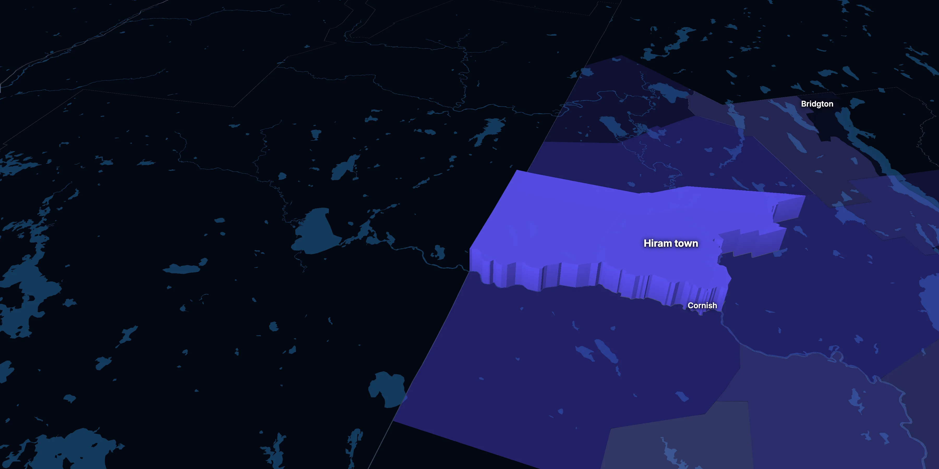
Hiram town, Oxford County, Maine · population, demographics and census data
Home to 1,748 people, the 182nd largest of Maine’s 482 towns and plantations.
- Population
- 1,748 ±288. Rank 182 of 482 in Maine
- Median household income
- $62,813 ±$10,080. Maine $74,733 · US $80,734
- Median age
- 41.6 ±10.2. Maine 44.8 · US 38.9
ACS 2020–2024 5-year estimates, U.S. Census Bureau
About Hiram town
Hiram town’s median household income is $62,813 (±$10,080), lower than both Maine ($74,733) and the US ($80,734), and its median age is 41.6 (±10.2), according to the ACS 2020–2024 5-year estimates.
With 1,748 residents, treat these as rough estimates. The survey reaches only a sample of households, so a small place’s figures can swing widely from year to year, and small differences may not mean much.
± is each figure’s margin of error, at 90% confidence, and † marks one too uncertain to lean on. Under each percentage in the tables is the number it counts. How the margins are worked out.
FIPS code 2301733315
Highlights
What stands out in Hiram town
The numbers where Hiram town sits furthest from Maine and the nation, or past a recognized policy benchmark.
Furthest from the national picture
1.2%
Very lowBorn outside the US
That’s lower than both Maine (4.1%) and the US (14.1%).
2.0%
Very lowSpeak a language other than English at home
That’s not statistically different from Maine (6.0%) but lower than the US (22.3%).
0.2%
Very lowBlack, not Hispanic
That’s lower than both Maine (1.8%) and the US (11.9%).
0.0%
Very lowAsian, not Hispanic
That’s lower than both Maine (1.1%) and the US (5.9%).
29.7%
2× the USLiving with a disability
That’s higher than both Maine (15.8%) and the US (13.3%). It’s the 6th highest of 276 Maine towns and plantations.
0.0%
Very lowTake public transit
That’s about the same as Maine (0.6%) but lower than the US (3.5%).
2010–2014 to 2020–2024
How Hiram town changed in ten years
These are survey estimates, which can swing from one release to the next in a town of 1,748 people, so read small changes with care.
Population, change since 2010–14
+2.2% in the town, +4.5% in Maine and +6.6% in the US.
Source: ACS 5-year, 2010–14 to 2020–24, table A00001.
Show data
| Hiram town | Maine | United States | |
|---|---|---|---|
| 2010–14 | 0.0% | 0.0% | 0.0% |
| 2011–15 | +4.4% | +0.0% | +0.8% |
| 2012–16 | +8.0% | +0.1% | +1.4% |
| 2013–17 | +1.2% | +0.1% | +2.2% |
| 2014–18 | +2.5% | +0.3% | +2.8% |
| 2015–19 | +2.1% | +0.5% | +3.4% |
| 2016–20 | +10.8% | +0.9% | +4.0% |
| 2017–21 | −2.2% | +2.1% | +5.0% |
| 2018–22 | −3.9% | +2.9% | +5.4% |
| 2019–23 | +2.7% | +3.7% | +5.8% |
| 2020–24 | +2.2% | +4.5% | +6.6% |
Embed
Median household income, in 2024 dollars
+11.4% in the town, +15.3% in Maine and +13.7% in the US.
Source: ACS 5-year, 2010–14 to 2020–24, table A14006.
Show data
| Hiram town | Maine | United States | |
|---|---|---|---|
| 2010–14 | $56,375 | $64,806 | $71,018 |
| 2011–15 | $58,066 | $65,393 | $71,435 |
| 2012–16 | $55,251 | $66,517 | $72,401 |
| 2013–17 | $53,763 | $67,932 | $73,862 |
| 2014–18 | $55,199 | $69,319 | $75,407 |
| 2015–19 | $60,358 | $71,148 | $77,198 |
| 2016–20 | $57,576 | $72,176 | $78,856 |
| 2017–21 | $55,331 | $73,237 | $80,006 |
| 2018–22 | $61,929 | $73,154 | $80,548 |
| 2019–23 | $64,336 | $73,882 | $80,845 |
| 2020–24 | $62,813 | $74,733 | $80,734 |
Embed
Living in poverty
−0.1 points in the town, −3.2 points in Maine and −3.1 points in the US.
Source: ACS 5-year, 2010–14 to 2020–24, table A13004.
Show data
| Hiram town | Maine | United States | |
|---|---|---|---|
| 2010–14 | 12.7% | 13.9% | 15.6% |
| 2011–15 | 14.0% | 13.9% | 15.5% |
| 2012–16 | 18.3% | 13.5% | 15.1% |
| 2013–17 | 21.4% | 12.9% | 14.6% |
| 2014–18 | 18.9% | 12.5% | 14.1% |
| 2015–19 | 16.3% | 11.8% | 13.4% |
| 2016–20 | 12.1% | 11.1% | 12.8% |
| 2017–21 | 15.2% | 11.0% | 12.6% |
| 2018–22 | 12.9% | 10.9% | 12.5% |
| 2019–23 | 13.8% | 10.8% | 12.4% |
| 2020–24 | 12.6% | 10.7% | 12.5% |
Embed
Bachelor’s degree or more
+11.0 points in the town, +7.8 points in Maine and +6.4 points in the US.
Source: ACS 5-year, 2010–14 to 2020–24, table A12001.
Show data
| Hiram town | Maine | United States | |
|---|---|---|---|
| 2010–14 | 14.0% | 28.4% | 29.3% |
| 2011–15 | 13.6% | 29.0% | 29.8% |
| 2012–16 | 13.8% | 29.3% | 30.3% |
| 2013–17 | 13.5% | 30.3% | 30.9% |
| 2014–18 | 16.8% | 30.9% | 31.5% |
| 2015–19 | 17.0% | 31.8% | 32.1% |
| 2016–20 | 14.8% | 32.5% | 32.9% |
| 2017–21 | 19.6% | 33.6% | 33.7% |
| 2018–22 | 21.5% | 34.1% | 34.3% |
| 2019–23 | 21.2% | 35.3% | 35.0% |
| 2020–24 | 25.0% | 36.2% | 35.7% |
Embed
Median gross rent, in 2024 dollars
−1.4% in the town, +11.1% in Maine and +15.6% in the US.
Source: ACS 5-year, 2010–14 to 2020–24, table A18009.
Show data
| Hiram town | Maine | United States | |
|---|---|---|---|
| 2010–14 | $1,085 | $1,025 | $1,222 |
| 2011–15 | $1,282 | $1,030 | $1,230 |
| 2012–16 | $1,073 | $1,034 | $1,242 |
| 2013–17 | $1,052 | $1,035 | $1,258 |
| 2014–18 | $1,073 | $1,039 | $1,279 |
| 2015–19 | $1,065 | $1,048 | $1,305 |
| 2016–20 | $1,103 | $1,059 | $1,330 |
| 2017–21 | $1,284 | $1,075 | $1,348 |
| 2018–22 | $1,303 | $1,081 | $1,359 |
| 2019–23 | $1,090 | $1,116 | $1,388 |
| 2020–24 | $1,070 | $1,139 | $1,413 |
Embed
Median home value, in 2024 dollars
+30.3% in the town, +28.7% in Maine and +42.6% in the US.
Source: ACS 5-year, 2010–14 to 2020–24, table A10036.
Show data
| Hiram town | Maine | United States | |
|---|---|---|---|
| 2010–14 | $196,924 | $230,520 | $233,308 |
| 2011–15 | $198,442 | $230,388 | $236,751 |
| 2012–16 | $185,707 | $230,334 | $241,720 |
| 2013–17 | $196,530 | $230,481 | $247,905 |
| 2014–18 | $194,730 | $230,750 | $256,264 |
| 2015–19 | $185,491 | $233,891 | $267,181 |
| 2016–20 | $195,580 | $240,228 | $278,810 |
| 2017–21 | $206,908 | $245,855 | $283,875 |
| 2018–22 | $225,623 | $262,387 | $302,152 |
| 2019–23 | $219,155 | $274,227 | $312,314 |
| 2020–24 | $256,600 | $296,600 | $332,700 |
Embed
ACS 5-year estimates. Each point is the five years ending then, and neighboring points share years. Dollar values are in 2024 dollars. Some towns and plantations annex land or merge, so part of a change can be a new boundary rather than new people.
| Indicator | 2010–2014 | 2020–2024 | Change | Maine’s change |
|---|---|---|---|---|
| Population | 1,711 | 1,748 | +2.2% | +4.5% |
| Median age | 42.7 | 41.6 | −1.1 years | +1.3 years |
| 65 and over | 15.7% | 15.7% | +0.0 points | +5.3 points |
| Born outside the US | 2.1% | 1.2% | −0.9 points | +0.5 points |
| Hispanic or Latino | 0.0% | 3.7% | +3.7 points | +0.8 points |
| Median household income | $56,375 | $62,813 | +11.4% | +15.3% |
| Living in poverty | 12.7% | 12.6% | −0.1 points | −3.2 points |
| Bachelor’s degree or more | 14.0% | 25.0% | +11.0 points | +7.8 points |
| Households that rent | 11.7% | 16.2% | +4.5 points | −2.8 points |
| Median gross rent | $1,085 | $1,070 | −1.4% | +11.1% |
| Median home value | $196,924 | $256,600 | +30.3% | +28.7% |
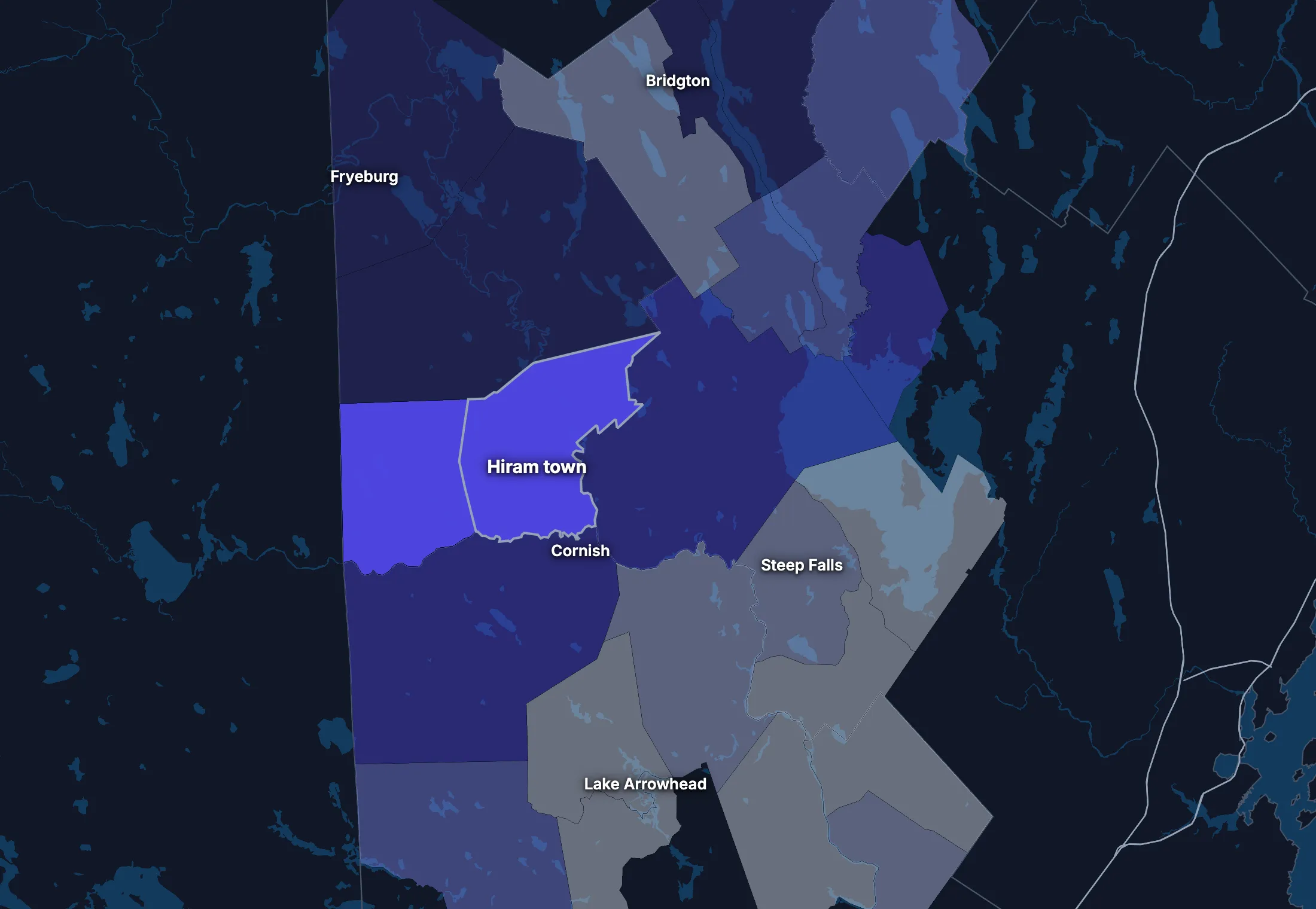
1 census tract
Hiram town on the map
Hiram town is smaller than a census tract, the smallest area these figures reach, so the map shows the tract it sits in, with the land around it.
People
Who lives in Hiram town
Its median age of 41.6 is about the same as both Maine (44.8) and the US (38.9).
Age
Source: ACS 2020–2024 5-year, table A01001.
Show data
| Hiram town | Maine | United States | |
|---|---|---|---|
| Under 18 | 20.9% ±3.9% , number 366 ±90 | 18.1% ±0.2% , number 250,540 ±2,114 | 22.0% ±<0.1% , number 73,517,834 ±38,890 |
| 18 to 24 | 9.3% ±4.6% , number 163 ±85 | 8.0% ±0.1% , number 111,027 ±1,855 | 9.1% ±<0.1% , number 30,597,362 ±37,780 |
| 25 to 34 | 12.4% ±3.7% , number 216 ±74 | 12.0% ±<0.1% , number 166,942 ±671 | 13.7% ±<0.1% , number 45,806,540 ±10,200 |
| 35 to 44 | 9.0% ±2.5% , number 158 ±51 | 12.2% ±0.2% , number 169,226 ±2,415 | 13.2% ±<0.1% , number 44,237,292 ±43,510 |
| 45 to 54 | 10.9% ±2.7% , number 190 ±57 | 12.2% ±<0.1% , number 169,595 ±565 | 12.2% ±<0.1% , number 40,743,799 ±8,564 |
| 55 to 64 | 21.7% ±6.1% , number 380 ±124 | 15.1% ±0.2% , number 210,067 ±2,571 | 12.7% ±<0.1% , number 42,386,044 ±41,500 |
| 65 to 74 | 7.8% ±1.5% , number 136 ±34 | 13.4% ±0.2% , number 186,307 ±2,555 | 10.2% ±<0.1% , number 34,092,907 ±38,800 |
| 75 and over | 8.0% ±2.6% , number 139 ±52 | 8.9% ±0.2% , number 124,113 ±2,121 | 7.0% ±<0.1% , number 23,540,721 ±31,560 |
Embed
Race and ethnicity
Source: ACS 2020–2024 5-year, table A04001.
Show data
| Hiram town | Maine | United States | |
|---|---|---|---|
| White, not Hispanic | 87.3% ±19.2% , number 1,526 ±223 | 89.9% ±0.2% , number 1,247,805 ±2,437 | 57.4% ±<0.1% , number 192,214,378 ±30,950 |
| Hispanic or Latino | 3.7% ±4.5% , number 65 ±80 | 2.2% , number 30,266 | 19.3% ±<0.1% , number 64,759,370 ±1,547 |
| Black, not Hispanic | 0.2% ±0.3% , number 3 ±5 | 1.8% ±0.1% , number 24,846 ±1,011 | 11.9% ±<0.1% , number 39,896,127 ±46,710 |
| Asian, not Hispanic | 0.0% ±0.6% , number 0 ±11 | 1.1% ±0.1% , number 15,854 ±716 | 5.9% ±<0.1% , number 19,678,814 ±22,770 |
| Other or multiracial | 8.8% ±4.2% , number 154 ±78 | 5.0% ±0.2% , number 69,046 ±2,910 | 5.5% ±<0.1% , number 18,373,810 ±69,180 |
Embed
Language spoken at home
Source: ACS 2020–2024 5-year, table C16001.
Show data
| Hiram town | Maine | United States | |
|---|---|---|---|
| English only | 98.0% ±4.4% , number 1,636 ±301 | 94.0% ±0.2% , number 1,245,787 ±2,731 | 77.7% ±0.1% , number 245,767,039 ±221,000 |
| Spanish | 1.0% ±1.2% , number 16 ±20 | 1.0% ±0.1% , number 13,107 ±1,032 | 13.6% ±<0.1% , number 42,869,908 ±143,800 |
| Other Indo-European | 1.0% ±1.5% , number 17 ±25 | 3.6% ±0.2% , number 47,569 ±2,262 | 3.9% ±<0.1% , number 12,249,474 ±54,760 |
| Asian and Pacific Island | 0.0% ±1.5% , number 0 ±25 | 0.7% ±0.1% , number 9,409 ±929 | 3.6% ±<0.1% , number 11,320,253 ±40,030 |
| Arabic and other | 0.0% ±0.9% , number 0 ±16 | 0.8% ±0.1% , number 9,958 ±1,063 | 1.2% ±<0.1% , number 3,935,874 ±33,550 |
Embed
Marital status
Source: ACS 2020–2024 5-year, table A11001.
Show data
| Hiram town | Maine | United States | |
|---|---|---|---|
| Now married | 42.6% ±10.2% , number 609 ±94 | 50.6% ±0.4% , number 599,700 ±4,939 | 47.8% ±0.1% , number 131,199,078 ±272,700 |
| Never married | 35.1% ±7.3% , number 502 ±139 | 29.1% ±0.3% , number 344,864 ±3,379 | 34.4% ±0.1% , number 94,480,845 ±211,900 |
| Divorced | 18.8% ±6.5% , number 269 ±105 | 13.2% ±0.3% , number 155,896 ±3,041 | 10.6% ±<0.1% , number 29,074,059 ±73,390 |
| Widowed | 3.4% ±1.6% , number 48 ±25 | 6.1% ±0.2% , number 72,454 ±1,816 | 5.6% ±<0.1% , number 15,250,943 ±26,710 |
| Separated | 0.2% ±0.8% , number 3 ±12 | 0.9% ±0.1% , number 11,193 ±901 | 1.7% ±<0.1% , number 4,592,038 ±29,170 |
Embed
Where people lived a year ago
Source: ACS 2020–2024 5-year, table A08001.
Show data
| Hiram town | Maine | United States | |
|---|---|---|---|
| Same home | 88.5% ±7.4% , number 1,540 ±287 | 89.4% ±0.3% , number 1,229,986 ±3,740 | 87.7% ±0.1% , number 290,692,803 ±173,800 |
| Same county | 4.4% ±2.8% , number 76 ±50 | 5.1% ±0.2% , number 70,289 ±2,758 | 6.3% ±<0.1% , number 20,792,831 ±117,600 |
| Another county in the state | 3.4% ±4.0% , number 60 ±71 | 2.4% ±0.1% , number 33,660 ±1,914 | 3.1% ±<0.1% , number 10,316,864 ±51,200 |
| Another state | 3.3% ±2.7% , number 57 ±48 | 2.7% ±0.2% , number 37,637 ±2,238 | 2.3% ±<0.1% , number 7,577,400 ±40,570 |
| Another country | 0.4% ±0.6% , number 7 ±11 | 0.3% ±0.1% , number 4,475 ±726 | 0.6% ±<0.1% , number 2,060,087 ±23,560 |
Embed
Top countries of birth, among those born abroad
Source: ACS 2020–2024 5-year, table A07001.
Show data
| Hiram town | |
|---|---|
| Nicaragua | 52.4% , number 11 |
| Australia | 47.6% , number 10 |
Embed
All the numbers
| Indicator | Hiram town | Maine | US | Rank in Maine* | Table |
|---|---|---|---|---|---|
| Population | 1,748 ±288 | 1,387,817 | 334,922,499 | 182nd | A00001 |
| People per square mile | 47 ±8 | 45 | 95 | 213th | A00002 |
| Land area (square miles) | 38 | – | – | – | A00002 |
| Median age | 41.6 ±10.2 | 44.8 ±0.1 | 38.9 ±0.1 | 220th | A01004 |
| Under 18 | 20.9% ±3.9% , number 366 ±90 | 18.1% ±0.2% , number 250,540 ±2,114 | 22.0% ±<0.1% , number 73,517,834 ±38,890 | 68th | B02002 |
| 65 and over | 15.7% ±2.4% , number 275 ±62 | 22.4% ±0.2% , number 310,420 ±3,321 | 17.2% ±<0.1% , number 57,633,628 ±50,010 | 252nd | B02002 |
| Born outside the US | 1.2%† (too uncertain to lean on) ±1.2% , number 21 ±21 | 4.1% ±0.1% , number 56,448 ±1,908 | 14.1% ±<0.1% , number 47,349,078 ±143,600 | 209th | A06001 |
| Speak a language other than English at home | 2.0%† (too uncertain to lean on) ±4.4% , number 33 ±43 | 6.0% ±0.2% , number 80,043 ±2,859 | 22.3% ±0.1% , number 70,375,509 ±162,500 | 188th | C16001 |
| Veterans (adults) | 11.9% ±4.1% , number 165 ±65 | 8.4% ±0.2% , number 95,013 ±2,071 | 6.2% ±<0.1% , number 16,185,883 ±45,250 | 49th | A16002 |
| Living with a disability | 29.7% ±7.2% , number 520 ±152 | 15.8% ±0.2% , number 217,077 ±3,312 | 13.3% ±<0.1% , number 43,869,797 ±68,920 | 6th | B18101 |
| Women 15–50 who had a baby in the past year | 3.0%† (too uncertain to lean on) ±3.5% , number 11 ±13 | 4.6% ±0.3% , number 13,507 ±920 | 5.1% ±<0.1% , number 4,009,203 ±20,900 | 166th | B13002 |
| Lived in the same home a year ago | 88.5% ±7.4% , number 1,540 ±287 | 89.4% ±0.3% , number 1,229,986 ±3,740 | 87.7% ±0.1% , number 290,692,803 ±173,800 | 207th | A08001 |
| White, not Hispanic | 87.3% ±19.2% , number 1,526 ±223 | 89.9% ±0.2% , number 1,247,805 ±2,437 | 57.4% ±<0.1% , number 192,214,378 ±30,950 | 251st | A04001 |
| Hispanic or Latino | 3.7%† (too uncertain to lean on) ±4.5% , number 65 ±80 | 2.2% , number 30,266 | 19.3% ±<0.1% , number 64,759,370 ±1,547 | 27th | A04001 |
| Black, not Hispanic | 0.2%† (too uncertain to lean on) ±0.3% , number 3 ±5 | 1.8% ±0.1% , number 24,846 ±1,011 | 11.9% ±<0.1% , number 39,896,127 ±46,710 | 139th | A04001 |
| Asian, not Hispanic | 0.0%† (too uncertain to lean on) ±0.6% , number 0 ±11 | 1.1% ±0.1% , number 15,854 ±716 | 5.9% ±<0.1% , number 19,678,814 ±22,770 | 178th | A04001 |
*1 is the highest. Population is ranked among all towns and plantations, and the rest among those of 1,000 people or more, whose figures can be ranked. Ranks use 5-year estimates, the only ones covering every town, so they can differ slightly from the figures here.
Income and work
Lower incomes than the US
The median household income is $62,813, lower than both Maine ($74,733) and the US ($80,734). 12.6% of people live in poverty, and 7.6% have no health insurance, about the same as both Maine (6.2%) and the US (8.4%).
Household income
Source: ACS 2020–2024 5-year, table A14001.
Show data
| Hiram town | Maine | United States | |
|---|---|---|---|
| Under $25,000 | 15.3% ±6.6% , number 99 ±45 | 15.0% ±0.4% , number 89,805 ±2,384 | 14.6% ±<0.1% , number 18,908,588 ±41,540 |
| $25,000 to $49,999 | 23.1% ±7.8% , number 150 ±55 | 18.4% ±0.4% , number 109,614 ±2,383 | 16.7% ±<0.1% , number 21,624,902 ±39,130 |
| $50,000 to $74,999 | 19.9% ±5.1% , number 129 ±38 | 16.8% ±0.4% , number 100,241 ±2,540 | 15.5% ±<0.1% , number 20,031,683 ±36,850 |
| $75,000 to $99,999 | 12.8% ±3.6% , number 83 ±26 | 13.0% ±0.4% , number 77,552 ±2,182 | 12.6% ±<0.1% , number 16,319,799 ±42,700 |
| $100,000 to $149,999 | 21.9% ±9.4% , number 142 ±64 | 18.4% ±0.4% , number 109,678 ±2,403 | 17.5% ±<0.1% , number 22,670,921 ±58,280 |
| $150,000 to $199,999 | 3.5% ±1.9% , number 23 ±13 | 9.1% ±0.3% , number 54,263 ±1,612 | 9.6% ±<0.1% , number 12,405,370 ±57,560 |
| $200,000 or more | 3.4% ±2.4% , number 22 ±16 | 9.4% ±0.3% , number 56,006 ±1,811 | 13.4% ±0.1% , number 17,266,233 ±82,370 |
Embed
What residents do for work
Source: ACS 2020–2024 5-year, table A17004.
Show data
| Hiram town | Maine | United States | |
|---|---|---|---|
| Education and health care | 25.5% ±4.3% , number 196 ±59 | 27.4% ±0.4% , number 189,648 ±2,818 | 23.5% ±0.1% , number 37,913,663 ±133,200 |
| Retail trade | 12.0% ±6.8% , number 92 ±57 | 12.6% ±0.4% , number 87,019 ±2,594 | 10.8% ±<0.1% , number 17,456,908 ±41,100 |
| Manufacturing | 11.3% ±5.0% , number 87 ±44 | 8.9% ±0.3% , number 61,825 ±2,042 | 9.9% ±<0.1% , number 15,940,000 ±38,890 |
| Arts, food and lodging | 11.2% ±5.3% , number 86 ±46 | 7.8% ±0.3% , number 53,995 ±1,840 | 8.7% ±<0.1% , number 13,952,453 ±52,980 |
| Construction | 8.5% ±3.4% , number 65 ±31 | 7.7% ±0.3% , number 53,182 ±1,802 | 6.9% ±<0.1% , number 11,167,040 ±57,000 |
| Transportation and warehousing | 8.5% ±11.0% , number 65 ±86 | 4.3% ±0.2% , number 29,515 ±1,331 | 5.9% ±<0.1% , number 9,568,767 ±29,300 |
| Other services | 6.0% ±4.7% , number 46 ±38 | 4.4% ±0.2% , number 30,625 ±1,250 | 4.7% ±<0.1% , number 7,588,496 ±24,900 |
| Finance, insurance and real estate | 4.6% ±3.0% , number 35 ±25 | 6.4% ±0.2% , number 44,249 ±1,531 | 6.7% ±<0.1% , number 10,783,159 ±41,000 |
Embed
Where workers come from and go
Hiram town has 324 jobs and 746 employed residents. 287 people commute in to work and 709 commute out, while 37 both live and work here. The most commuters come from Porter town (Oxford, ME).
Most commuters come from
- Porter town (Oxford, ME): 54
- Parsonsfield town (York, ME): 51
- Cornish town (York, ME): 38
Most residents commute to
- Portland city (Cumberland, ME): 74
- Cornish town (York, ME): 56
- Scarborough town (Cumberland, ME): 39
Show data
| Hiram town | |
|---|---|
| Live and work here | 37 |
| Work here, live elsewhere | 287 |
| Live here, work elsewhere | 709 |
Embed
All the numbers
| Indicator | Hiram town | Maine | US | Rank in Maine* | Table |
|---|---|---|---|---|---|
| Median household income | $62,813 ±$10,080 | $74,733 ±$795 | $80,734 ±$166 | 193rd | A14006 |
| Income per person | $41,929 ±$13,790 | $43,742 ±$403 | $44,673 ±$122 | 109th | A14024 |
| Income inequality (Gini index) | 0.551 ±0.172 | 0.456 ±0.003 | 0.483 | 7th | A14028 |
| Living in poverty | 12.6% ±6.7% , number 215 ±120 | 10.7% ±0.3% , number 144,830 ±3,974 | 12.5% ±0.1% , number 40,735,661 ±275,900 | 93rd | A13004 |
| Unemployment rate | 4.4% ±2.8% , number 35 ±24 | 3.8% ±0.2% , number 27,132 ±1,470 | 5.2% ±<0.1% , number 8,902,365 ±38,980 | 89th | A17005 |
| No health insurance | 7.6% ±2.6% , number 132 ±50 | 6.2% ±0.2% , number 84,556 ±3,009 | 8.4% ±<0.1% , number 27,734,911 ±158,900 | 101st | A20001 |
*1 is the highest. Population is ranked among all towns and plantations, and the rest among those of 1,000 people or more, whose figures can be ranked. Ranks use 5-year estimates, the only ones covering every town, so they can differ slightly from the figures here.
Education
Fewer college degrees than the US
25.0% of adults 25 and over have a bachelor’s degree or more, lower than both Maine (36.2%) and the US (35.7%).
Highest level of education
Source: ACS 2020–2024 5-year, table A12001.
Show data
| Hiram town | Maine | United States | |
|---|---|---|---|
| Less than high school | 5.9% ±3.3% , number 72 ±42 | 5.2% ±0.2% , number 53,812 ±1,753 | 10.4% ±<0.1% , number 23,992,410 ±82,490 |
| High school only | 44.6% ±8.1% , number 544 ±140 | 30.1% ±0.4% , number 309,041 ±3,957 | 26.0% ±0.1% , number 60,094,716 ±262,500 |
| Some college | 24.4% ±7.4% , number 298 ±106 | 28.5% ±0.4% , number 292,001 ±4,292 | 27.9% ±0.1% , number 64,356,961 ±143,900 |
| Bachelor’s degree | 14.8% ±2.6% , number 180 ±46 | 22.5% ±0.4% , number 230,761 ±3,631 | 21.6% ±0.1% , number 49,868,171 ±191,400 |
| Graduate degree | 10.3% ±3.2% , number 125 ±45 | 13.7% ±0.3% , number 140,635 ±2,881 | 14.1% ±0.1% , number 32,495,045 ±159,600 |
Embed
All the numbers
| Indicator | Hiram town | Maine | US | Rank in Maine* | Table |
|---|---|---|---|---|---|
| Bachelor’s degree or more | 25.0% ±2.6% , number 305 ±65 | 36.2% ±0.5% , number 371,396 ±4,635 | 35.7% ±0.1% , number 82,363,216 ±249,200 | 179th | A12001 |
| High school graduate or more | 94.1% ±23.1% , number 1,147 ±187 | 94.8% ±0.7% , number 972,438 ±7,454 | 89.6% ±0.2% , number 206,814,893 ±389,500 | 165th | A12001 |
*1 is the highest. Population is ranked among all towns and plantations, and the rest among those of 1,000 people or more, whose figures can be ranked. Ranks use 5-year estimates, the only ones covering every town, so they can differ slightly from the figures here.
Housing
Homes and what they cost
16.2% of households rent, lower than both Maine (25.7%) and the US (34.8%). The median home is worth $256,600 and the median rent is $1,070.
Housing costs and income, 2010–2014 to 2020–2024, after inflation
Source: ACS 5-year, table A10036, A18009, A14006.
Show data
| Hiram town | Maine | United States | |
|---|---|---|---|
| Median home value | +30.3% | +28.7% | +42.6% |
| Median rent | −1.4% | +11.1% | +15.6% |
| Median household income | +11.4% | +15.3% | +13.7% |
Embed
Types of homes
Source: ACS 2020–2024 5-year, table A10032.
Show data
| Hiram town | Maine | United States | |
|---|---|---|---|
| Single-family, detached | 82.5% ±6.2% , number 706 ±96 | 70.0% ±0.4% , number 526,150 ±2,973 | 61.3% ±0.1% , number 88,075,458 ±149,800 |
| Single-family, attached | 1.1% ±1.0% , number 9 ±9 | 2.6% ±0.1% , number 19,219 ±982 | 6.2% ±<0.1% , number 8,955,086 ±33,580 |
| 2 to 4 units | 3.4% ±2.8% , number 29 ±24 | 10.1% ±0.3% , number 76,246 ±2,264 | 7.7% ±<0.1% , number 11,031,346 ±42,810 |
| 5 to 19 units | 0.0% ±1.8% , number 0 ±16 | 5.5% ±0.2% , number 41,584 ±1,641 | 8.8% ±<0.1% , number 12,625,154 ±51,990 |
| 20 or more units | 0.0% ±1.8% , number 0 ±16 | 3.6% ±0.2% , number 26,881 ±1,294 | 10.3% ±<0.1% , number 14,859,547 ±31,000 |
| Mobile homes and other | 13.1% ±5.0% , number 112 ±45 | 8.2% ±0.2% , number 61,796 ±1,799 | 5.7% ±<0.1% , number 8,228,764 ±48,580 |
Embed
When homes were built
Source: ACS 2020–2024 5-year, table A10055.
Show data
| Hiram town | Maine | United States | |
|---|---|---|---|
| 2010 or later | 6.2% ±4.5% , number 40 ±29 | 8.9% ±0.3% , number 52,938 ±1,612 | 11.6% ±<0.1% , number 14,996,534 ±51,640 |
| 2000 to 2009 | 18.7% ±5.3% , number 121 ±39 | 12.5% ±0.3% , number 74,764 ±2,066 | 13.8% ±<0.1% , number 17,865,859 ±70,250 |
| 1980 to 1999 | 18.4% ±5.3% , number 119 ±38 | 25.2% ±0.4% , number 150,674 ±2,735 | 25.3% ±<0.1% , number 32,758,140 ±75,080 |
| 1960 to 1979 | 28.7% ±11.2% , number 186 ±78 | 20.3% ±0.4% , number 121,221 ±2,580 | 23.9% ±<0.1% , number 30,938,809 ±78,560 |
| Before 1960 | 28.1% ±6.5% , number 182 ±50 | 33.1% ±0.5% , number 197,562 ±3,274 | 25.3% ±<0.1% , number 32,668,154 ±83,060 |
Embed
All the numbers
| Indicator | Hiram town | Maine | US | Rank in Maine* | Table |
|---|---|---|---|---|---|
| Housing units | 856 ±97 | – | – | – | A10001 |
| Households | 648 ±93 | – | – | – | A10008 |
| People per household | 2.70 ±0.30 | 2.26 ±0.01 | 2.53 ±0.01 | 21st | A10003 |
| Households that rent | 16.2% ±5.6% , number 105 ±39 | 25.7% ±0.4% , number 153,586 ±2,467 | 34.8% ±0.1% , number 45,017,354 ±163,600 | 147th | A10060 |
| Vacant homes | 24.3% ±7.1% , number 208 ±65 | 20.6% ±0.3% , number 154,717 ±2,142 | 10.1% ±0.1% , number 14,547,859 ±200,400 | 94th | A10047, A10060 |
| Median gross rent | $1,070 ±$161 | $1,139 ±$13 | $1,413 ±$2 | 123rd | A18009 |
| Median home value | $256,600 ±$41,710 | $296,600 ±$2,876 | $332,700 ±$236 | 144th | A10036 |
| Renters paying 30% or more of income | 41.9% ±25.4% , number 44 ±31 | 44.1% ±1.3% , number 67,661 ±2,283 | 47.6% ±0.2% , number 21,422,415 ±63,960 | 109th | A18002 |
| Owners paying 30% or more of income | 28.9% ±9.3% , number 157 ±57 | 21.8% ±0.5% , number 96,594 ±2,326 | 22.5% ±0.1% , number 18,961,895 ±39,930 | 29th | A10040 |
| Homes built before 1960 | 28.1% ±6.5% , number 182 ±50 | 33.1% ±0.5% , number 197,562 ±3,274 | 25.3% ±<0.1% , number 32,668,154 ±83,060 | 124th | A10055 |
*1 is the highest. Population is ranked among all towns and plantations, and the rest among those of 1,000 people or more, whose figures can be ranked. Ranks use 5-year estimates, the only ones covering every town, so they can differ slightly from the figures here.
Getting around
A driving town
71.3% of workers drive alone and 8.6% work from home. 50.1% of those who travel to work spend 30 minutes or more getting there.
How people get to work
Source: ACS 2020–2024 5-year, table A09005.
Show data
| Hiram town | Maine | United States | |
|---|---|---|---|
| Drive alone | 71.3% ±23.4% , number 546 ±116 | 70.8% ±0.5% , number 481,348 ±4,253 | 68.8% ±0.1% , number 109,447,738 ±95,800 |
| Carpool | 11.5% ±7.8% , number 88 ±64 | 7.9% ±0.3% , number 53,511 ±1,962 | 8.5% ±<0.1% , number 13,569,614 ±52,500 |
| Public transit | 0.0% ±2.0% , number 0 ±16 | 0.6% ±0.1% , number 4,384 ±523 | 3.5% ±<0.1% , number 5,573,279 ±22,170 |
| Walk | 0.0% ±1.4% , number 0 ±11 | 3.4% ±0.2% , number 23,442 ±1,232 | 2.4% ±<0.1% , number 3,772,609 ±17,080 |
| Work from home | 8.6% ±3.4% , number 66 ±31 | 15.9% ±0.4% , number 107,940 ±2,678 | 15.1% ±<0.1% , number 24,042,489 ±82,860 |
| Other | 8.6% ±11.3% , number 66 ±88 | 1.3% ±0.1% , number 9,052 ±735 | 1.7% ±<0.1% , number 2,708,365 ±17,940 |
Embed
Time spent getting to work
Source: ACS 2020–2024 5-year, table B09001.
Show data
| Hiram town | Maine | United States | |
|---|---|---|---|
| Under 10 minutes | 17.0% ±12.9% , number 119 ±96 | 17.7% ±0.5% , number 101,244 ±2,723 | 12.7% ±<0.1% , number 17,153,542 ±40,730 |
| 10 to 19 minutes | 16.6% ±3.8% , number 116 ±40 | 29.8% ±0.6% , number 170,198 ±3,427 | 28.7% ±<0.1% , number 38,741,521 ±54,980 |
| 20 to 29 minutes | 16.3% ±6.4% , number 114 ±54 | 19.0% ±0.4% , number 108,502 ±2,483 | 21.3% ±<0.1% , number 28,723,420 ±52,330 |
| 30 to 39 minutes | 9.6% ±6.0% , number 67 ±46 | 15.2% ±0.4% , number 86,724 ±2,217 | 16.9% ±<0.1% , number 22,853,044 ±46,230 |
| 40 to 59 minutes | 26.9% ±4.9% , number 188 ±60 | 11.4% ±0.3% , number 65,369 ±1,880 | 11.9% ±<0.1% , number 16,024,037 ±44,090 |
| 60 minutes or more | 13.7% ±5.4% , number 96 ±45 | 6.9% ±0.3% , number 39,700 ±1,794 | 8.6% ±<0.1% , number 11,576,041 ±36,550 |
Embed
Vehicles per household
Source: ACS 2020–2024 5-year, table A10030.
Show data
| Hiram town | Maine | United States | |
|---|---|---|---|
| None | 4.5% ±3.0% , number 29 ±20 | 6.8% ±0.3% , number 40,455 ±1,768 | 8.4% ±<0.1% , number 10,793,323 ±36,450 |
| One | 28.9% ±7.2% , number 187 ±54 | 33.6% ±0.5% , number 200,419 ±3,184 | 33.1% ±0.1% , number 42,801,892 ±122,600 |
| Two | 36.3% ±10.0% , number 235 ±73 | 39.9% ±0.5% , number 237,980 ±2,951 | 36.6% ±0.1% , number 47,334,152 ±191,100 |
| Three or more | 30.4% ±7.0% , number 197 ±53 | 19.8% ±0.4% , number 118,305 ±2,507 | 21.9% ±0.1% , number 28,298,129 ±85,940 |
Embed
All the numbers
| Indicator | Hiram town | Maine | US | Rank in Maine* | Table |
|---|---|---|---|---|---|
| Drive to work alone | 71.3% ±23.4% , number 546 ±116 | 70.8% ±0.5% , number 481,348 ±4,253 | 68.8% ±0.1% , number 109,447,738 ±95,800 | 180th | A09005 |
| Take public transit | 0.0%† (too uncertain to lean on) ±2.0% , number 0 ±16 | 0.6% ±0.1% , number 4,384 ±523 | 3.5% ±<0.1% , number 5,573,279 ±22,170 | 89th | A09005 |
| Work from home | 8.6% ±3.4% , number 66 ±31 | 15.9% ±0.4% , number 107,940 ±2,678 | 15.1% ±<0.1% , number 24,042,489 ±82,860 | 215th | A09005 |
| Commute 30 minutes or more | 50.1% ±18.2% , number 351 ±88 | 33.5% ±0.5% , number 191,793 ±3,416 | 37.4% ±<0.1% , number 50,453,122 ±73,600 | 65th | B09001 |
| Households with no vehicle | 4.5%† (too uncertain to lean on) ±3.3% , number 29 ±22 | 6.8% ±0.3% , number 40,455 ±1,529 | 8.4% ±<0.1% , number 10,793,323 ±27,220 | 127th | A10030 |
*1 is the highest. Population is ranked among all towns and plantations, and the rest among those of 1,000 people or more, whose figures can be ranked. Ranks use 5-year estimates, the only ones covering every town, so they can differ slightly from the figures here.
Places
In and around Hiram town
Population, from the latest estimates available. Figures cover the whole of each place.
Places nearby
- Gorham: 7,593
- North Windham: 5,417
- Lake Arrowhead: 3,322
- Steep Falls: 1,861
- Bridgton: 1,756
- Fryeburg: 1,484
- South Windham: 1,212
- Cornish: 1,024
Its county
- Oxford County: 59,255
Towns and townships like this one
- West Peoria city, IL: 4,191
- New London township, IA: 2,685
- Mariaville town, ME: 724
- Massena township, IA: 595
Towns and townships at least a third this size, with the closest income, education, age, housing and origins.
Turn Hiram town into your planning report.
Social Explorer Studio builds an editable profile of any place, with tables and charts beside the county and state, and exports to Word, PDF and Excel.
Questions about Hiram town
What is the population of Hiram town, Maine?
1,748 people (±288), according to the ACS 2020–2024 5-year estimates. That’s the 182nd largest of 482 towns and plantations in Maine.
What is the FIPS code for Hiram town, Maine?
2301733315. The first two digits, 23, are Maine’s state code, the next three, 017, its county’s, and the last five, 33315, identify the town within it. The Census Bureau’s full geographic identifier (GEOID) is 0600000US2301733315.
What county is Hiram town in?
Hiram town is in Oxford County.
What is the median household income in Hiram town?
$62,813 (±$10,080), according to the ACS 2020–2024 5-year estimates, lower than both Maine ($74,733) and the US ($80,734).
What is the median age in Hiram town?
41.6 years (±10.2), according to the ACS 2020–2024 5-year estimates, about the same as both Maine (44.8) and the US (38.9).
How much does housing cost in Hiram town?
Hiram town’s median home value is $256,600 (±$41,710) and its median gross rent is $1,070 (±$161) a month, according to the ACS 2020–2024 5-year estimates. 41.9% (±25.4%) of its renters pay 30% or more of their income on rent.
Where do people who work in Hiram town live?
37 of its 324 jobs are held by people who live here. Of those who commute in, the most come from Porter town (Oxford, ME), Parsonsfield town (York, ME), Cornish town (York, ME).
Where does this census data come from?
The U.S. Census Bureau’s American Community Survey, through Social Explorer’s tables: the latest 1-year estimates where they exist, for the most recent numbers, and 5-year estimates otherwise. Each table lists its code, so you can find it again.
Is this data free to use?
Yes. You can read it, cite it, download the CSV and embed the charts, with no account. To map other variables, compare your own areas or build a report, see Social Explorer’s plans in a live demo.
Sources and how to cite
American Community Survey 2020–2024 5-year estimates, U.S. Census Bureau, from Social Explorer’s tables A00001, A00002, A01004, A04001, A06001, A08001, A09005, A10001, A10003, A10008, A10030, A10036, A10040, A10047, A10055, A10060, A12001, A13004, A14006, A14024, A14028, A16002, A17005, A18002, A18009, A20001, B02002, B09001, B13002, B18101, C16001. Maps by census tract use 2020–2024 5-year estimates, since the 1-year survey doesn’t cover tracts. Commuting: LEHD LODES 2023. These are estimates from a sample, each with its margin of error. Data retrieved November 14, 2026. How these profiles are made.
U.S. Census Bureau, American Community Survey 2020–2024 5-year estimates, via Social Explorer. “Hiram town, Maine.” https://www.socialexplorer.com/places/maine/hiram-town. Accessed November 14, 2026.