

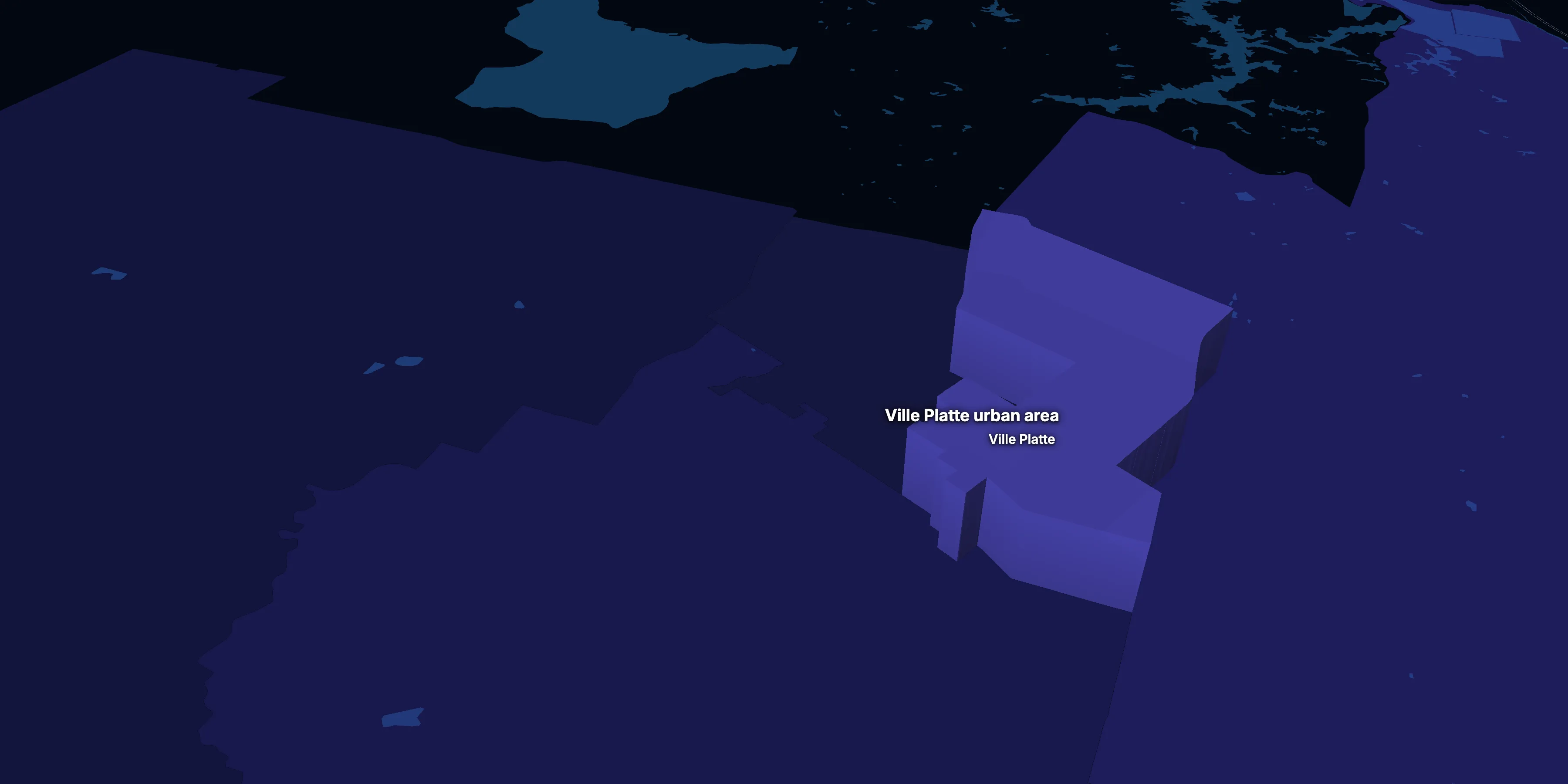
Ville Platte urban area, Louisiana · population, demographics and census data
Home to 7,286 people, the 33rd largest of Louisiana’s 47 urban areas.
- Population
- 7,286 ±313. Rank 33 of 47 in Louisiana
- Median household income
- $27,876 ±$5,368. Louisiana $60,756 · US $80,734
- Median age
- 39.1 ±2.1. Louisiana 38.0 · US 38.9
ACS 2020–2024 5-year estimates, U.S. Census Bureau
About the Ville Platte urban area
The Ville Platte urban area’s median household income is $27,876 (±$5,368), lower than both Louisiana ($60,756) and the US ($80,734), and its median age is 39.1 (±2.1), according to the ACS 2020–2024 5-year estimates.
With 7,286 residents, treat these as rough estimates. The survey reaches only a sample of households, so a small place’s figures can swing widely from year to year, and small differences may not mean much.
± is each figure’s margin of error, at 90% confidence, and † marks one too uncertain to lean on. Under each percentage in the tables is the number it counts. How the margins are worked out.
Urban area code 90676
Highlights
What stands out in the Ville Platte urban area
The numbers where the Ville Platte urban area sits furthest from Louisiana and the nation, or past a recognized policy benchmark.
Past a policy benchmark
32.7%
Very highLiving in poverty
That’s higher than both Louisiana (18.9%) and the US (12.5%). HUD and the New Markets Tax Credit use 20% poverty to mark low-income areas.
21.4%
Very highUnemployment rate
That’s higher than both Louisiana (6.3%) and the US (5.2%). The Department of Labor uses 6% as its floor for a labor surplus area. It’s the highest of 47 Louisiana urban areas.
55.9%
HighHouseholds that rent
That’s higher than both Louisiana (32.6%) and the US (34.8%). A majority of households here rent, so tenant issues shape the housing market. It’s the 7th highest of 47 Louisiana urban areas.
Furthest from the national picture
25.0%
2nd in LouisianaHouseholds with no vehicle
That’s higher than both Louisiana (8.4%) and the US (8.4%). It’s the 2nd highest of 47 Louisiana urban areas.
62.7%
5.5× the USBlack, not Hispanic
That’s higher than both Louisiana (30.5%) and the US (11.9%).
$27,876
Lowest in LouisianaMedian household income
That’s lower than both Louisiana ($60,756) and the US ($80,734). It’s the lowest of 47 Louisiana urban areas.
Over time
How the Ville Platte urban area has changed
The Census Bureau draws urban areas anew after each census, and these are its 2020 urban areas, so there are no earlier figures for the same area.
1 census tract
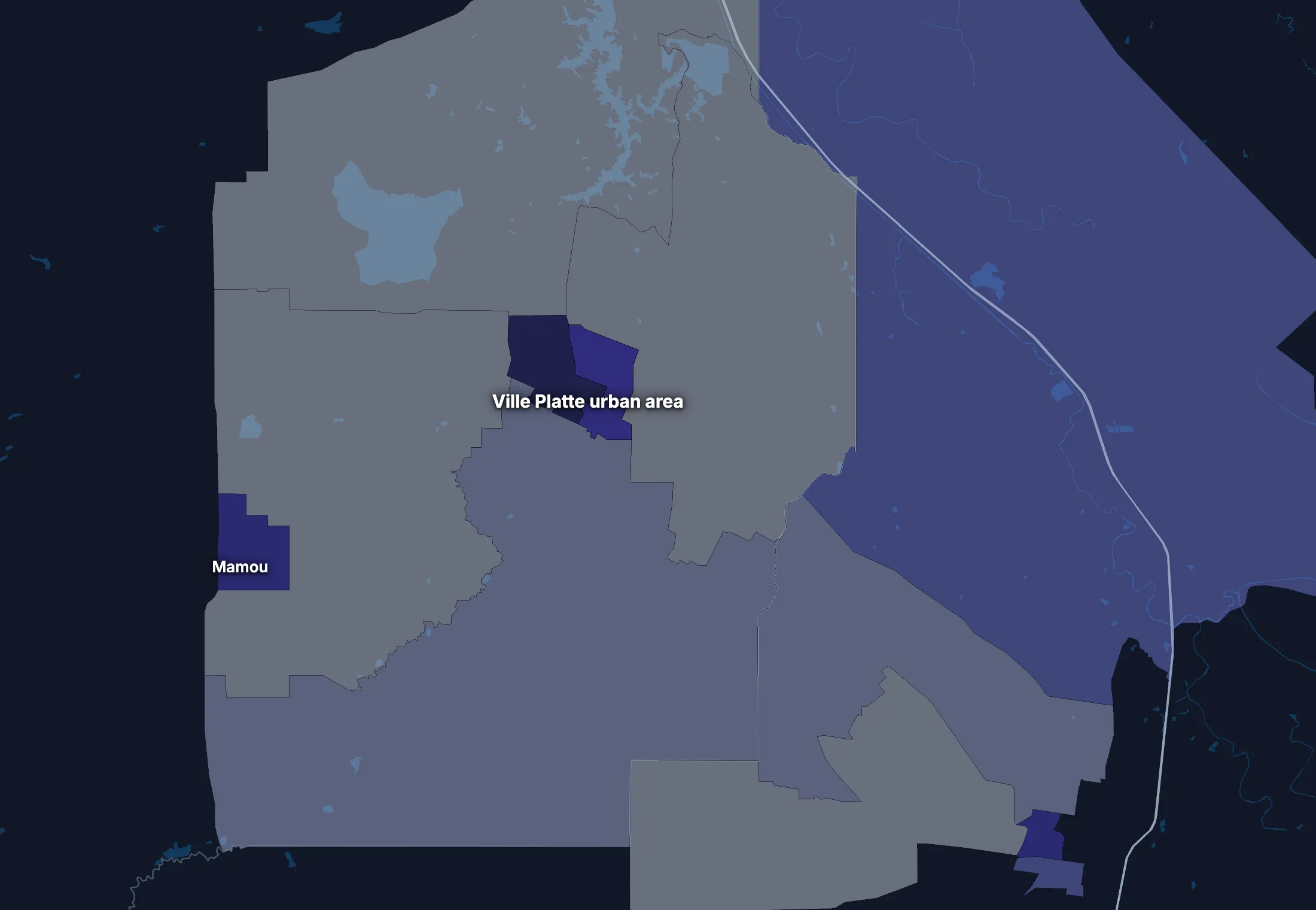
The Ville Platte urban area on the map
The Ville Platte urban area is smaller than a census tract, the smallest area these figures reach, so the map shows the tract it sits in, with the land around it.
People
Who lives in the Ville Platte urban area
Its median age of 39.1 is about the same as both Louisiana (38.0) and the US (38.9).
Age
Source: ACS 2020–2024 5-year, table A01001.
Show data
| Ville Platte urban area | Louisiana | United States | |
|---|---|---|---|
| Under 18 | 23.9% ±5.0% , number 1,739 ±369 | 23.5% ±0.1% , number 1,082,850 ±5,823 | 22.0% ±<0.1% , number 73,517,834 ±38,890 |
| 18 to 24 | 14.0% ±3.9% , number 1,019 ±288 | 9.1% ±0.1% , number 421,675 ±4,715 | 9.1% ±<0.1% , number 30,597,362 ±37,780 |
| 25 to 34 | 8.2% ±2.1% , number 594 ±154 | 13.3% ±<0.1% , number 611,260 ±1,745 | 13.7% ±<0.1% , number 45,806,540 ±10,200 |
| 35 to 44 | 15.0% ±4.3% , number 1,090 ±318 | 13.3% ±0.1% , number 613,966 ±5,501 | 13.2% ±<0.1% , number 44,237,292 ±43,510 |
| 45 to 54 | 9.1% ±2.6% , number 666 ±193 | 11.5% ±<0.1% , number 529,268 ±1,357 | 12.2% ±<0.1% , number 40,743,799 ±8,564 |
| 55 to 64 | 10.8% ±2.3% , number 787 ±174 | 12.6% ±0.1% , number 580,538 ±5,278 | 12.7% ±<0.1% , number 42,386,044 ±41,500 |
| 65 to 74 | 9.9% ±2.3% , number 723 ±172 | 10.2% ±0.1% , number 471,351 ±4,798 | 10.2% ±<0.1% , number 34,092,907 ±38,800 |
| 75 and over | 9.2% ±2.4% , number 668 ±174 | 6.5% ±0.1% , number 301,053 ±3,680 | 7.0% ±<0.1% , number 23,540,721 ±31,560 |
Embed
Race and ethnicity
Source: ACS 2020–2024 5-year, table A04001.
Show data
| Ville Platte urban area | Louisiana | United States | |
|---|---|---|---|
| White, not Hispanic | 29.3% ±5.5% , number 2,134 ±412 | 55.7% ±0.1% , number 2,570,539 ±3,449 | 57.4% ±<0.1% , number 192,214,378 ±30,950 |
| Hispanic or Latino | 2.7% ±2.9% , number 198 ±210 | 7.2% ±<0.1% , number 332,716 ±268 | 19.3% ±<0.1% , number 64,759,370 ±1,547 |
| Black, not Hispanic | 62.7% ±6.5% , number 4,568 ±511 | 30.5% ±0.1% , number 1,407,844 ±5,177 | 11.9% ±<0.1% , number 39,896,127 ±46,710 |
| Asian, not Hispanic | 0.8% ±0.8% , number 61 ±60 | 1.7% ±<0.1% , number 78,910 ±1,396 | 5.9% ±<0.1% , number 19,678,814 ±22,770 |
| Other or multiracial | 4.5% ±3.0% , number 325 ±218 | 4.8% ±0.1% , number 221,952 ±6,807 | 5.5% ±<0.1% , number 18,373,810 ±69,180 |
Embed
Language spoken at home
Source: ACS 2020–2024 5-year, table C16001.
Show data
| Ville Platte urban area | Louisiana | United States | |
|---|---|---|---|
| English only | 85.6% ±6.3% , number 5,731 ±522 | 91.5% ±0.1% , number 3,960,051 ±5,660 | 77.7% ±0.1% , number 245,767,039 ±221,000 |
| Spanish | 1.2% ±1.1% , number 81 ±73 | 4.7% ±0.1% , number 201,847 ±4,617 | 13.6% ±<0.1% , number 42,869,908 ±143,800 |
| Other Indo-European | 12.7% ±4.3% , number 851 ±295 | 2.2% ±0.1% , number 95,969 ±3,175 | 3.9% ±<0.1% , number 12,249,474 ±54,760 |
| Asian and Pacific Island | 0.5% ±0.9% , number 34 ±58 | 1.1% ±0.1% , number 49,667 ±2,529 | 3.6% ±<0.1% , number 11,320,253 ±40,030 |
| Arabic and other | 0.0% ±0.4% , number 0 ±28 | 0.4% ±<0.1% , number 19,385 ±1,818 | 1.2% ±<0.1% , number 3,935,874 ±33,550 |
Embed
Marital status
Source: ACS 2020–2024 5-year, table A11001.
Show data
| Ville Platte urban area | Louisiana | United States | |
|---|---|---|---|
| Now married | 29.9% ±5.4% , number 1,769 ±335 | 43.4% ±0.3% , number 1,613,429 ±10,190 | 47.8% ±0.1% , number 131,199,078 ±272,700 |
| Never married | 44.5% ±6.8% , number 2,630 ±431 | 36.4% ±0.2% , number 1,354,447 ±7,986 | 34.4% ±0.1% , number 94,480,845 ±211,900 |
| Divorced | 9.3% ±2.9% , number 549 ±173 | 11.7% ±0.2% , number 433,938 ±5,771 | 10.6% ±<0.1% , number 29,074,059 ±73,390 |
| Widowed | 10.3% ±2.5% , number 611 ±150 | 6.3% ±0.1% , number 234,885 ±3,908 | 5.6% ±<0.1% , number 15,250,943 ±26,710 |
| Separated | 6.0% ±2.7% , number 355 ±161 | 2.2% ±0.1% , number 80,383 ±3,109 | 1.7% ±<0.1% , number 4,592,038 ±29,170 |
Embed
Where people lived a year ago
Source: ACS 2020–2024 5-year, table A08001.
Show data
| Ville Platte urban area | Louisiana | United States | |
|---|---|---|---|
| Same home | 86.5% ±6.8% , number 6,215 ±566 | 88.6% ±0.2% , number 4,038,359 ±8,868 | 87.7% ±0.1% , number 290,692,803 ±173,800 |
| Same county | 8.8% ±6.7% , number 631 ±484 | 6.2% ±0.2% , number 282,881 ±7,745 | 6.3% ±<0.1% , number 20,792,831 ±117,600 |
| Another county in the state | 2.9% ±2.1% , number 211 ±150 | 3.1% ±0.1% , number 142,067 ±5,042 | 3.1% ±<0.1% , number 10,316,864 ±51,200 |
| Another state | 1.7% ±1.8% , number 121 ±131 | 1.6% ±0.1% , number 75,004 ±3,866 | 2.3% ±<0.1% , number 7,577,400 ±40,570 |
| Another country | 0.1% ±0.2% , number 8 ±14 | 0.4% ±<0.1% , number 20,408 ±1,679 | 0.6% ±<0.1% , number 2,060,087 ±23,560 |
Embed
Top countries of birth, among those born abroad
Source: ACS 2020–2024 5-year, table A07001.
Show data
| Ville Platte urban area | |
|---|---|
| India | 58.2% , number 32 |
| Mexico | 23.6% , number 13 |
| Pakistan | 10.9% , number 6 |
| Trinidad and Tobago | 5.5% , number 3 |
| England | 1.8% , number 1 |
Embed
All the numbers
| Indicator | Ville Platte urban area | Louisiana | US | Rank in Louisiana* | Table |
|---|---|---|---|---|---|
| Population | 7,286 ±313 | 4,611,961 | 334,922,499 | 33rd | A00001 |
| People per square mile | n/a | 107 | 95 | – | A00002 |
| Land area (square miles) | n/a | – | – | – | A00002 |
| Median age | 39.1 ±2.1 | 38.0 ±0.1 | 38.9 ±0.1 | 14th | A01004 |
| Under 18 | 23.9% ±5.0% , number 1,739 ±369 | 23.5% ±0.1% , number 1,082,850 ±5,823 | 22.0% ±<0.1% , number 73,517,834 ±38,890 | 31st | B02002 |
| 65 and over | 19.1% ±3.3% , number 1,391 ±245 | 16.7% ±0.1% , number 772,404 ±6,047 | 17.2% ±<0.1% , number 57,633,628 ±50,010 | 10th | B02002 |
| Born outside the US | 0.8%† (too uncertain to lean on) ±0.6% , number 55 ±45 | 4.9% ±0.1% , number 224,537 ±4,508 | 14.1% ±<0.1% , number 47,349,078 ±143,600 | 40th | A06001 |
| Speak a language other than English at home | 14.4% ±6.3% , number 966 ±311 | 8.5% ±0.1% , number 366,868 ±6,411 | 22.3% ±0.1% , number 70,375,509 ±162,500 | 6th | C16001 |
| Veterans (adults) | 5.2% ±2.3% , number 286 ±128 | 6.1% ±0.1% , number 212,834 ±3,526 | 6.2% ±<0.1% , number 16,185,883 ±45,250 | 29th | A16002 |
| Living with a disability | 22.6% ±4.7% , number 1,612 ±342 | 16.3% ±0.1% , number 737,712 ±6,714 | 13.3% ±<0.1% , number 43,869,797 ±68,920 | 11th | B18101 |
| Women 15–50 who had a baby in the past year | 13.1% ±8.1% , number 200 ±129 | 5.7% ±0.2% , number 61,378 ±2,325 | 5.1% ±<0.1% , number 4,009,203 ±20,900 | 5th | B13002 |
| Lived in the same home a year ago | 86.5% ±6.8% , number 6,215 ±566 | 88.6% ±0.2% , number 4,038,359 ±8,868 | 87.7% ±0.1% , number 290,692,803 ±173,800 | 31st | A08001 |
| White, not Hispanic | 29.3% ±5.5% , number 2,134 ±412 | 55.7% ±0.1% , number 2,570,539 ±3,449 | 57.4% ±<0.1% , number 192,214,378 ±30,950 | 39th | A04001 |
| Hispanic or Latino | 2.7%† (too uncertain to lean on) ±2.9% , number 198 ±210 | 7.2% ±<0.1% , number 332,716 ±268 | 19.3% ±<0.1% , number 64,759,370 ±1,547 | 35th | A04001 |
| Black, not Hispanic | 62.7% ±6.5% , number 4,568 ±511 | 30.5% ±0.1% , number 1,407,844 ±5,177 | 11.9% ±<0.1% , number 39,896,127 ±46,710 | 9th | A04001 |
| Asian, not Hispanic | 0.8%† (too uncertain to lean on) ±0.8% , number 61 ±60 | 1.7% ±<0.1% , number 78,910 ±1,396 | 5.9% ±<0.1% , number 19,678,814 ±22,770 | 22nd | A04001 |
*1 is the highest. Population is ranked among all urban areas, and the rest among those of 1,000 people or more, whose figures can be ranked. Ranks use 5-year estimates, the only ones covering every urban area, so they can differ slightly from the figures here.
Income and work
Lower incomes and a wide coverage gap
The median household income is $27,876, lower than both Louisiana ($60,756) and the US ($80,734). 32.7% of people live in poverty, and 14.4% have no health insurance, higher than both Louisiana (7.8%) and the US (8.4%).
Household income
Source: ACS 2020–2024 5-year, table A14001.
Show data
| Ville Platte urban area | Louisiana | United States | |
|---|---|---|---|
| Under $25,000 | 48.0% ±9.0% , number 1,545 ±323 | 22.4% ±0.3% , number 403,392 ±5,747 | 14.6% ±<0.1% , number 18,908,588 ±41,540 |
| $25,000 to $49,999 | 24.0% ±7.7% , number 771 ±257 | 20.2% ±0.3% , number 364,334 ±5,245 | 16.7% ±<0.1% , number 21,624,902 ±39,130 |
| $50,000 to $74,999 | 16.4% ±6.5% , number 528 ±214 | 15.9% ±0.2% , number 286,493 ±4,397 | 15.5% ±<0.1% , number 20,031,683 ±36,850 |
| $75,000 to $99,999 | 3.1% ±1.7% , number 100 ±55 | 11.7% ±0.2% , number 210,659 ±3,812 | 12.6% ±<0.1% , number 16,319,799 ±42,700 |
| $100,000 to $149,999 | 4.4% ±2.5% , number 143 ±82 | 14.8% ±0.3% , number 267,273 ±5,060 | 17.5% ±<0.1% , number 22,670,921 ±58,280 |
| $150,000 to $199,999 | 3.7% ±2.6% , number 120 ±84 | 7.3% ±0.2% , number 131,787 ±3,180 | 9.6% ±<0.1% , number 12,405,370 ±57,560 |
| $200,000 or more | 0.4% ±0.5% , number 12 ±16 | 7.8% ±0.2% , number 140,842 ±3,380 | 13.4% ±0.1% , number 17,266,233 ±82,370 |
Embed
What residents do for work
Source: ACS 2020–2024 5-year, table A17004.
Show data
| Ville Platte urban area | Louisiana | United States | |
|---|---|---|---|
| Education and health care | 28.0% ±8.2% , number 622 ±206 | 25.5% ±0.3% , number 513,931 ±5,935 | 23.5% ±0.1% , number 37,913,663 ±133,200 |
| Retail trade | 18.0% ±5.8% , number 401 ±143 | 11.1% ±0.2% , number 222,955 ±4,391 | 10.8% ±<0.1% , number 17,456,908 ±41,100 |
| Arts, food and lodging | 10.5% ±5.3% , number 233 ±124 | 9.2% ±0.2% , number 186,200 ±4,219 | 8.7% ±<0.1% , number 13,952,453 ±52,980 |
| Manufacturing | 9.3% ±3.9% , number 206 ±92 | 7.5% ±0.2% , number 151,330 ±3,495 | 9.9% ±<0.1% , number 15,940,000 ±38,890 |
| Public administration | 9.1% ±7.5% , number 203 ±169 | 5.5% ±0.2% , number 110,613 ±3,282 | 4.7% ±<0.1% , number 7,624,243 ±43,950 |
| Agriculture and mining | 6.4% ±4.0% , number 142 ±92 | 3.1% ±0.1% , number 61,894 ±2,440 | 1.6% ±<0.1% , number 2,511,442 ±17,160 |
| Other services | 5.7% ±3.9% , number 126 ±89 | 5.2% ±0.2% , number 105,467 ±3,357 | 4.7% ±<0.1% , number 7,588,496 ±24,900 |
| Construction | 4.8% ±4.6% , number 107 ±103 | 8.4% ±0.2% , number 168,490 ±3,624 | 6.9% ±<0.1% , number 11,167,040 ±57,000 |
Embed
All the numbers
| Indicator | Ville Platte urban area | Louisiana | US | Rank in Louisiana* | Table |
|---|---|---|---|---|---|
| Median household income | $27,876 ±$5,368 | $60,756 ±$408 | $80,734 ±$166 | 47th | A14006 |
| Income per person | $18,308 ±$2,150 | $35,038 ±$248 | $44,673 ±$122 | 42nd | A14024 |
| Income inequality (Gini index) | 0.479 ±0.045 | 0.495 ±0.003 | 0.483 | 26th | A14028 |
| Living in poverty | 32.7% ±8.1% , number 2,307 ±585 | 18.9% ±0.3% , number 848,967 ±13,960 | 12.5% ±0.1% , number 40,735,661 ±275,900 | 18th | A13004 |
| Unemployment rate | 21.4% ±8.2% , number 606 ±244 | 6.3% ±0.2% , number 135,161 ±3,705 | 5.2% ±<0.1% , number 8,902,365 ±38,980 | 1st | A17005 |
| No health insurance | 14.4% ±4.9% , number 1,031 ±351 | 7.8% ±0.2% , number 353,984 ±6,926 | 8.4% ±<0.1% , number 27,734,911 ±158,900 | 1st | A20001 |
*1 is the highest. Population is ranked among all urban areas, and the rest among those of 1,000 people or more, whose figures can be ranked. Ranks use 5-year estimates, the only ones covering every urban area, so they can differ slightly from the figures here.
Education
Fewer college degrees than the US
13.2% of adults 25 and over have a bachelor’s degree or more, lower than both Louisiana (27.0%) and the US (35.7%).
Highest level of education
Source: ACS 2020–2024 5-year, table A12001.
Show data
| Ville Platte urban area | Louisiana | United States | |
|---|---|---|---|
| Less than high school | 37.9% ±8.0% , number 1,716 ±381 | 12.7% ±0.2% , number 395,744 ±6,360 | 10.4% ±<0.1% , number 23,992,410 ±82,490 |
| High school only | 32.5% ±5.4% , number 1,471 ±264 | 32.5% ±0.3% , number 1,009,514 ±8,646 | 26.0% ±0.1% , number 60,094,716 ±262,500 |
| Some college | 16.4% ±4.5% , number 744 ±212 | 27.7% ±0.3% , number 861,796 ±9,574 | 27.9% ±0.1% , number 64,356,961 ±143,900 |
| Bachelor’s degree | 10.6% ±4.4% , number 479 ±200 | 17.0% ±0.2% , number 527,354 ±7,550 | 21.6% ±0.1% , number 49,868,171 ±191,400 |
| Graduate degree | 2.6% ±1.4% , number 118 ±63 | 10.1% ±0.2% , number 313,028 ±5,153 | 14.1% ±0.1% , number 32,495,045 ±159,600 |
Embed
All the numbers
| Indicator | Ville Platte urban area | Louisiana | US | Rank in Louisiana* | Table |
|---|---|---|---|---|---|
| Bachelor’s degree or more | 13.2% ±4.5% , number 597 ±210 | 27.0% ±0.3% , number 840,382 ±9,141 | 35.7% ±0.1% , number 82,363,216 ±249,200 | 32nd | A12001 |
| High school graduate or more | 62.1% ±7.6% , number 2,812 ±399 | 87.3% ±0.5% , number 2,711,692 ±15,810 | 89.6% ±0.2% , number 206,814,893 ±389,500 | 47th | A12001 |
*1 is the highest. Population is ranked among all urban areas, and the rest among those of 1,000 people or more, whose figures can be ranked. Ranks use 5-year estimates, the only ones covering every urban area, so they can differ slightly from the figures here.
Housing
Homes and what they cost
55.9% of households rent, higher than both Louisiana (32.6%) and the US (34.8%). The median home is worth $100,800 and the median rent is $685.
Types of homes
Source: ACS 2020–2024 5-year, table A10032.
Show data
| Ville Platte urban area | Louisiana | United States | |
|---|---|---|---|
| Single-family, detached | 70.1% ±2.8% , number 2,695 ±236 | 65.3% ±0.3% , number 1,377,991 ±6,747 | 61.3% ±0.1% , number 88,075,458 ±149,800 |
| Single-family, attached | 0.0% ±0.5% , number 0 ±20 | 2.8% ±0.1% , number 59,424 ±2,230 | 6.2% ±<0.1% , number 8,955,086 ±33,580 |
| 2 to 4 units | 9.4% ±3.8% , number 362 ±148 | 7.9% ±0.2% , number 166,408 ±3,795 | 7.7% ±<0.1% , number 11,031,346 ±42,810 |
| 5 to 19 units | 3.9% ±4.0% , number 150 ±154 | 6.1% ±0.2% , number 128,947 ±3,757 | 8.8% ±<0.1% , number 12,625,154 ±51,990 |
| 20 or more units | 8.3% ±4.0% , number 320 ±157 | 5.1% ±0.1% , number 106,844 ±2,995 | 10.3% ±<0.1% , number 14,859,547 ±31,000 |
| Mobile homes and other | 8.3% ±3.7% , number 319 ±143 | 12.8% ±0.2% , number 269,288 ±4,525 | 5.7% ±<0.1% , number 8,228,764 ±48,580 |
Embed
When homes were built
Source: ACS 2020–2024 5-year, table A10055.
Show data
| Ville Platte urban area | Louisiana | United States | |
|---|---|---|---|
| 2010 or later | 3.1% ±2.1% , number 99 ±69 | 14.3% ±0.2% , number 257,441 ±4,491 | 11.6% ±<0.1% , number 14,996,534 ±51,640 |
| 2000 to 2009 | 7.7% ±4.3% , number 249 ±142 | 14.8% ±0.2% , number 266,509 ±4,545 | 13.8% ±<0.1% , number 17,865,859 ±70,250 |
| 1980 to 1999 | 30.4% ±7.0% , number 978 ±243 | 26.1% ±0.4% , number 470,530 ±6,541 | 25.3% ±<0.1% , number 32,758,140 ±75,080 |
| 1960 to 1979 | 44.1% ±8.6% , number 1,419 ±306 | 27.8% ±0.3% , number 501,690 ±6,331 | 23.9% ±<0.1% , number 30,938,809 ±78,560 |
| Before 1960 | 14.7% ±5.3% , number 474 ±176 | 17.1% ±0.2% , number 308,610 ±4,483 | 25.3% ±<0.1% , number 32,668,154 ±83,060 |
Embed
All the numbers
| Indicator | Ville Platte urban area | Louisiana | US | Rank in Louisiana* | Table |
|---|---|---|---|---|---|
| Housing units | 3,846 ±299 | – | – | – | A10001 |
| Households | 3,219 ±297 | – | – | – | A10008 |
| People per household | 2.21 ±0.19 | 2.49 ±0.01 | 2.53 ±0.01 | 43rd | A10003 |
| Households that rent | 55.9% ±7.9% , number 1,801 ±303 | 32.6% ±0.3% , number 588,653 ±6,261 | 34.8% ±0.1% , number 45,017,354 ±163,600 | 7th | A10060 |
| Vacant homes | 16.3% ±4.2% , number 627 ±167 | 14.4% ±0.2% , number 304,122 ±5,145 | 10.1% ±0.1% , number 14,547,859 ±200,400 | 26th | A10047, A10060 |
| Median gross rent | $685 ±$50 | $1,064 ±$8 | $1,413 ±$2 | 41st | A18009 |
| Median home value | $100,800 ±$36,260 | $216,500 ±$1,367 | $332,700 ±$236 | 35th | A10036 |
| Renters paying 30% or more of income | 50.1% ±11.6% , number 903 ±258 | 47.7% ±0.8% , number 280,905 ±5,352 | 47.6% ±0.2% , number 21,422,415 ±63,960 | 20th | A18002 |
| Owners paying 30% or more of income | 20.0% ±9.4% , number 284 ±140 | 20.3% ±0.3% , number 246,897 ±4,276 | 22.5% ±0.1% , number 18,961,895 ±39,930 | 21st | A10040 |
| Homes built before 1960 | 14.7% ±5.3% , number 474 ±176 | 17.1% ±0.2% , number 308,610 ±4,483 | 25.3% ±<0.1% , number 32,668,154 ±83,060 | 38th | A10055 |
*1 is the highest. Population is ranked among all urban areas, and the rest among those of 1,000 people or more, whose figures can be ranked. Ranks use 5-year estimates, the only ones covering every urban area, so they can differ slightly from the figures here.
Getting around
A driving urban area with short commutes
25.9% of those who travel to work spend 30 minutes or more getting there, and 25.0% of households have no vehicle.
How people get to work
Source: ACS 2020–2024 5-year, table A09005.
Show data
| Ville Platte urban area | Louisiana | United States | |
|---|---|---|---|
| Drive alone | 77.0% ±5.1% , number 1,598 ±275 | 78.6% ±0.3% , number 1,562,517 ±8,815 | 68.8% ±0.1% , number 109,447,738 ±95,800 |
| Carpool | 7.5% ±5.5% , number 156 ±116 | 8.7% ±0.2% , number 173,191 ±4,451 | 8.5% ±<0.1% , number 13,569,614 ±52,500 |
| Public transit | 0.1% ±1.0% , number 3 ±21 | 1.1% ±0.1% , number 21,502 ±1,528 | 3.5% ±<0.1% , number 5,573,279 ±22,170 |
| Walk | 12.8% ±14.0% , number 266 ±294 | 1.8% ±0.1% , number 36,441 ±2,135 | 2.4% ±<0.1% , number 3,772,609 ±17,080 |
| Work from home | 2.2% ±2.4% , number 45 ±50 | 8.1% ±0.2% , number 161,264 ±3,571 | 15.1% ±<0.1% , number 24,042,489 ±82,860 |
| Other | 0.4% ±1.5% , number 8 ±32 | 1.7% ±0.1% , number 33,950 ±1,749 | 1.7% ±<0.1% , number 2,708,365 ±17,940 |
Embed
Time spent getting to work
Source: ACS 2020–2024 5-year, table B09001.
Show data
| Ville Platte urban area | Louisiana | United States | |
|---|---|---|---|
| Under 10 minutes | 39.1% ±14.4% , number 794 ±319 | 13.2% ±0.3% , number 241,888 ±5,270 | 12.7% ±<0.1% , number 17,153,542 ±40,730 |
| 10 to 19 minutes | 25.4% ±8.1% , number 515 ±184 | 32.3% ±0.4% , number 589,925 ±7,269 | 28.7% ±<0.1% , number 38,741,521 ±54,980 |
| 20 to 29 minutes | 9.7% ±5.0% , number 196 ±106 | 20.4% ±0.3% , number 372,812 ±6,010 | 21.3% ±<0.1% , number 28,723,420 ±52,330 |
| 30 to 39 minutes | 7.8% ±4.4% , number 159 ±93 | 15.9% ±0.3% , number 290,644 ±5,398 | 16.9% ±<0.1% , number 22,853,044 ±46,230 |
| 40 to 59 minutes | 8.9% ±7.2% , number 181 ±149 | 10.1% ±0.2% , number 185,216 ±4,123 | 11.9% ±<0.1% , number 16,024,037 ±44,090 |
| 60 minutes or more | 9.2% ±4.7% , number 186 ±101 | 8.0% ±0.2% , number 147,116 ±3,428 | 8.6% ±<0.1% , number 11,576,041 ±36,550 |
Embed
Vehicles per household
Source: ACS 2020–2024 5-year, table A10030.
Show data
| Ville Platte urban area | Louisiana | United States | |
|---|---|---|---|
| None | 25.0% ±6.5% , number 806 ±222 | 8.4% ±0.2% , number 152,488 ±3,466 | 8.4% ±<0.1% , number 10,793,323 ±36,450 |
| One | 46.1% ±9.0% , number 1,485 ±320 | 36.9% ±0.3% , number 665,332 ±6,322 | 33.1% ±0.1% , number 42,801,892 ±122,600 |
| Two | 23.1% ±6.5% , number 742 ±219 | 37.1% ±0.4% , number 670,193 ±6,730 | 36.6% ±0.1% , number 47,334,152 ±191,100 |
| Three or more | 5.8% ±3.1% , number 186 ±102 | 17.6% ±0.3% , number 316,767 ±4,873 | 21.9% ±0.1% , number 28,298,129 ±85,940 |
Embed
All the numbers
| Indicator | Ville Platte urban area | Louisiana | US | Rank in Louisiana* | Table |
|---|---|---|---|---|---|
| Drive to work alone | 77.0% ±5.1% , number 1,598 ±275 | 78.6% ±0.3% , number 1,562,517 ±8,815 | 68.8% ±0.1% , number 109,447,738 ±95,800 | 39th | A09005 |
| Take public transit | 0.1%† (too uncertain to lean on) ±1.0% , number 3 ±21 | 1.1% ±0.1% , number 21,502 ±1,528 | 3.5% ±<0.1% , number 5,573,279 ±22,170 | 25th | A09005 |
| Work from home | 2.2%† (too uncertain to lean on) ±2.4% , number 45 ±50 | 8.1% ±0.2% , number 161,264 ±3,571 | 15.1% ±<0.1% , number 24,042,489 ±82,860 | 44th | A09005 |
| Commute 30 minutes or more | 25.9% ±9.1% , number 526 ±203 | 34.1% ±0.4% , number 622,976 ±7,609 | 37.4% ±<0.1% , number 50,453,122 ±73,600 | 32nd | B09001 |
| Households with no vehicle | 25.0% ±6.5% , number 806 ±222 | 8.4% ±0.2% , number 152,488 ±3,408 | 8.4% ±<0.1% , number 10,793,323 ±27,220 | 2nd | A10030 |
*1 is the highest. Population is ranked among all urban areas, and the rest among those of 1,000 people or more, whose figures can be ranked. Ranks use 5-year estimates, the only ones covering every urban area, so they can differ slightly from the figures here.
Places
In and around the Ville Platte urban area
Population, from the latest estimates available. Figures cover the whole of each place.
Places nearby
- Opelousas: 15,495
- Eunice: 9,239
- Oakdale: 6,546
- Ville Platte: 6,253
- Church Point: 4,096
- Bunkie: 3,253
- Sunset: 3,074
- Mamou: 2,864
Its county
- Evangeline Parish: 32,060
Urban areas like this one
- Bogalusa, LA Urban Area: 10,733
- Helena-West Helena, AR Urban Area: 7,634
- Caruthersville, MO Urban Area: 5,061
- Monroeville, AL Urban Area: 4,036
Urban areas at least a third this size, with the closest income, education, age, housing and origins.
Turn the Ville Platte urban area into your planning report.
Social Explorer Studio builds an editable profile of any place, with tables and charts beside the county and state, and exports to Word, PDF and Excel.
Questions about the Ville Platte urban area
What is the population of Ville Platte, LA Urban Area?
7,286 people (±313), according to the ACS 2020–2024 5-year estimates. That’s the 33rd largest of 47 urban areas in Louisiana.
What is an urban area?
A densely settled area drawn by the Census Bureau from census blocks after each census, with at least 2,000 homes or 5,000 people, whatever the city lines. The Ville Platte urban area, code 90676, is one of its 2020 urban areas.
What county is the Ville Platte urban area in?
The Ville Platte urban area is in Evangeline Parish.
What is the median household income in the Ville Platte urban area?
$27,876 (±$5,368), according to the ACS 2020–2024 5-year estimates, lower than both Louisiana ($60,756) and the US ($80,734).
What is the median age in the Ville Platte urban area?
39.1 years (±2.1), according to the ACS 2020–2024 5-year estimates, about the same as both Louisiana (38.0) and the US (38.9).
How much does housing cost in the Ville Platte urban area?
The Ville Platte urban area’s median home value is $100,800 (±$36,260) and its median gross rent is $685 (±$50) a month, according to the ACS 2020–2024 5-year estimates. 50.1% (±11.6%) of its renters pay 30% or more of their income on rent.
Where does this census data come from?
The U.S. Census Bureau’s American Community Survey, through Social Explorer’s tables: the latest 1-year estimates where they exist, for the most recent numbers, and 5-year estimates otherwise. Each table lists its code, so you can find it again.
Is this data free to use?
Yes. You can read it, cite it, download the CSV and embed the charts, with no account. To map other variables, compare your own areas or build a report, see Social Explorer’s plans in a live demo.
Sources and how to cite
American Community Survey 2020–2024 5-year estimates, U.S. Census Bureau, from Social Explorer’s tables A00001, A00002, A01004, A04001, A06001, A08001, A09005, A10001, A10003, A10008, A10030, A10036, A10040, A10047, A10055, A10060, A12001, A13004, A14006, A14024, A14028, A16002, A17005, A18002, A18009, A20001, B02002, B09001, B13002, B18101, C16001. Maps by census tract use 2020–2024 5-year estimates, since the 1-year survey doesn’t cover tracts. These are estimates from a sample, each with its margin of error. Data retrieved November 14, 2026. How these profiles are made.
U.S. Census Bureau, American Community Survey 2020–2024 5-year estimates, via Social Explorer. “Ville Platte, LA Urban Area.” https://www.socialexplorer.com/places/urban/ville-platte-la-urban-area. Accessed November 14, 2026.