

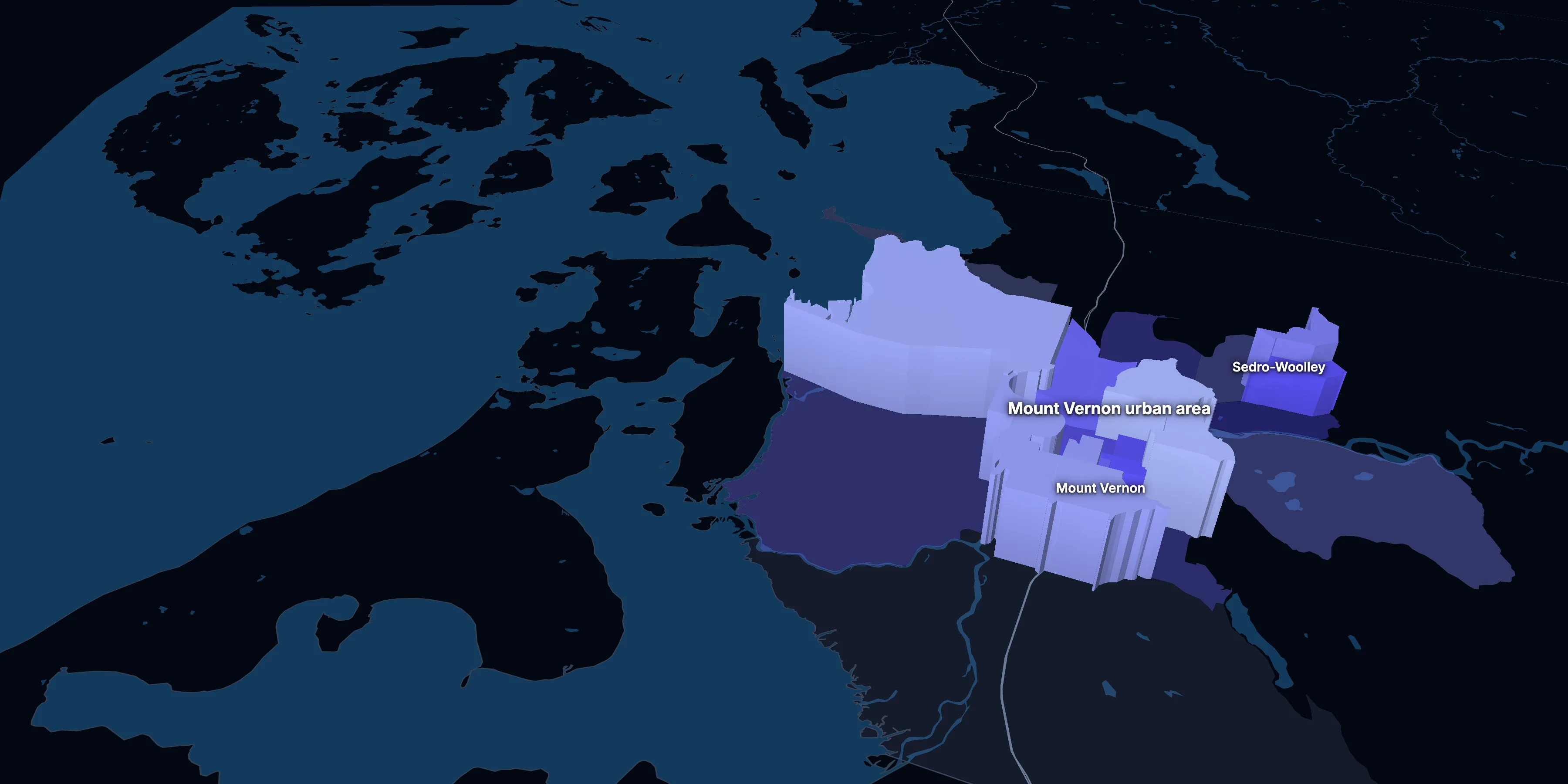
Mount Vernon urban area, Washington · population, demographics and census data
Home to 66,464 people, the 11th largest of Washington’s 58 urban areas, anchored by Mount Vernon and Sedro-Woolley.
- Population
- 66,464 ±4,208. Rank 11 of 58 in Washington
- Median household income
- $88,152 ±$6,923. Washington $101,946 · US $84,780
- Median age
- 36.7 ±1.8. Washington 38.9 · US 39.5
ACS 2025 1-year estimates, U.S. Census Bureau
Taller, lighter tracts have higher household incomes
About the Mount Vernon urban area
The Mount Vernon urban area’s median household income is $88,152 (±$6,923), lower than Washington ($101,946) but about the same as the US ($84,780), and its median age is 36.7 (±1.8), according to the ACS 2025 1-year estimates. Its largest city is Mount Vernon.
± is each figure’s margin of error, at 90% confidence, and † marks one too uncertain to lean on. Under each percentage in the tables is the number it counts. How the margins are worked out.
Urban area code 60490
Highlights
What stands out in the Mount Vernon urban area
The numbers where the Mount Vernon urban area sits furthest from Washington and the nation, or past a recognized policy benchmark.
Past a policy benchmark
3.0%
Tight marketVacant homes
That’s lower than both Washington (7.3%) and the US (10.1%). Below 5% vacancy is the usual sign of a tight housing market. It’s the 8th lowest of 58 Washington urban areas.
Furthest from the national picture
0.5%
Very lowTake public transit
That’s lower than both Washington (3.5%) and the US (3.5%).
3.1%
Very lowAsian, not Hispanic
That’s lower than both Washington (11.0%) and the US (6.5%).
27.1%
Lower than the USBachelor’s degree or more
That’s lower than both Washington (41.4%) and the US (37.4%).
$520,500
Higher than the USMedian home value
That’s lower than Washington ($605,600) but higher than the US ($371,100).
10.3%
Lower than the USWork from home
That’s lower than both Washington (19.8%) and the US (15.1%).
Over time
How the Mount Vernon urban area has changed
The Census Bureau draws urban areas anew after each census, and these are its 2020 urban areas, so there are no earlier figures for the same area.
14 census tracts
The Mount Vernon urban area, tract by tract
Urban area averages hide a lot. These census tracts are the closest the census comes to neighborhoods.
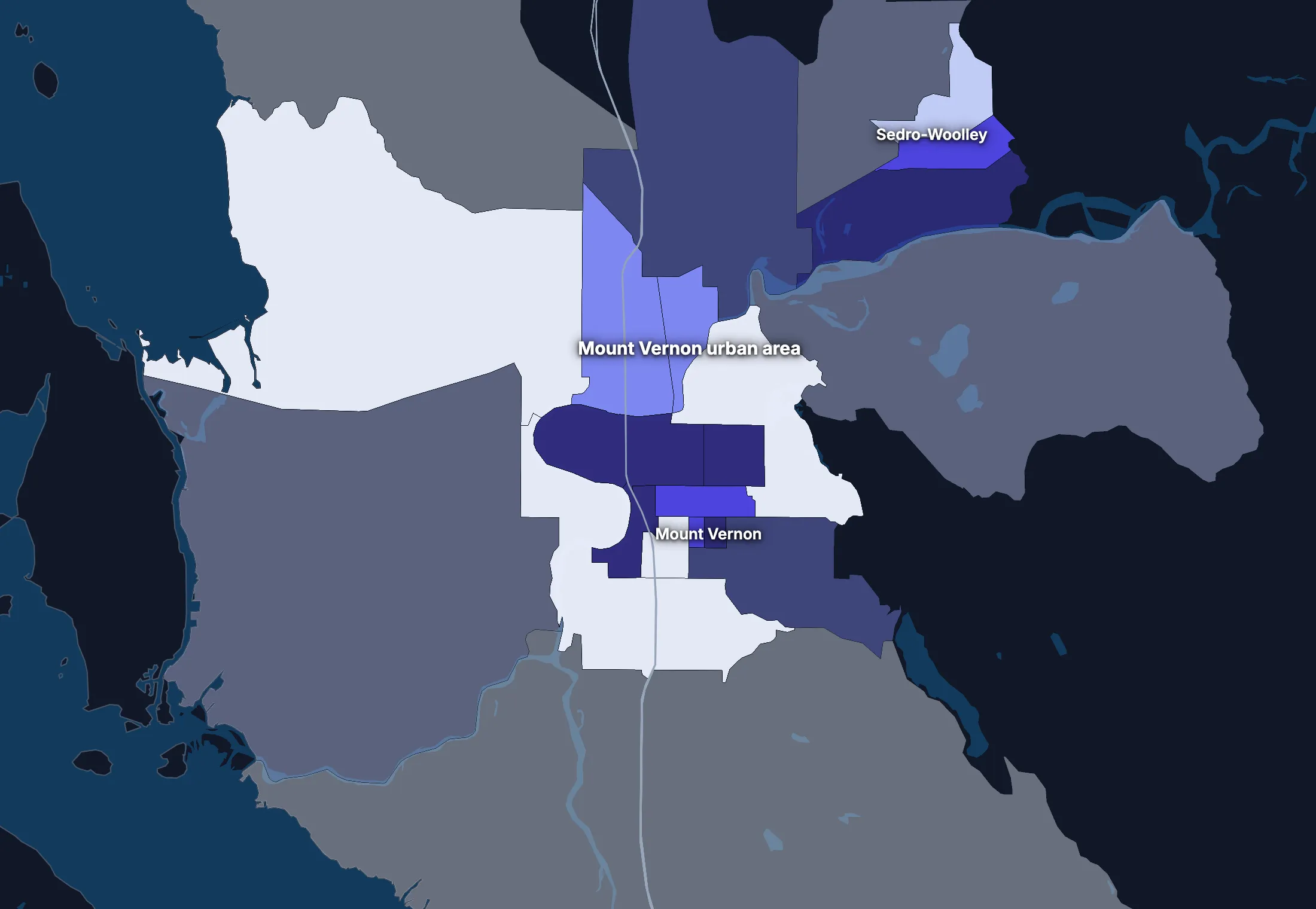
Where the urban area’s average misleads
Each tick is one census tract, and the dark line marks the urban area. Hover over a tick or tap it to see the tract.
Poverty
2 of 14 tracts are at least 1.5 times the urban area’s overall 13.8%, and 5 are at two-thirds of it or less.
Highest: Tract 9523.03, 26.2%. Lowest: Tract 9519, 2.0%.
Renters paying 30% or more of income
0 of 14 tracts are at least 1.5 times the urban area’s overall 54.5%, and 1 is at two-thirds of it or less.
Lowest: Tract 9515.03, 31.7%.
Adults with a bachelor’s degree
2 of 14 tracts are at least 1.5 times the urban area’s overall 24.7%, and 3 are at two-thirds of it or less.
Highest: Tract 9525, 37.7%. Lowest: Tract 9515.01, 11.1%.
Median household income
1 of 14 tracts is at least 1.5 times the typical tract’s $79,971, and 2 are at two-thirds of it or less.
Highest: Tract 9523.04, $120,429. Lowest: Tract 9525, $47,121.
American Community Survey 2020–2024 5-year estimates, by census tract. Income is capped at $250,000+ by the Census Bureau.
People
Who lives in the Mount Vernon urban area
A younger urban area than Washington (38.9) or the US (39.5), with a median age of 36.7. 12.1% of residents were born outside the US, and 25.0% speak a language other than English at home.
Age
Source: ACS 2025 1-year, table A01001.
Show data
| Mount Vernon urban area | Washington | United States | |
|---|---|---|---|
| Under 18 | 22.7% ±3.4% , number 15,091 ±2,477 | 20.3% ±0.2% , number 1,626,299 ±16,050 | 21.0% ±<0.1% , number 71,689,151 ±111,800 |
| 18 to 24 | 9.7% ±2.1% , number 6,475 ±1,444 | 8.5% ±0.2% , number 682,121 ±14,320 | 9.3% ±<0.1% , number 31,716,680 ±98,660 |
| 25 to 34 | 14.1% ±2.1% , number 9,362 ±1,531 | 15.1% ±0.1% , number 1,211,915 ±7,802 | 13.6% ±<0.1% , number 46,357,354 ±55,690 |
| 35 to 44 | 11.4% ±2.3% , number 7,598 ±1,594 | 14.8% ±0.2% , number 1,180,849 ±16,680 | 13.4% ±<0.1% , number 45,746,189 ±105,700 |
| 45 to 54 | 12.2% ±2.2% , number 8,115 ±1,552 | 11.7% ±0.1% , number 935,887 ±6,510 | 11.8% ±<0.1% , number 40,257,563 ±53,540 |
| 55 to 64 | 9.1% ±1.6% , number 6,016 ±1,150 | 11.3% ±0.2% , number 902,598 ±13,890 | 12.1% ±<0.1% , number 41,242,904 ±104,700 |
| 65 to 74 | 10.4% ±1.7% , number 6,930 ±1,211 | 10.4% ±0.2% , number 833,369 ±12,300 | 10.8% ±<0.1% , number 36,895,650 ±91,520 |
| 75 and over | 10.3% ±1.9% , number 6,877 ±1,323 | 7.8% ±0.2% , number 627,982 ±12,430 | 8.2% ±<0.1% , number 27,879,368 ±78,140 |
Embed
Race and ethnicity
Source: ACS 2025 1-year, table A04001.
Show data
| Mount Vernon urban area | Washington | United States | |
|---|---|---|---|
| White, not Hispanic | 59.9% ±4.4% , number 39,786 ±3,872 | 59.3% ±0.1% , number 4,746,285 ±9,858 | 55.0% ±<0.1% , number 187,959,031 ±58,340 |
| Hispanic or Latino | 30.4% ±2.4% , number 20,196 ±2,070 | 15.5% , number 1,240,205 | 20.5% ±<0.1% , number 69,975,516 ±13,270 |
| Black, not Hispanic | 1.4% ±0.6% , number 951 ±410 | 4.0% ±0.1% , number 319,953 ±8,788 | 11.7% ±<0.1% , number 40,096,453 ±106,200 |
| Asian, not Hispanic | 3.1% ±1.4% , number 2,033 ±920 | 11.0% ±0.1% , number 881,496 ±11,130 | 6.5% ±<0.1% , number 22,096,709 ±58,340 |
| Other or multiracial | 5.3% ±1.4% , number 3,498 ±965 | 10.2% ±0.2% , number 813,081 ±19,330 | 6.3% ±<0.1% , number 21,657,150 ±150,100 |
Embed
Language spoken at home
Source: ACS 2020–2024 5-year, table C16001.
Show data
| Mount Vernon urban area | Washington | United States | |
|---|---|---|---|
| English only | 75.0% ±1.4% , number 48,075 ±1,137 | 78.6% ±0.2% , number 5,800,400 ±13,180 | 77.7% ±0.1% , number 245,767,039 ±221,000 |
| Spanish | 21.3% ±1.5% , number 13,657 ±984 | 9.0% ±0.1% , number 665,921 ±7,473 | 13.6% ±<0.1% , number 42,869,908 ±143,800 |
| Other Indo-European | 1.9% ±0.6% , number 1,195 ±394 | 4.4% ±0.1% , number 322,611 ±7,237 | 3.9% ±<0.1% , number 12,249,474 ±54,760 |
| Asian and Pacific Island | 1.4% ±0.4% , number 884 ±226 | 6.6% ±0.1% , number 486,334 ±7,544 | 3.6% ±<0.1% , number 11,320,253 ±40,030 |
| Arabic and other | 0.4% ±0.3% , number 282 ±171 | 1.5% ±0.1% , number 108,280 ±4,472 | 1.2% ±<0.1% , number 3,935,874 ±33,550 |
Embed
Marital status
Source: ACS 2025 1-year, table A11001.
Show data
| Mount Vernon urban area | Washington | United States | |
|---|---|---|---|
| Now married | 50.2% ±3.0% , number 27,319 ±2,422 | 49.7% ±0.4% , number 3,309,123 ±29,200 | 47.9% ±0.1% , number 135,567,564 ±223,300 |
| Never married | 31.8% ±3.8% , number 17,315 ±2,379 | 33.4% ±0.3% , number 2,224,893 ±22,270 | 34.8% ±0.1% , number 98,647,238 ±152,600 |
| Divorced | 10.5% ±2.3% , number 5,740 ±1,309 | 11.0% ±0.2% , number 734,195 ±16,160 | 10.2% ±<0.1% , number 28,879,967 ±112,900 |
| Widowed | 5.4% ±1.4% , number 2,951 ±790 | 4.6% ±0.2% , number 305,246 ±10,050 | 5.5% ±<0.1% , number 15,599,094 ±69,430 |
| Separated | 2.0% ±1.1% , number 1,107 ±607 | 1.3% ±0.1% , number 89,534 ±7,512 | 1.6% ±<0.1% , number 4,441,399 ±49,160 |
Embed
Where people lived a year ago
Source: ACS 2025 1-year, table A08001.
Show data
| Mount Vernon urban area | Washington | United States | |
|---|---|---|---|
| Same home | 85.3% ±4.3% , number 55,305 ±4,583 | 86.2% ±0.4% , number 6,825,959 ±31,570 | 88.4% ±0.1% , number 298,889,697 ±214,800 |
| Same county | 9.5% ±5.2% , number 6,177 ±3,368 | 7.8% ±0.3% , number 617,465 ±23,050 | 6.0% ±<0.1% , number 20,202,671 ±166,300 |
| Another county in the state | 3.0% ±1.5% , number 1,936 ±966 | 2.6% ±0.2% , number 209,753 ±15,420 | 3.0% ±<0.1% , number 10,168,097 ±89,190 |
| Another state | 2.1% ±1.1% , number 1,346 ±726 | 2.5% ±0.2% , number 199,582 ±12,620 | 2.1% ±<0.1% , number 7,025,589 ±81,660 |
| Another country | 0.1% ±0.1% , number 43 ±72 | 0.8% ±0.1% , number 63,637 ±7,784 | 0.6% ±<0.1% , number 1,984,943 ±47,210 |
Embed
Top countries of birth, among those born abroad
Source: ACS 2020–2024 5-year, table A07001.
Show data
| Mount Vernon urban area | |
|---|---|
| Mexico | 62.2% , number 5,282 |
| Philippines | 7.3% , number 622 |
| Canada | 4.1% , number 348 |
| Ukraine | 3.3% , number 279 |
| India | 3.2% , number 271 |
| Ecuador | 2.5% , number 214 |
Embed
All the numbers
| Indicator | Mount Vernon urban area | Washington | US | Rank in Washington* | Table |
|---|---|---|---|---|---|
| Population | 66,464 ±4,208 | 8,001,020 | 341,784,859 | 11th | A00001 |
| People per square mile | 2,168 ±137 | 120 | 97 | – | A00002 |
| Land area (square miles) | 31 | – | – | – | A00002 |
| Median age | 36.7 ±1.8 | 38.9 ±0.1 | 39.5 ±0.1 | 36th | A01004 |
| Under 18 | 22.7% ±3.4% , number 15,091 ±2,477 | 20.3% ±0.2% , number 1,626,299 ±16,050 | 21.0% ±<0.1% , number 71,689,151 ±111,800 | 25th | B02002 |
| 65 and over | 20.8% ±2.4% , number 13,807 ±1,793 | 18.3% ±0.2% , number 1,461,351 ±17,490 | 19.0% ±<0.1% , number 64,775,018 ±120,300 | 26th | B02002 |
| Born outside the US | 12.1% ±2.4% , number 8,035 ±1,678 | 16.6% ±0.3% , number 1,329,131 ±21,750 | 14.7% ±0.1% , number 50,409,320 ±204,800 | 20th | A06001 |
| Speak a language other than English at home (5-year) | 25.0% ±1.4% , number 16,018 ±1,097 | 21.4% ±0.2% , number 1,583,146 ±13,610 | 22.3% ±0.1% , number 70,375,509 ±162,500 | 13th | C16001 |
| Veterans (adults) | 7.6% ±2.2% , number 3,913 ±1,151 | 6.9% ±0.2% , number 434,198 ±12,550 | 5.9% ±<0.1% , number 15,746,228 ±85,320 | 34th | A16002 |
| Living with a disability | 15.7% ±2.5% , number 10,308 ±1,742 | 13.9% ±0.2% , number 1,098,714 ±18,810 | 13.7% ±<0.1% , number 46,271,455 ±126,000 | 36th | B18101 |
| Women 15–50 who had a baby in the past year | 9.4% ±5.0% , number 1,546 ±843 | 4.9% ±0.3% , number 93,576 ±5,702 | 5.0% ±0.1% , number 4,016,759 ±44,040 | 28th | B13002 |
| Lived in the same home a year ago | 85.3% ±4.3% , number 55,305 ±4,583 | 86.2% ±0.4% , number 6,825,959 ±31,570 | 88.4% ±0.1% , number 298,889,697 ±214,800 | 38th | A08001 |
| White, not Hispanic | 59.9% ±4.4% , number 39,786 ±3,872 | 59.3% ±0.1% , number 4,746,285 ±9,858 | 55.0% ±<0.1% , number 187,959,031 ±58,340 | 43rd | A04001 |
| Hispanic or Latino | 30.4% ±2.4% , number 20,196 ±2,070 | 15.5% , number 1,240,205 | 20.5% ±<0.1% , number 69,975,516 ±13,270 | 14th | A04001 |
| Black, not Hispanic | 1.4% ±0.6% , number 951 ±410 | 4.0% ±0.1% , number 319,953 ±8,788 | 11.7% ±<0.1% , number 40,096,453 ±106,200 | 21st | A04001 |
| Asian, not Hispanic | 3.1% ±1.4% , number 2,033 ±920 | 11.0% ±0.1% , number 881,496 ±11,130 | 6.5% ±<0.1% , number 22,096,709 ±58,340 | 20th | A04001 |
*1 is the highest. Population is ranked among all urban areas, and the rest among those of 1,000 people or more, whose figures can be ranked. Ranks use 5-year estimates, the only ones covering every urban area, so they can differ slightly from the figures here.
Income and work
Income and work
The median household income is $88,152, lower than Washington ($101,946) but about the same as the US ($84,780). 14.6% of people live in poverty, and 4.9% have no health insurance, lower than both Washington (7.0%) and the US (8.4%).
Household income
Source: ACS 2025 1-year, table A14001.
Show data
| Mount Vernon urban area | Washington | United States | |
|---|---|---|---|
| Under $25,000 | 11.7% ±3.5% , number 3,004 ±942 | 10.9% ±0.4% , number 347,147 ±12,720 | 14.0% ±0.1% , number 18,727,548 ±88,990 |
| $25,000 to $49,999 | 13.1% ±3.8% , number 3,374 ±1,017 | 12.2% ±0.4% , number 387,819 ±13,240 | 15.4% ±0.1% , number 20,665,585 ±101,400 |
| $50,000 to $74,999 | 15.8% ±4.9% , number 4,061 ±1,301 | 13.7% ±0.4% , number 436,582 ±12,610 | 15.3% ±0.1% , number 20,513,565 ±88,500 |
| $75,000 to $99,999 | 14.7% ±4.0% , number 3,780 ±1,078 | 12.0% ±0.4% , number 380,835 ±11,250 | 12.5% ±0.1% , number 16,814,245 ±87,520 |
| $100,000 to $149,999 | 22.5% ±5.5% , number 5,793 ±1,492 | 19.0% ±0.5% , number 605,313 ±15,150 | 17.9% ±0.1% , number 24,018,984 ±99,670 |
| $150,000 to $199,999 | 10.3% ±2.7% , number 2,635 ±722 | 11.7% ±0.4% , number 373,432 ±11,950 | 10.1% ±0.1% , number 13,521,827 ±70,660 |
| $200,000 or more | 11.9% ±4.0% , number 3,053 ±1,050 | 20.4% ±0.4% , number 649,001 ±13,160 | 14.8% ±0.1% , number 19,801,668 ±84,120 |
Embed
What residents do for work
Source: ACS 2020–2024 5-year, table A17004.
Show data
| Mount Vernon urban area | Washington | United States | |
|---|---|---|---|
| Education and health care | 23.0% ±2.2% , number 7,347 ±746 | 21.7% ±0.2% , number 830,316 ±8,012 | 23.5% ±0.1% , number 37,913,663 ±133,200 |
| Retail trade | 11.8% ±1.6% , number 3,789 ±520 | 11.6% ±0.2% , number 442,222 ±5,976 | 10.8% ±<0.1% , number 17,456,908 ±41,100 |
| Manufacturing | 10.5% ±1.5% , number 3,376 ±500 | 9.0% ±0.1% , number 344,238 ±4,936 | 9.9% ±<0.1% , number 15,940,000 ±38,890 |
| Construction | 9.9% ±1.2% , number 3,153 ±386 | 7.1% ±0.1% , number 270,120 ±4,004 | 6.9% ±<0.1% , number 11,167,040 ±57,000 |
| Professional and business services | 9.3% ±1.3% , number 2,980 ±426 | 14.6% ±0.1% , number 558,813 ±5,444 | 12.6% ±<0.1% , number 20,282,450 ±59,650 |
| Arts, food and lodging | 9.3% ±1.3% , number 2,977 ±439 | 8.2% ±0.1% , number 314,540 ±5,649 | 8.7% ±<0.1% , number 13,952,453 ±52,980 |
| Transportation and warehousing | 5.3% ±0.9% , number 1,707 ±285 | 5.9% ±0.1% , number 223,543 ±4,155 | 5.9% ±<0.1% , number 9,568,767 ±29,300 |
| Other services | 5.2% ±1.1% , number 1,668 ±358 | 4.3% ±0.1% , number 163,528 ±3,701 | 4.7% ±<0.1% , number 7,588,496 ±24,900 |
Embed
All the numbers
| Indicator | Mount Vernon urban area | Washington | US | Rank in Washington* | Table |
|---|---|---|---|---|---|
| Median household income | $88,152 ±$6,923 | $101,946 ±$719 | $84,780 ±$215 | 26th | A14006 |
| Income per person | $40,691 ±$3,545 | $56,777 ±$592 | $47,171 ±$115 | 32nd | A14024 |
| Income inequality (Gini index) | 0.395 ±0.033 | 0.472 ±0.004 | 0.482 ±0.001 | 38th | A14028 |
| Living in poverty (5-year) | 14.6% ±1.9% , number 9,835 ±1,272 | 9.9% ±0.2% , number 760,577 ±11,690 | 12.5% ±0.1% , number 40,735,661 ±275,900 | 20th | A13004 |
| Unemployment rate | 6.8% ±2.3% , number 2,163 ±749 | 5.5% ±0.2% , number 230,092 ±10,500 | 4.9% ±<0.1% , number 8,574,594 ±64,350 | 23rd | A17005 |
| No health insurance | 4.9% ±2.0% , number 3,196 ±1,308 | 7.0% ±0.2% , number 549,620 ±17,320 | 8.4% ±<0.1% , number 28,323,306 ±152,000 | 17th | A20001 |
*1 is the highest. Population is ranked among all urban areas, and the rest among those of 1,000 people or more, whose figures can be ranked. Ranks use 5-year estimates, the only ones covering every urban area, so they can differ slightly from the figures here.
Education
Fewer college degrees than the US
27.1% of adults 25 and over have a bachelor’s degree or more, lower than both Washington (41.4%) and the US (37.4%).
Highest level of education
Source: ACS 2025 1-year, table A12001.
Show data
| Mount Vernon urban area | Washington | United States | |
|---|---|---|---|
| Less than high school | 13.3% ±4.9% , number 5,959 ±2,219 | 7.3% ±0.3% , number 417,838 ±15,470 | 9.4% ±0.1% , number 22,321,002 ±120,500 |
| High school only | 25.3% ±2.9% , number 11,345 ±1,523 | 21.9% ±0.4% , number 1,245,563 ±24,910 | 25.6% ±0.1% , number 61,096,726 ±203,400 |
| Some college | 34.4% ±5.1% , number 15,435 ±2,518 | 29.3% ±0.5% , number 1,670,381 ±26,990 | 27.7% ±0.1% , number 65,920,977 ±173,500 |
| Bachelor’s degree | 16.9% ±3.3% , number 7,572 ±1,570 | 24.7% ±0.4% , number 1,405,445 ±21,400 | 22.3% ±0.1% , number 53,224,312 ±196,700 |
| Graduate degree | 10.2% ±2.5% , number 4,587 ±1,175 | 16.7% ±0.3% , number 953,373 ±18,950 | 15.0% ±0.1% , number 35,816,011 ±159,400 |
Embed
All the numbers
| Indicator | Mount Vernon urban area | Washington | US | Rank in Washington* | Table |
|---|---|---|---|---|---|
| Bachelor’s degree or more | 27.1% ±3.9% , number 12,159 ±1,961 | 41.4% ±0.5% , number 2,358,818 ±28,590 | 37.4% ±0.1% , number 89,040,323 ±253,200 | 36th | A12001 |
| High school graduate or more | 86.7% ±5.0% , number 38,939 ±3,537 | 92.7% ±0.8% , number 5,274,762 ±46,540 | 90.6% ±0.2% , number 216,058,026 ±368,200 | 37th | A12001 |
*1 is the highest. Population is ranked among all urban areas, and the rest among those of 1,000 people or more, whose figures can be ranked. Ranks use 5-year estimates, the only ones covering every urban area, so they can differ slightly from the figures here.
Housing
Homes and what they cost
34.6% of households rent, about the same as both Washington (37.2%) and the US (34.7%). The median home is worth $520,500 and the median rent is $1,641.
Types of homes
Source: ACS 2025 1-year, table A10032.
Show data
| Mount Vernon urban area | Washington | United States | |
|---|---|---|---|
| Single-family, detached | 60.2% ±5.2% , number 16,160 ±1,805 | 60.8% ±0.5% , number 2,090,952 ±15,580 | 60.9% ±0.1% , number 90,335,844 ±173,300 |
| Single-family, attached | 6.4% ±4.2% , number 1,717 ±1,144 | 4.8% ±0.2% , number 164,126 ±8,037 | 6.4% ±<0.1% , number 9,527,703 ±51,230 |
| 2 to 4 units | 10.5% ±3.9% , number 2,807 ±1,055 | 5.9% ±0.3% , number 202,749 ±9,442 | 7.5% ±0.1% , number 11,109,005 ±75,790 |
| 5 to 19 units | 6.1% ±2.7% , number 1,649 ±736 | 8.8% ±0.3% , number 302,833 ±11,870 | 8.7% ±0.1% , number 12,829,882 ±97,590 |
| 20 or more units | 11.3% ±4.5% , number 3,036 ±1,219 | 14.2% ±0.4% , number 488,005 ±13,780 | 11.1% ±0.1% , number 16,381,450 ±92,310 |
| Mobile homes and other | 5.4% ±2.8% , number 1,455 ±749 | 5.5% ±0.2% , number 188,144 ±6,325 | 5.4% ±<0.1% , number 8,045,083 ±53,680 |
Embed
When homes were built
Source: ACS 2025 1-year, table A10055.
Show data
| Mount Vernon urban area | Washington | United States | |
|---|---|---|---|
| 2010 or later | 14.9% ±3.7% , number 3,835 ±991 | 18.0% ±0.5% , number 571,414 ±15,360 | 15.1% ±0.1% , number 20,257,912 ±101,300 |
| 2000 to 2009 | 21.4% ±5.8% , number 5,497 ±1,545 | 15.4% ±0.4% , number 490,141 ±12,840 | 13.8% ±0.1% , number 18,535,840 ±92,260 |
| 1980 to 1999 | 27.5% ±5.3% , number 7,078 ±1,474 | 25.9% ±0.5% , number 823,552 ±17,530 | 24.1% ±0.1% , number 32,332,570 ±118,900 |
| 1960 to 1979 | 19.0% ±4.9% , number 4,874 ±1,327 | 21.8% ±0.5% , number 693,415 ±16,680 | 22.9% ±0.1% , number 30,726,302 ±110,000 |
| Before 1960 | 17.2% ±4.4% , number 4,416 ±1,178 | 18.9% ±0.5% , number 601,607 ±14,650 | 24.0% ±0.1% , number 32,210,798 ±121,500 |
Embed
All the numbers
| Indicator | Mount Vernon urban area | Washington | US | Rank in Washington* | Table |
|---|---|---|---|---|---|
| Housing units | 26,824 ±1,914 | – | – | – | A10001 |
| Households | 25,700 ±2,065 | – | – | – | A10008 |
| People per household | 2.54 ±0.15 | 2.47 ±0.01 | 2.49 ±0.01 | 25th | A10003 |
| Households that rent | 34.6% ±5.7% , number 8,905 ±1,620 | 37.2% ±0.5% , number 1,182,426 ±16,490 | 34.7% ±0.1% , number 46,551,688 ±193,200 | 22nd | A10060 |
| Vacant homes (5-year) | 3.0% ±0.8% , number 813 ±221 | 7.3% ±0.2% , number 241,800 ±5,686 | 10.1% ±0.1% , number 14,547,859 ±200,400 | 51st | A10047, A10060 |
| Median gross rent | $1,641 ±$208 | $1,873 ±$16 | $1,557 ±$4 | 21st | A18009 |
| Median home value | $520,500 ±$28,100 | $605,600 ±$4,205 | $371,100 ±$646 | 24th | A10036 |
| Renters paying 30% or more of income | 56.8% ±13.9% , number 5,059 ±1,540 | 48.2% ±1.3% , number 570,011 ±16,890 | 48.3% ±0.2% , number 22,486,693 ±122,100 | 11th | A18002 |
| Owners paying 30% or more of income | 28.1% ±7.7% , number 4,714 ±1,362 | 26.1% ±0.6% , number 522,271 ±13,610 | 24.2% ±0.1% , number 21,201,943 ±93,050 | 18th | A10040 |
| Homes built before 1960 | 17.2% ±4.4% , number 4,416 ±1,178 | 18.9% ±0.5% , number 601,607 ±14,650 | 24.0% ±0.1% , number 32,210,798 ±121,500 | 28th | A10055 |
*1 is the highest. Population is ranked among all urban areas, and the rest among those of 1,000 people or more, whose figures can be ranked. Ranks use 5-year estimates, the only ones covering every urban area, so they can differ slightly from the figures here.
Getting around
A driving urban area with short commutes
76.8% of workers drive alone and 10.3% work from home. 32.7% of those who travel to work spend 30 minutes or more getting there, and 7.8% of households have no vehicle.
How people get to work
Source: ACS 2020–2024 5-year, table A09005.
Show data
| Mount Vernon urban area | Washington | United States | |
|---|---|---|---|
| Drive alone | 76.8% ±1.9% , number 24,012 ±900 | 63.4% ±0.2% , number 2,401,413 ±11,500 | 68.8% ±0.1% , number 109,447,738 ±95,800 |
| Carpool | 9.9% ±1.5% , number 3,092 ±487 | 8.5% ±0.2% , number 320,462 ±6,816 | 8.5% ±<0.1% , number 13,569,614 ±52,500 |
| Public transit | 0.5% ±0.3% , number 158 ±89 | 3.5% ±0.1% , number 133,982 ±3,064 | 3.5% ±<0.1% , number 5,573,279 ±22,170 |
| Walk | 1.5% ±0.4% , number 479 ±132 | 3.0% ±0.1% , number 115,120 ±2,967 | 2.4% ±<0.1% , number 3,772,609 ±17,080 |
| Work from home | 10.3% ±1.7% , number 3,233 ±553 | 19.8% ±0.2% , number 749,107 ±7,420 | 15.1% ±<0.1% , number 24,042,489 ±82,860 |
| Other | 0.9% ±0.4% , number 282 ±137 | 1.8% ±0.1% , number 67,530 ±2,366 | 1.7% ±<0.1% , number 2,708,365 ±17,940 |
Embed
Time spent getting to work
Source: ACS 2025 1-year, table B09001.
Show data
| Mount Vernon urban area | Washington | United States | |
|---|---|---|---|
| Under 10 minutes | 15.0% ±3.9% , number 3,784 ±1,075 | 11.9% ±0.4% , number 393,072 ±13,560 | 12.0% ±0.1% , number 17,199,225 ±93,440 |
| 10 to 19 minutes | 33.0% ±5.5% , number 8,334 ±1,660 | 28.6% ±0.7% , number 942,579 ±23,140 | 27.8% ±0.1% , number 40,059,540 ±137,700 |
| 20 to 29 minutes | 19.3% ±5.4% , number 4,866 ±1,457 | 20.7% ±0.5% , number 682,209 ±16,330 | 21.0% ±0.1% , number 30,221,743 ±111,100 |
| 30 to 39 minutes | 12.4% ±3.4% , number 3,140 ±918 | 16.6% ±0.5% , number 547,368 ±15,510 | 17.1% ±0.1% , number 24,659,138 ±103,800 |
| 40 to 59 minutes | 9.3% ±2.7% , number 2,346 ±737 | 12.8% ±0.4% , number 423,378 ±14,380 | 12.6% ±0.1% , number 18,104,709 ±97,070 |
| 60 minutes or more | 10.9% ±4.3% , number 2,759 ±1,136 | 9.4% ±0.3% , number 309,254 ±11,590 | 9.5% ±0.1% , number 13,681,705 ±84,440 |
Embed
Vehicles per household
Source: ACS 2025 1-year, table A10030.
Show data
| Mount Vernon urban area | Washington | United States | |
|---|---|---|---|
| None | 7.8% ±3.8% , number 2,014 ±990 | 7.7% ±0.3% , number 244,502 ±10,110 | 8.8% ±0.1% , number 11,781,997 ±77,240 |
| One | 30.4% ±6.2% , number 7,801 ±1,704 | 30.8% ±0.6% , number 978,281 ±18,970 | 33.1% ±0.1% , number 44,424,682 ±160,700 |
| Two | 28.3% ±5.3% , number 7,265 ±1,488 | 35.8% ±0.6% , number 1,137,661 ±18,630 | 36.0% ±0.1% , number 48,200,889 ±176,800 |
| Three or more | 33.5% ±6.5% , number 8,620 ±1,803 | 25.8% ±0.5% , number 819,685 ±17,070 | 22.1% ±0.1% , number 29,655,854 ±113,300 |
Embed
All the numbers
| Indicator | Mount Vernon urban area | Washington | US | Rank in Washington* | Table |
|---|---|---|---|---|---|
| Drive to work alone (5-year) | 76.8% ±1.9% , number 24,012 ±900 | 63.4% ±0.2% , number 2,401,413 ±11,500 | 68.8% ±0.1% , number 109,447,738 ±95,800 | 11th | A09005 |
| Take public transit (5-year) | 0.5% ±0.3% , number 158 ±89 | 3.5% ±0.1% , number 133,982 ±3,064 | 3.5% ±<0.1% , number 5,573,279 ±22,170 | 35th | A09005 |
| Work from home (5-year) | 10.3% ±1.7% , number 3,233 ±553 | 19.8% ±0.2% , number 749,107 ±7,420 | 15.1% ±<0.1% , number 24,042,489 ±82,860 | 36th | A09005 |
| Commute 30 minutes or more | 32.7% ±5.4% , number 8,245 ±1,636 | 38.8% ±0.7% , number 1,280,000 ±24,110 | 39.2% ±0.1% , number 56,445,552 ±165,300 | 18th | B09001 |
| Households with no vehicle | 7.8% ±3.9% , number 2,014 ±1,011 | 7.7% ±0.3% , number 244,502 ±10,260 | 8.8% ±<0.1% , number 11,781,997 ±64,240 | 40th | A10030 |
*1 is the highest. Population is ranked among all urban areas, and the rest among those of 1,000 people or more, whose figures can be ranked. Ranks use 5-year estimates, the only ones covering every urban area, so they can differ slightly from the figures here.
Places
In and around the Mount Vernon urban area
Population, from the latest estimates available. Figures cover the whole of each place, including any part outside the urban area.
Largest cities
- Mount Vernon: 35,377
- Sedro-Woolley: 12,831
- Burlington: 10,003
Its county
- Skagit County: 132,975
Urban areas like this one
- Salem, OR Urban Area: 271,150
- Galveston–Texas City, TX Urban Area: 195,223
- Wenatchee, WA Urban Area: 78,739
- Oakdale, CA Urban Area: 25,180
Urban areas at least a third this size, with the closest income, education, age, housing and origins.
Turn the Mount Vernon urban area into your planning report.
Social Explorer Studio builds an editable profile of any place, with tables and charts beside the county and state, and exports to Word, PDF and Excel.
Questions about the Mount Vernon urban area
What is the population of Mount Vernon, WA Urban Area?
66,464 people (±4,208), according to the ACS 2025 1-year estimates. That’s the 11th largest of 58 urban areas in Washington.
What is an urban area?
A densely settled area drawn by the Census Bureau from census blocks after each census, with at least 2,000 homes or 5,000 people, whatever the city lines. The Mount Vernon urban area, code 60490, is one of its 2020 urban areas.
What county is the Mount Vernon urban area in?
The Mount Vernon urban area is in Skagit County.
What is the largest city in the Mount Vernon urban area?
Mount Vernon, with 35,377 people. Other large cities here include Sedro-Woolley and Burlington. These figures cover the whole of each place, including any part outside the urban area.
What is the median household income in the Mount Vernon urban area?
$88,152 (±$6,923), according to the ACS 2025 1-year estimates, lower than Washington ($101,946) but about the same as the US ($84,780).
What is the median age in the Mount Vernon urban area?
36.7 years (±1.8), according to the ACS 2025 1-year estimates, lower than both Washington (38.9) and the US (39.5).
How much does housing cost in the Mount Vernon urban area?
The Mount Vernon urban area’s median home value is $520,500 (±$28,100) and its median gross rent is $1,641 (±$208) a month, according to the ACS 2025 1-year estimates. 56.8% (±13.9%) of its renters pay 30% or more of their income on rent.
Where does this census data come from?
The U.S. Census Bureau’s American Community Survey, through Social Explorer’s tables: the latest 1-year estimates where they exist, for the most recent numbers, and 5-year estimates otherwise. Each table lists its code, so you can find it again.
Is this data free to use?
Yes. You can read it, cite it, download the CSV and embed the charts, with no account. To map other variables, compare your own areas or build a report, see Social Explorer’s plans in a live demo.
Sources and how to cite
American Community Survey 2025 1-year estimates, or 2020–2024 5-year estimates where noted, U.S. Census Bureau, from Social Explorer’s tables A00001, A00002, A01004, A04001, A06001, A08001, A09005, A10001, A10003, A10008, A10030, A10036, A10040, A10047, A10055, A10060, A12001, A13004, A14006, A14024, A14028, A16002, A17005, A18002, A18009, A20001, B02002, B09001, B13002, B18101, C16001. Maps by census tract use 2020–2024 5-year estimates, since the 1-year survey doesn’t cover tracts. These are estimates from a sample, each with its margin of error. Data retrieved November 14, 2026. How these profiles are made.
U.S. Census Bureau, American Community Survey 2025 1-year estimates, or 2020–2024 5-year estimates where noted, via Social Explorer. “Mount Vernon, WA Urban Area.” https://www.socialexplorer.com/places/urban/mount-vernon-wa-urban-area. Accessed November 14, 2026.