

La Follette urban area, Tennessee · population, demographics and census data
Home to 21,178 people, the 21st largest of Tennessee’s 68 urban areas, anchored by La Follette and Jacksboro.
- Population
- 21,178 ±1,142. Rank 21 of 68 in Tennessee
- Median household income
- $51,751 ±$5,573. Tennessee $69,595 · US $80,734
- Median age
- 42.3 ±2.7. Tennessee 38.9 · US 38.9
ACS 2020–2024 5-year estimates, U.S. Census Bureau
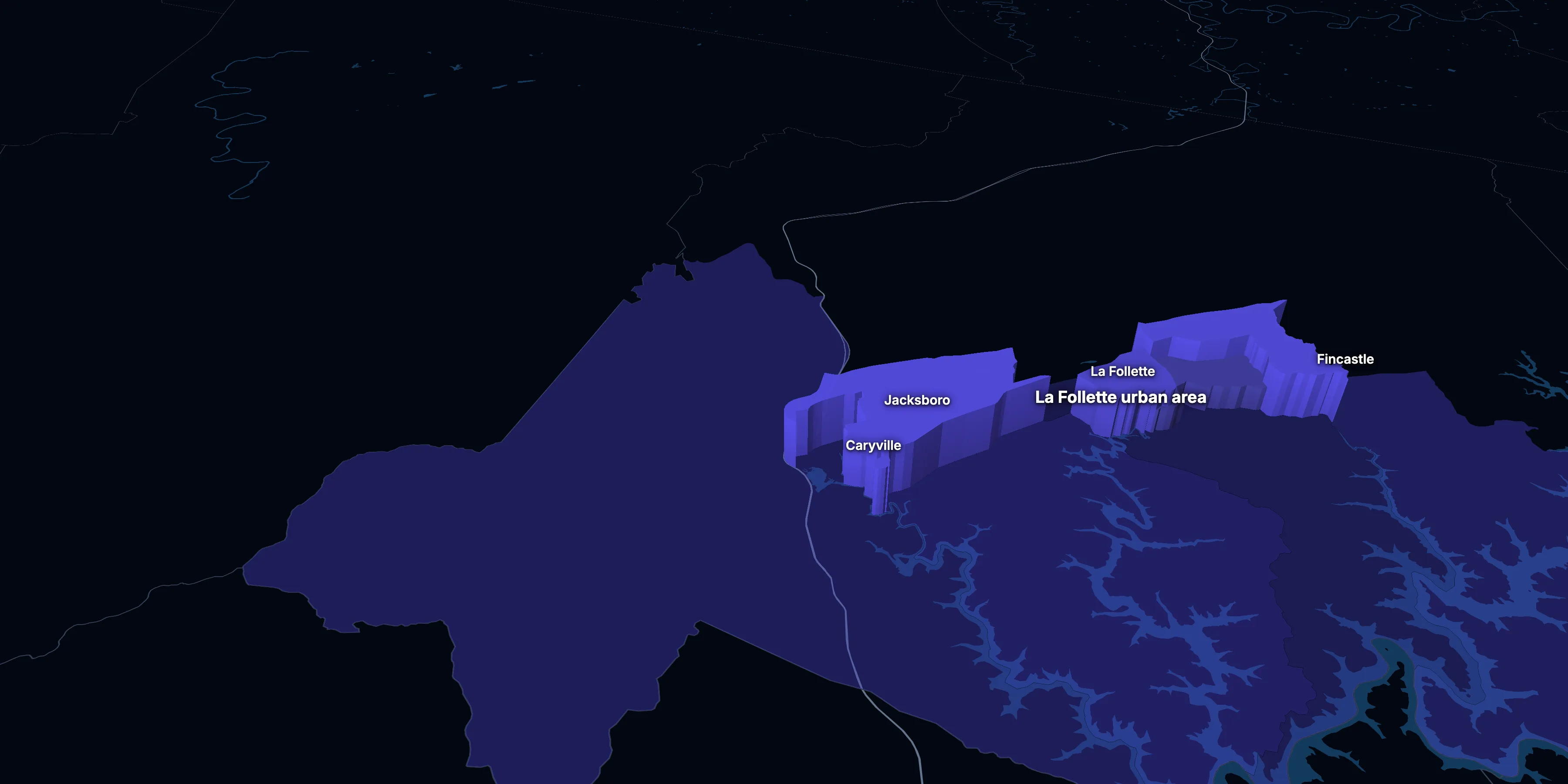
Taller, lighter tracts have higher household incomes
About the La Follette urban area
The La Follette urban area’s median household income is $51,751 (±$5,573), lower than both Tennessee ($69,595) and the US ($80,734), and its median age is 42.3 (±2.7), according to the ACS 2020–2024 5-year estimates. Its largest city is La Follette.
± is each figure’s margin of error, at 90% confidence, and † marks one too uncertain to lean on. Under each percentage in the tables is the number it counts. How the margins are worked out.
Urban area code 46153
Highlights
What stands out in the La Follette urban area
The numbers where the La Follette urban area sits furthest from Tennessee and the nation, or past a recognized policy benchmark.
Past a policy benchmark
17.0%
ElevatedLiving in poverty
That’s higher than both Tennessee (13.8%) and the US (12.5%). HUD and the New Markets Tax Credit use 20% poverty to mark low-income areas.
Furthest from the national picture
24.1%
2× the USLiving with a disability
That’s higher than both Tennessee (14.9%) and the US (13.3%). It’s the 10th highest of 68 Tennessee urban areas.
0.1%
Very lowTake public transit
That’s about the same as Tennessee (0.5%) but lower than the US (3.5%).
11.6%
Very lowBachelor’s degree or more
That’s lower than both Tennessee (31.1%) and the US (35.7%). It’s the 4th lowest of 68 Tennessee urban areas.
1.3%
Very lowBorn outside the US
That’s lower than both Tennessee (6.1%) and the US (14.1%). It’s the 10th lowest of 68 Tennessee urban areas.
$756
Lower than the USMedian gross rent
That’s lower than both Tennessee ($1,189) and the US ($1,413).
Over time
How the La Follette urban area has changed
The Census Bureau draws urban areas anew after each census, and these are its 2020 urban areas, so there are no earlier figures for the same area.
4 census tracts
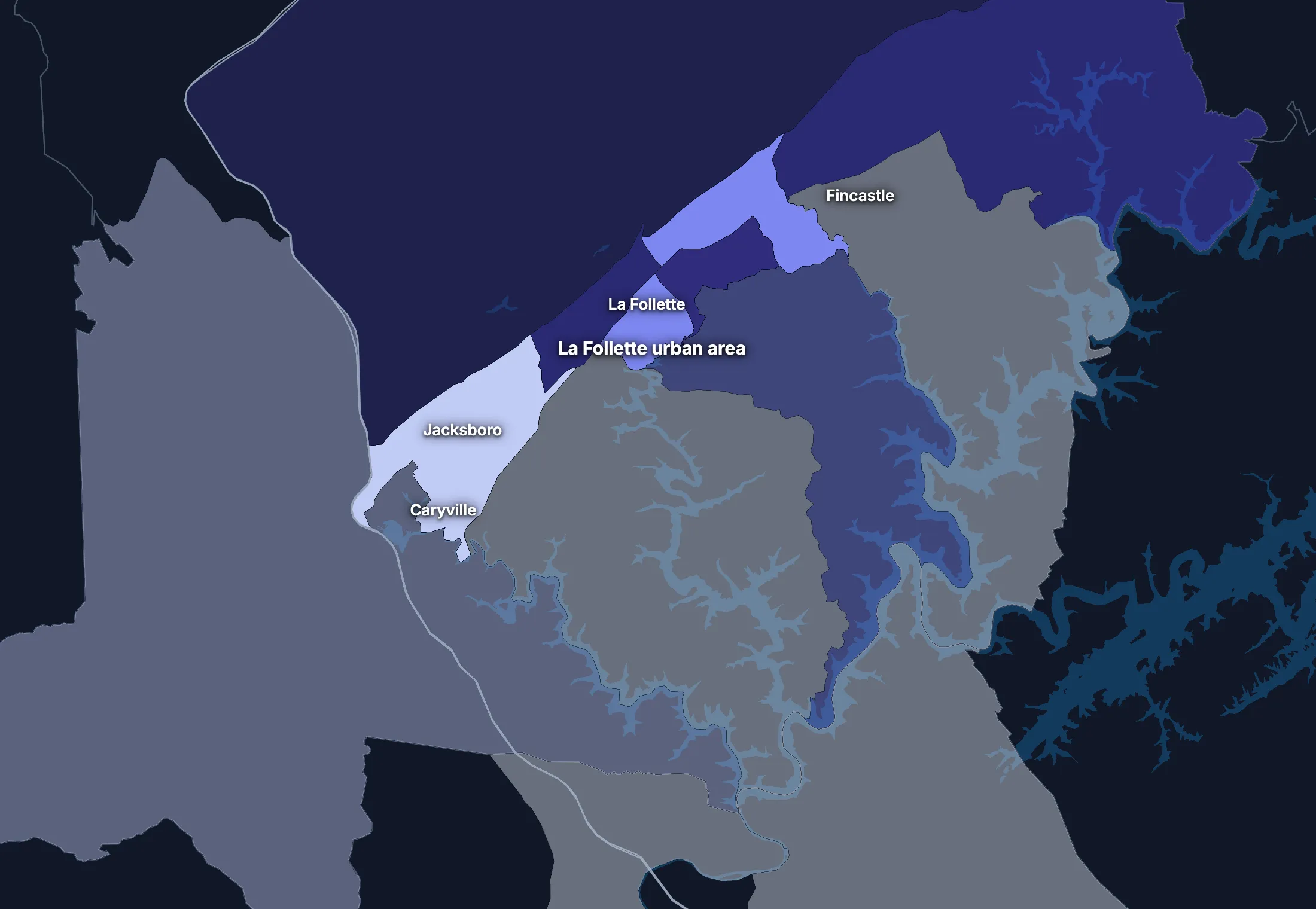
The La Follette urban area, tract by tract
Urban area averages hide a lot. These census tracts are the closest the census comes to neighborhoods.
Where the urban area’s average misleads
Each tick is one census tract, and the dark line marks the urban area. Hover over a tick or tap it to see the tract.
Adults with a bachelor’s degree
0 of 4 tracts are at least 1.5 times the urban area’s overall 12.8%, and 1 is at two-thirds of it or less.
Lowest: Tract 9507.02, 5.7%.
Median household income
0 of 4 tracts are at least 1.5 times the typical tract’s $52,971, and 1 is at two-thirds of it or less.
Lowest: Tract 9507.02, $29,616.
American Community Survey 2020–2024 5-year estimates, by census tract. Income is capped at $250,000+ by the Census Bureau.
People
Who lives in the La Follette urban area
An older urban area than Tennessee (38.9) or the US (38.9), with a median age of 42.3.
Age
Source: ACS 2020–2024 5-year, table A01001.
Show data
| La Follette urban area | Tennessee | United States | |
|---|---|---|---|
| Under 18 | 20.7% ±2.0% , number 4,391 ±481 | 22.2% ±0.1% , number 1,566,969 ±6,893 | 22.0% ±<0.1% , number 73,517,834 ±38,890 |
| 18 to 24 | 8.9% ±1.2% , number 1,878 ±267 | 8.9% ±0.1% , number 629,084 ±5,212 | 9.1% ±<0.1% , number 30,597,362 ±37,780 |
| 25 to 34 | 12.4% ±1.3% , number 2,633 ±312 | 13.8% ±<0.1% , number 977,398 ±1,698 | 13.7% ±<0.1% , number 45,806,540 ±10,200 |
| 35 to 44 | 12.4% ±1.5% , number 2,623 ±344 | 12.8% ±0.1% , number 906,506 ±6,310 | 13.2% ±<0.1% , number 44,237,292 ±43,510 |
| 45 to 54 | 14.3% ±1.4% , number 3,033 ±344 | 12.4% ±<0.1% , number 873,240 ±1,489 | 12.2% ±<0.1% , number 40,743,799 ±8,564 |
| 55 to 64 | 11.6% ±1.2% , number 2,460 ±293 | 12.8% ±0.1% , number 907,239 ±6,455 | 12.7% ±<0.1% , number 42,386,044 ±41,500 |
| 65 to 74 | 11.3% ±1.7% , number 2,398 ±391 | 10.3% ±0.1% , number 729,187 ±5,684 | 10.2% ±<0.1% , number 34,092,907 ±38,800 |
| 75 and over | 8.3% ±1.1% , number 1,762 ±261 | 6.7% ±0.1% , number 476,760 ±4,024 | 7.0% ±<0.1% , number 23,540,721 ±31,560 |
Embed
Race and ethnicity
Source: ACS 2020–2024 5-year, table A04001.
Show data
| La Follette urban area | Tennessee | United States | |
|---|---|---|---|
| White, not Hispanic | 94.5% ±1.7% , number 20,021 ±1,136 | 71.0% ±0.1% , number 5,018,980 ±3,671 | 57.4% ±<0.1% , number 192,214,378 ±30,950 |
| Hispanic or Latino | 2.5% ±0.3% , number 527 ±68 | 7.4% ±<0.1% , number 523,528 ±277 | 19.3% ±<0.1% , number 64,759,370 ±1,547 |
| Black, not Hispanic | 0.5% ±0.3% , number 108 ±68 | 15.4% ±0.1% , number 1,090,494 ±4,152 | 11.9% ±<0.1% , number 39,896,127 ±46,710 |
| Asian, not Hispanic | 0.3% ±0.2% , number 56 ±48 | 1.9% ±<0.1% , number 133,337 ±2,203 | 5.9% ±<0.1% , number 19,678,814 ±22,770 |
| Other or multiracial | 2.2% ±0.5% , number 466 ±118 | 4.2% ±0.1% , number 300,044 ±6,483 | 5.5% ±<0.1% , number 18,373,810 ±69,180 |
Embed
Language spoken at home
Source: ACS 2020–2024 5-year, table C16001.
Show data
| La Follette urban area | Tennessee | United States | |
|---|---|---|---|
| English only | 98.5% ±1.2% , number 19,548 ±1,055 | 91.4% ±0.1% , number 6,081,056 ±8,001 | 77.7% ±0.1% , number 245,767,039 ±221,000 |
| Spanish | 1.2% ±0.6% , number 238 ±117 | 5.2% ±0.1% , number 348,679 ±5,025 | 13.6% ±<0.1% , number 42,869,908 ±143,800 |
| Other Indo-European | 0.2% ±0.3% , number 33 ±54 | 1.4% ±0.1% , number 90,984 ±3,987 | 3.9% ±<0.1% , number 12,249,474 ±54,760 |
| Asian and Pacific Island | 0.1% ±0.3% , number 26 ±55 | 1.1% ±<0.1% , number 73,629 ±3,034 | 3.6% ±<0.1% , number 11,320,253 ±40,030 |
| Arabic and other | 0.0% ±0.2% , number 0 ±37 | 0.9% ±0.1% , number 61,111 ±4,507 | 1.2% ±<0.1% , number 3,935,874 ±33,550 |
Embed
Marital status
Source: ACS 2020–2024 5-year, table A11001.
Show data
| La Follette urban area | Tennessee | United States | |
|---|---|---|---|
| Now married | 47.7% ±3.2% , number 8,400 ±700 | 48.8% ±0.2% , number 2,821,518 ±12,780 | 47.8% ±0.1% , number 131,199,078 ±272,700 |
| Never married | 25.3% ±2.1% , number 4,446 ±429 | 31.2% ±0.2% , number 1,800,280 ±9,465 | 34.4% ±0.1% , number 94,480,845 ±211,900 |
| Divorced | 15.0% ±1.9% , number 2,637 ±362 | 11.9% ±0.1% , number 687,609 ±6,979 | 10.6% ±<0.1% , number 29,074,059 ±73,390 |
| Widowed | 8.8% ±1.3% , number 1,552 ±250 | 6.4% ±0.1% , number 367,610 ±4,186 | 5.6% ±<0.1% , number 15,250,943 ±26,710 |
| Separated | 3.2% ±1.3% , number 558 ±237 | 1.7% ±<0.1% , number 100,848 ±2,820 | 1.7% ±<0.1% , number 4,592,038 ±29,170 |
Embed
Where people lived a year ago
Source: ACS 2020–2024 5-year, table A08001.
Show data
| La Follette urban area | Tennessee | United States | |
|---|---|---|---|
| Same home | 87.1% ±1.7% , number 18,143 ±1,048 | 87.1% ±0.2% , number 6,082,385 ±12,760 | 87.7% ±0.1% , number 290,692,803 ±173,800 |
| Same county | 7.4% ±1.9% , number 1,532 ±400 | 6.4% ±0.1% , number 445,169 ±9,727 | 6.3% ±<0.1% , number 20,792,831 ±117,600 |
| Another county in the state | 3.4% ±1.5% , number 711 ±311 | 3.1% ±0.1% , number 217,379 ±6,236 | 3.1% ±<0.1% , number 10,316,864 ±51,200 |
| Another state | 1.9% ±0.9% , number 397 ±184 | 3.0% ±0.1% , number 211,490 ±5,979 | 2.3% ±<0.1% , number 7,577,400 ±40,570 |
| Another country | 0.2% ±0.3% , number 42 ±54 | 0.4% ±<0.1% , number 27,326 ±2,647 | 0.6% ±<0.1% , number 2,060,087 ±23,560 |
Embed
Top countries of birth, among those born abroad
Source: ACS 2020–2024 5-year, table A07001.
Show data
| La Follette urban area | |
|---|---|
| Mexico | 41.7% , number 115 |
| Guatemala | 13.8% , number 38 |
| China, Excluding Hong Kong and Taiwan | 12.3% , number 34 |
| Cuba | 6.2% , number 17 |
| Honduras | 5.4% , number 15 |
| Laos | 4.7% , number 13 |
Embed
All the numbers
| Indicator | La Follette urban area | Tennessee | US | Rank in Tennessee* | Table |
|---|---|---|---|---|---|
| Population | 21,178 ±1,142 | 7,066,383 | 334,922,499 | 21st | A00001 |
| People per square mile | n/a | 171 | 95 | – | A00002 |
| Land area (square miles) | n/a | – | – | – | A00002 |
| Median age | 42.3 ±2.7 | 38.9 ±0.1 | 38.9 ±0.1 | 11th | A01004 |
| Under 18 | 20.7% ±2.0% , number 4,391 ±481 | 22.2% ±0.1% , number 1,566,969 ±6,893 | 22.0% ±<0.1% , number 73,517,834 ±38,890 | 49th | B02002 |
| 65 and over | 19.6% ±2.0% , number 4,160 ±470 | 17.1% ±0.1% , number 1,205,947 ±6,964 | 17.2% ±<0.1% , number 57,633,628 ±50,010 | 20th | B02002 |
| Born outside the US | 1.3% ±0.5% , number 276 ±111 | 6.1% ±0.1% , number 431,545 ±6,949 | 14.1% ±<0.1% , number 47,349,078 ±143,600 | 59th | A06001 |
| Speak a language other than English at home | 1.5%† (too uncertain to lean on) ±1.2% , number 297 ±145 | 8.6% ±0.1% , number 574,403 ±8,406 | 22.3% ±0.1% , number 70,375,509 ±162,500 | 63rd | C16001 |
| Veterans (adults) | 7.6% ±1.3% , number 1,270 ±230 | 7.3% ±0.1% , number 399,814 ±5,074 | 6.2% ±<0.1% , number 16,185,883 ±45,250 | 27th | A16002 |
| Living with a disability | 24.1% ±2.2% , number 4,995 ±533 | 14.9% ±0.1% , number 1,041,249 ±7,872 | 13.3% ±<0.1% , number 43,869,797 ±68,920 | 10th | B18101 |
| Women 15–50 who had a baby in the past year | 7.2% ±2.6% , number 363 ±136 | 5.2% ±0.2% , number 86,308 ±2,508 | 5.1% ±<0.1% , number 4,009,203 ±20,900 | 16th | B13002 |
| Lived in the same home a year ago | 87.1% ±1.7% , number 18,143 ±1,048 | 87.1% ±0.2% , number 6,082,385 ±12,760 | 87.7% ±0.1% , number 290,692,803 ±173,800 | 41st | A08001 |
| White, not Hispanic | 94.5% ±1.7% , number 20,021 ±1,136 | 71.0% ±0.1% , number 5,018,980 ±3,671 | 57.4% ±<0.1% , number 192,214,378 ±30,950 | 5th | A04001 |
| Hispanic or Latino | 2.5% ±0.3% , number 527 ±68 | 7.4% ±<0.1% , number 523,528 ±277 | 19.3% ±<0.1% , number 64,759,370 ±1,547 | 59th | A04001 |
| Black, not Hispanic | 0.5% ±0.3% , number 108 ±68 | 15.4% ±0.1% , number 1,090,494 ±4,152 | 11.9% ±<0.1% , number 39,896,127 ±46,710 | 65th | A04001 |
| Asian, not Hispanic | 0.3%† (too uncertain to lean on) ±0.2% , number 56 ±48 | 1.9% ±<0.1% , number 133,337 ±2,203 | 5.9% ±<0.1% , number 19,678,814 ±22,770 | 48th | A04001 |
*1 is the highest. Population is ranked among all urban areas, and the rest among those of 1,000 people or more, whose figures can be ranked. Ranks use 5-year estimates, the only ones covering every urban area, so they can differ slightly from the figures here.
Income and work
Lower incomes than the US
The median household income is $51,751, lower than both Tennessee ($69,595) and the US ($80,734). 17.0% of people live in poverty, and 7.6% have no health insurance, lower than Tennessee (10.0%) but about the same as the US (8.4%).
Household income
Source: ACS 2020–2024 5-year, table A14001.
Show data
| La Follette urban area | Tennessee | United States | |
|---|---|---|---|
| Under $25,000 | 23.2% ±3.8% , number 2,114 ±362 | 16.6% ±0.2% , number 469,660 ±6,183 | 14.6% ±<0.1% , number 18,908,588 ±41,540 |
| $25,000 to $49,999 | 24.9% ±3.9% , number 2,274 ±369 | 19.4% ±0.2% , number 549,302 ±6,643 | 16.7% ±<0.1% , number 21,624,902 ±39,130 |
| $50,000 to $74,999 | 17.5% ±3.0% , number 1,591 ±283 | 17.3% ±0.2% , number 488,287 ±5,766 | 15.5% ±<0.1% , number 20,031,683 ±36,850 |
| $75,000 to $99,999 | 14.3% ±3.1% , number 1,305 ±289 | 13.2% ±0.2% , number 371,698 ±4,562 | 12.6% ±<0.1% , number 16,319,799 ±42,700 |
| $100,000 to $149,999 | 13.5% ±3.3% , number 1,226 ±307 | 16.8% ±0.2% , number 475,457 ±5,620 | 17.5% ±<0.1% , number 22,670,921 ±58,280 |
| $150,000 to $199,999 | 2.9% ±1.2% , number 268 ±110 | 7.7% ±0.1% , number 216,988 ±3,778 | 9.6% ±<0.1% , number 12,405,370 ±57,560 |
| $200,000 or more | 3.7% ±2.0% , number 337 ±185 | 9.0% ±0.1% , number 252,885 ±3,814 | 13.4% ±0.1% , number 17,266,233 ±82,370 |
Embed
What residents do for work
Source: ACS 2020–2024 5-year, table A17004.
Show data
| La Follette urban area | Tennessee | United States | |
|---|---|---|---|
| Education and health care | 19.8% ±3.0% , number 1,814 ±309 | 22.4% ±0.2% , number 752,213 ±7,199 | 23.5% ±0.1% , number 37,913,663 ±133,200 |
| Manufacturing | 18.1% ±2.6% , number 1,661 ±276 | 12.5% ±0.2% , number 420,933 ±5,543 | 9.9% ±<0.1% , number 15,940,000 ±38,890 |
| Retail trade | 10.1% ±2.7% , number 930 ±263 | 11.6% ±0.2% , number 388,493 ±5,772 | 10.8% ±<0.1% , number 17,456,908 ±41,100 |
| Construction | 9.3% ±2.1% , number 855 ±208 | 7.1% ±0.2% , number 238,941 ±5,133 | 6.9% ±<0.1% , number 11,167,040 ±57,000 |
| Finance, insurance and real estate | 8.6% ±2.6% , number 789 ±243 | 6.1% ±0.1% , number 203,600 ±3,804 | 6.7% ±<0.1% , number 10,783,159 ±41,000 |
| Transportation and warehousing | 8.3% ±2.6% , number 763 ±243 | 7.2% ±0.1% , number 241,760 ±4,520 | 5.9% ±<0.1% , number 9,568,767 ±29,300 |
| Professional and business services | 7.2% ±1.9% , number 657 ±184 | 10.7% ±0.2% , number 359,446 ±5,407 | 12.6% ±<0.1% , number 20,282,450 ±59,650 |
| Arts, food and lodging | 6.7% ±2.6% , number 612 ±240 | 8.9% ±0.2% , number 299,914 ±5,624 | 8.7% ±<0.1% , number 13,952,453 ±52,980 |
Embed
All the numbers
| Indicator | La Follette urban area | Tennessee | US | Rank in Tennessee* | Table |
|---|---|---|---|---|---|
| Median household income | $51,751 ±$5,573 | $69,595 ±$429 | $80,734 ±$166 | 38th | A14006 |
| Income per person | $29,803 ±$2,457 | $39,437 ±$230 | $44,673 ±$122 | 34th | A14024 |
| Income inequality (Gini index) | 0.443 ±0.031 | 0.476 ±0.003 | 0.483 | 38th | A14028 |
| Living in poverty | 17.0% ±2.6% , number 3,533 ±582 | 13.8% ±0.2% , number 950,340 ±15,730 | 12.5% ±0.1% , number 40,735,661 ±275,900 | 38th | A13004 |
| Unemployment rate | 4.7% ±1.4% , number 453 ±140 | 4.7% ±0.1% , number 164,955 ±4,178 | 5.2% ±<0.1% , number 8,902,365 ±38,980 | 37th | A17005 |
| No health insurance | 7.6% ±1.2% , number 1,573 ±272 | 10.0% ±0.1% , number 699,452 ±9,602 | 8.4% ±<0.1% , number 27,734,911 ±158,900 | 55th | A20001 |
*1 is the highest. Population is ranked among all urban areas, and the rest among those of 1,000 people or more, whose figures can be ranked. Ranks use 5-year estimates, the only ones covering every urban area, so they can differ slightly from the figures here.
Education
Fewer college degrees than the US
11.6% of adults 25 and over have a bachelor’s degree or more, lower than both Tennessee (31.1%) and the US (35.7%).
Highest level of education
Source: ACS 2020–2024 5-year, table A12001.
Show data
| La Follette urban area | Tennessee | United States | |
|---|---|---|---|
| Less than high school | 14.4% ±2.1% , number 2,142 ±324 | 10.0% ±0.1% , number 484,711 ±6,768 | 10.4% ±<0.1% , number 23,992,410 ±82,490 |
| High school only | 43.7% ±3.3% , number 6,513 ±593 | 31.2% ±0.2% , number 1,520,002 ±11,240 | 26.0% ±0.1% , number 60,094,716 ±262,500 |
| Some college | 30.3% ±3.1% , number 4,522 ±509 | 27.8% ±0.2% , number 1,353,016 ±10,950 | 27.9% ±0.1% , number 64,356,961 ±143,900 |
| Bachelor’s degree | 6.5% ±1.7% , number 962 ±251 | 19.4% ±0.2% , number 942,539 ±9,432 | 21.6% ±0.1% , number 49,868,171 ±191,400 |
| Graduate degree | 5.2% ±1.4% , number 770 ±219 | 11.7% ±0.1% , number 570,062 ±6,479 | 14.1% ±0.1% , number 32,495,045 ±159,600 |
Embed
All the numbers
| Indicator | La Follette urban area | Tennessee | US | Rank in Tennessee* | Table |
|---|---|---|---|---|---|
| Bachelor’s degree or more | 11.6% ±2.2% , number 1,732 ±333 | 31.1% ±0.2% , number 1,512,601 ±11,440 | 35.7% ±0.1% , number 82,363,216 ±249,200 | 65th | A12001 |
| High school graduate or more | 85.6% ±3.8% , number 12,767 ±850 | 90.0% ±0.4% , number 4,385,619 ±19,420 | 89.6% ±0.2% , number 206,814,893 ±389,500 | 51st | A12001 |
*1 is the highest. Population is ranked among all urban areas, and the rest among those of 1,000 people or more, whose figures can be ranked. Ranks use 5-year estimates, the only ones covering every urban area, so they can differ slightly from the figures here.
Housing
Homes and what they cost
36.9% of households rent, higher than Tennessee (33.1%) but about the same as the US (34.8%). The median home is worth $198,000 and the median rent is $756.
Types of homes
Source: ACS 2020–2024 5-year, table A10032.
Show data
| La Follette urban area | Tennessee | United States | |
|---|---|---|---|
| Single-family, detached | 72.2% ±2.4% , number 7,175 ±420 | 68.3% ±0.2% , number 2,145,674 ±6,460 | 61.3% ±0.1% , number 88,075,458 ±149,800 |
| Single-family, attached | 0.7% ±0.7% , number 68 ±65 | 3.8% ±0.1% , number 120,244 ±2,813 | 6.2% ±<0.1% , number 8,955,086 ±33,580 |
| 2 to 4 units | 8.3% ±2.0% , number 821 ±199 | 5.6% ±0.1% , number 174,657 ±4,397 | 7.7% ±<0.1% , number 11,031,346 ±42,810 |
| 5 to 19 units | 6.5% ±2.0% , number 647 ±202 | 8.1% ±0.1% , number 254,055 ±4,499 | 8.8% ±<0.1% , number 12,625,154 ±51,990 |
| 20 or more units | 2.6% ±1.3% , number 259 ±127 | 6.0% ±0.1% , number 188,684 ±3,624 | 10.3% ±<0.1% , number 14,859,547 ±31,000 |
| Mobile homes and other | 9.8% ±2.2% , number 973 ±220 | 8.3% ±0.1% , number 260,356 ±3,763 | 5.7% ±<0.1% , number 8,228,764 ±48,580 |
Embed
When homes were built
Source: ACS 2020–2024 5-year, table A10055.
Show data
| La Follette urban area | Tennessee | United States | |
|---|---|---|---|
| 2010 or later | 9.2% ±3.0% , number 839 ±274 | 15.2% ±0.2% , number 428,681 ±5,487 | 11.6% ±<0.1% , number 14,996,534 ±51,640 |
| 2000 to 2009 | 11.5% ±2.3% , number 1,047 ±216 | 16.0% ±0.2% , number 453,218 ±6,760 | 13.8% ±<0.1% , number 17,865,859 ±70,250 |
| 1980 to 1999 | 31.8% ±4.4% , number 2,900 ±423 | 28.8% ±0.3% , number 813,656 ±7,348 | 25.3% ±<0.1% , number 32,758,140 ±75,080 |
| 1960 to 1979 | 26.9% ±3.7% , number 2,456 ±358 | 23.2% ±0.2% , number 654,167 ±6,570 | 23.9% ±<0.1% , number 30,938,809 ±78,560 |
| Before 1960 | 20.5% ±3.6% , number 1,873 ±342 | 16.8% ±0.2% , number 474,555 ±5,839 | 25.3% ±<0.1% , number 32,668,154 ±83,060 |
Embed
All the numbers
| Indicator | La Follette urban area | Tennessee | US | Rank in Tennessee* | Table |
|---|---|---|---|---|---|
| Housing units | 9,943 ±479 | – | – | – | A10001 |
| Households | 9,115 ±437 | – | – | – | A10008 |
| People per household | 2.27 ±0.09 | 2.45 ±0.01 | 2.53 ±0.01 | 49th | A10003 |
| Households that rent | 36.9% ±3.4% , number 3,363 ±349 | 33.1% ±0.3% , number 933,708 ±7,883 | 34.8% ±0.1% , number 45,017,354 ±163,600 | 47th | A10060 |
| Vacant homes | 8.3% ±2.4% , number 828 ±237 | 10.2% ±0.2% , number 319,393 ±6,990 | 10.1% ±0.1% , number 14,547,859 ±200,400 | 37th | A10047, A10060 |
| Median gross rent | $756 ±$59 | $1,189 ±$7 | $1,413 ±$2 | 54th | A18009 |
| Median home value | $198,000 ±$18,730 | $286,700 ±$1,492 | $332,700 ±$236 | 42nd | A10036 |
| Renters paying 30% or more of income | 37.9% ±6.5% , number 1,276 ±256 | 44.3% ±0.6% , number 413,964 ±6,248 | 47.6% ±0.2% , number 21,422,415 ±63,960 | 47th | A18002 |
| Owners paying 30% or more of income | 19.3% ±4.1% , number 1,111 ±247 | 18.4% ±0.3% , number 348,004 ±5,244 | 22.5% ±0.1% , number 18,961,895 ±39,930 | 33rd | A10040 |
| Homes built before 1960 | 20.5% ±3.6% , number 1,873 ±342 | 16.8% ±0.2% , number 474,555 ±5,839 | 25.3% ±<0.1% , number 32,668,154 ±83,060 | 35th | A10055 |
*1 is the highest. Population is ranked among all urban areas, and the rest among those of 1,000 people or more, whose figures can be ranked. Ranks use 5-year estimates, the only ones covering every urban area, so they can differ slightly from the figures here.
Getting around
A driving urban area with long commutes
83.0% of workers drive alone and 8.3% work from home. 43.4% of those who travel to work spend 30 minutes or more getting there, and 6.1% of households have no vehicle.
How people get to work
Source: ACS 2020–2024 5-year, table A09005.
Show data
| La Follette urban area | Tennessee | United States | |
|---|---|---|---|
| Drive alone | 83.0% ±4.9% , number 7,468 ±758 | 75.8% ±0.1% , number 2,512,992 ±9,035 | 68.8% ±0.1% , number 109,447,738 ±95,800 |
| Carpool | 7.2% ±2.2% , number 649 ±203 | 8.4% ±0.2% , number 278,809 ±5,177 | 8.5% ±<0.1% , number 13,569,614 ±52,500 |
| Public transit | 0.1% ±0.4% , number 13 ±35 | 0.5% ±<0.1% , number 17,813 ±1,376 | 3.5% ±<0.1% , number 5,573,279 ±22,170 |
| Walk | 0.5% ±0.3% , number 43 ±31 | 1.2% ±<0.1% , number 39,883 ±1,659 | 2.4% ±<0.1% , number 3,772,609 ±17,080 |
| Work from home | 8.3% ±2.0% , number 743 ±194 | 12.9% ±0.2% , number 426,680 ±6,123 | 15.1% ±<0.1% , number 24,042,489 ±82,860 |
| Other | 0.9% ±0.6% , number 83 ±52 | 1.2% ±0.1% , number 38,132 ±1,861 | 1.7% ±<0.1% , number 2,708,365 ±17,940 |
Embed
Time spent getting to work
Source: ACS 2020–2024 5-year, table B09001.
Show data
| La Follette urban area | Tennessee | United States | |
|---|---|---|---|
| Under 10 minutes | 17.1% ±3.8% , number 1,415 ±339 | 12.0% ±0.2% , number 345,457 ±5,633 | 12.7% ±<0.1% , number 17,153,542 ±40,730 |
| 10 to 19 minutes | 29.5% ±4.3% , number 2,433 ±409 | 28.9% ±0.3% , number 833,865 ±8,436 | 28.7% ±<0.1% , number 38,741,521 ±54,980 |
| 20 to 29 minutes | 10.0% ±2.7% , number 828 ±231 | 22.6% ±0.3% , number 652,292 ±8,772 | 21.3% ±<0.1% , number 28,723,420 ±52,330 |
| 30 to 39 minutes | 12.2% ±3.2% , number 1,011 ±279 | 17.7% ±0.2% , number 511,447 ±6,966 | 16.9% ±<0.1% , number 22,853,044 ±46,230 |
| 40 to 59 minutes | 20.0% ±5.0% , number 1,649 ±440 | 11.8% ±0.2% , number 339,400 ±5,168 | 11.9% ±<0.1% , number 16,024,037 ±44,090 |
| 60 minutes or more | 11.1% ±2.5% , number 920 ±222 | 7.1% ±0.2% , number 205,168 ±4,744 | 8.6% ±<0.1% , number 11,576,041 ±36,550 |
Embed
Vehicles per household
Source: ACS 2020–2024 5-year, table A10030.
Show data
| La Follette urban area | Tennessee | United States | |
|---|---|---|---|
| None | 6.1% ±1.7% , number 558 ±154 | 5.2% ±0.1% , number 147,219 ±3,419 | 8.4% ±<0.1% , number 10,793,323 ±36,450 |
| One | 38.0% ±3.7% , number 3,463 ±374 | 30.9% ±0.3% , number 873,114 ±8,060 | 33.1% ±0.1% , number 42,801,892 ±122,600 |
| Two | 29.2% ±4.4% , number 2,665 ±422 | 38.0% ±0.3% , number 1,072,153 ±8,986 | 36.6% ±0.1% , number 47,334,152 ±191,100 |
| Three or more | 26.6% ±4.4% , number 2,429 ±417 | 25.9% ±0.2% , number 731,791 ±6,641 | 21.9% ±0.1% , number 28,298,129 ±85,940 |
Embed
All the numbers
| Indicator | La Follette urban area | Tennessee | US | Rank in Tennessee* | Table |
|---|---|---|---|---|---|
| Drive to work alone | 83.0% ±4.9% , number 7,468 ±758 | 75.8% ±0.1% , number 2,512,992 ±9,035 | 68.8% ±0.1% , number 109,447,738 ±95,800 | 11th | A09005 |
| Take public transit | 0.1%† (too uncertain to lean on) ±0.4% , number 13 ±35 | 0.5% ±<0.1% , number 17,813 ±1,376 | 3.5% ±<0.1% , number 5,573,279 ±22,170 | 27th | A09005 |
| Work from home | 8.3% ±2.0% , number 743 ±194 | 12.9% ±0.2% , number 426,680 ±6,123 | 15.1% ±<0.1% , number 24,042,489 ±82,860 | 37th | A09005 |
| Commute 30 minutes or more | 43.4% ±5.8% , number 3,580 ±567 | 36.6% ±0.3% , number 1,056,015 ±9,886 | 37.4% ±<0.1% , number 50,453,122 ±73,600 | 15th | B09001 |
| Households with no vehicle | 6.1% ±1.7% , number 558 ±157 | 5.2% ±0.1% , number 147,219 ±3,110 | 8.4% ±<0.1% , number 10,793,323 ±27,220 | 35th | A10030 |
*1 is the highest. Population is ranked among all urban areas, and the rest among those of 1,000 people or more, whose figures can be ranked. Ranks use 5-year estimates, the only ones covering every urban area, so they can differ slightly from the figures here.
Places
In and around the La Follette urban area
Population, from the latest estimates available. Figures cover the whole of each place, including any part outside the urban area.
Largest places
- La Follette: 7,273
- Jacksboro: 2,650
- Caryville: 2,073
- Fincastle: 1,374
Its county
- Campbell County: 39,761
Urban areas like this one
- East Liverpool, OH–WV–PA Urban Area: 21,457
- New Castle, IN Urban Area: 18,466
- Connersville, IN Urban Area: 14,047
- Merrill, WI Urban Area: 9,467
Urban areas at least a third this size, with the closest income, education, age, housing and origins.
Turn the La Follette urban area into your planning report.
Social Explorer Studio builds an editable profile of any place, with tables and charts beside the county and state, and exports to Word, PDF and Excel.
Questions about the La Follette urban area
What is the population of La Follette, TN Urban Area?
21,178 people (±1,142), according to the ACS 2020–2024 5-year estimates. That’s the 21st largest of 68 urban areas in Tennessee.
What is an urban area?
A densely settled area drawn by the Census Bureau from census blocks after each census, with at least 2,000 homes or 5,000 people, whatever the city lines. The La Follette urban area, code 46153, is one of its 2020 urban areas.
What county is the La Follette urban area in?
The La Follette urban area is in Campbell County.
What is the largest city in the La Follette urban area?
La Follette, with 7,273 people. Other large places here include Jacksboro, Caryville and Fincastle. These figures cover the whole of each place, including any part outside the urban area.
What is the median household income in the La Follette urban area?
$51,751 (±$5,573), according to the ACS 2020–2024 5-year estimates, lower than both Tennessee ($69,595) and the US ($80,734).
What is the median age in the La Follette urban area?
42.3 years (±2.7), according to the ACS 2020–2024 5-year estimates, higher than both Tennessee (38.9) and the US (38.9).
How much does housing cost in the La Follette urban area?
The La Follette urban area’s median home value is $198,000 (±$18,730) and its median gross rent is $756 (±$59) a month, according to the ACS 2020–2024 5-year estimates. 37.9% (±6.5%) of its renters pay 30% or more of their income on rent.
Where does this census data come from?
The U.S. Census Bureau’s American Community Survey, through Social Explorer’s tables: the latest 1-year estimates where they exist, for the most recent numbers, and 5-year estimates otherwise. Each table lists its code, so you can find it again.
Is this data free to use?
Yes. You can read it, cite it, download the CSV and embed the charts, with no account. To map other variables, compare your own areas or build a report, see Social Explorer’s plans in a live demo.
Sources and how to cite
American Community Survey 2020–2024 5-year estimates, U.S. Census Bureau, from Social Explorer’s tables A00001, A00002, A01004, A04001, A06001, A08001, A09005, A10001, A10003, A10008, A10030, A10036, A10040, A10047, A10055, A10060, A12001, A13004, A14006, A14024, A14028, A16002, A17005, A18002, A18009, A20001, B02002, B09001, B13002, B18101, C16001. Maps by census tract use 2020–2024 5-year estimates, since the 1-year survey doesn’t cover tracts. These are estimates from a sample, each with its margin of error. Data retrieved November 14, 2026. How these profiles are made.
U.S. Census Bureau, American Community Survey 2020–2024 5-year estimates, via Social Explorer. “La Follette, TN Urban Area.” https://www.socialexplorer.com/places/urban/la-follette-tn-urban-area. Accessed November 14, 2026.