

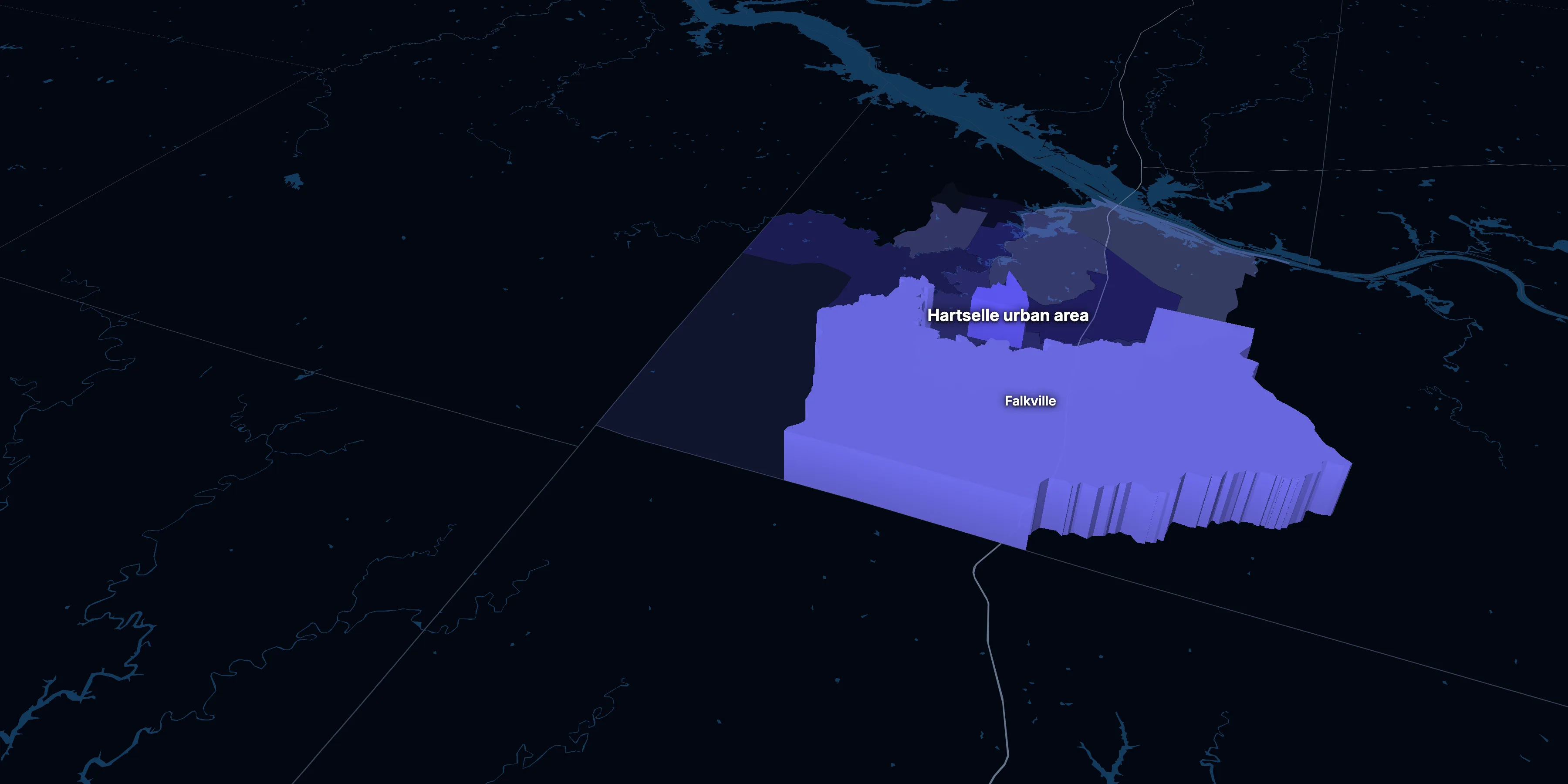
Hartselle urban area, Alabama · population, demographics and census data
Home to 17,132 people, the 22nd largest of Alabama’s 48 urban areas, anchored by Falkville.
- Population
- 17,132 ±632. Rank 22 of 48 in Alabama
- Median household income
- $68,323 ±$10,000. Alabama $63,999 · US $80,734
- Median age
- 38.4 ±1.6. Alabama 39.3 · US 38.9
ACS 2020–2024 5-year estimates, U.S. Census Bureau
About the Hartselle urban area
The Hartselle urban area’s median household income is $68,323 (±$10,000), about the same as Alabama ($63,999) but lower than the US ($80,734), and its median age is 38.4 (±1.6), according to the ACS 2020–2024 5-year estimates. Its largest community is Falkville.
± is each figure’s margin of error, at 90% confidence, and † marks one too uncertain to lean on. Under each percentage in the tables is the number it counts. How the margins are worked out.
Urban area code 37351
Highlights
What stands out in the Hartselle urban area
The numbers where the Hartselle urban area sits furthest from Alabama and the nation, or past a recognized policy benchmark.
Furthest from the national picture
0.0%
Very lowTake public transit
That’s about the same as Alabama (0.4%) but lower than the US (3.5%).
1.1%
Very lowBorn outside the US
That’s lower than both Alabama (4.0%) and the US (14.1%). It’s the 5th lowest of 48 Alabama urban areas.
0.0%
Very lowAsian, not Hispanic
That’s lower than both Alabama (1.4%) and the US (5.9%).
$780
Lower than the USMedian gross rent
That’s lower than both Alabama ($1,007) and the US ($1,413).
6.2%
Very lowWork from home
That’s lower than both Alabama (8.8%) and the US (15.1%).
1.9%
Very lowSpeak a language other than English at home
That’s lower than both Alabama (6.0%) and the US (22.3%). It’s the 5th lowest of 48 Alabama urban areas.
Over time
How the Hartselle urban area has changed
The Census Bureau draws urban areas anew after each census, and these are its 2020 urban areas, so there are no earlier figures for the same area.
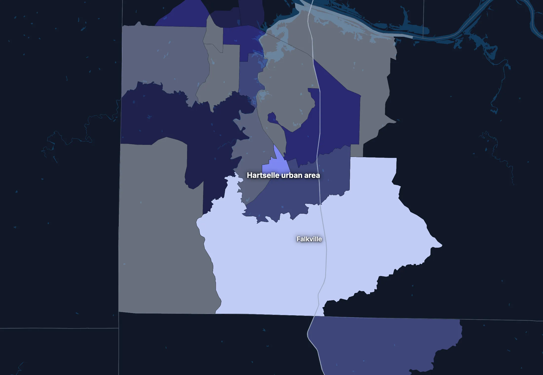
2 census tracts
The Hartselle urban area, tract by tract
Urban area averages hide a lot. These census tracts are the closest the census comes to neighborhoods.
People
Who lives in the Hartselle urban area
Its median age of 38.4 is about the same as both Alabama (39.3) and the US (38.9).
Age
Source: ACS 2020–2024 5-year, table A01001.
Show data
| Hartselle urban area | Alabama | United States | |
|---|---|---|---|
| Under 18 | 25.5% ±3.3% , number 4,366 ±591 | 22.2% ±0.1% , number 1,130,725 ±5,708 | 22.0% ±<0.1% , number 73,517,834 ±38,890 |
| 18 to 24 | 8.4% ±1.8% , number 1,444 ±312 | 9.5% ±0.1% , number 482,337 ±4,669 | 9.1% ±<0.1% , number 30,597,362 ±37,780 |
| 25 to 34 | 12.1% ±1.7% , number 2,070 ±303 | 12.9% ±<0.1% , number 655,463 ±1,426 | 13.7% ±<0.1% , number 45,806,540 ±10,200 |
| 35 to 44 | 11.3% ±1.9% , number 1,942 ±329 | 12.4% ±0.1% , number 632,006 ±4,825 | 13.2% ±<0.1% , number 44,237,292 ±43,510 |
| 45 to 54 | 13.2% ±1.9% , number 2,265 ±340 | 12.2% ±<0.1% , number 618,872 ±1,209 | 12.2% ±<0.1% , number 40,743,799 ±8,564 |
| 55 to 64 | 11.6% ±1.8% , number 1,982 ±320 | 13.0% ±0.1% , number 663,106 ±5,269 | 12.7% ±<0.1% , number 42,386,044 ±41,500 |
| 65 to 74 | 10.4% ±1.8% , number 1,777 ±312 | 10.7% ±0.1% , number 542,349 ±4,730 | 10.2% ±<0.1% , number 34,092,907 ±38,800 |
| 75 and over | 7.5% ±1.4% , number 1,286 ±252 | 7.1% ±0.1% , number 361,910 ±3,673 | 7.0% ±<0.1% , number 23,540,721 ±31,560 |
Embed
Race and ethnicity
Source: ACS 2020–2024 5-year, table A04001.
Show data
| Hartselle urban area | Alabama | United States | |
|---|---|---|---|
| White, not Hispanic | 86.7% ±3.6% , number 14,855 ±831 | 63.4% ±<0.1% , number 3,224,860 ±2,242 | 57.4% ±<0.1% , number 192,214,378 ±30,950 |
| Hispanic or Latino | 2.2% ±1.2% , number 376 ±210 | 5.6% ±<0.1% , number 284,135 ±217 | 19.3% ±<0.1% , number 64,759,370 ±1,547 |
| Black, not Hispanic | 6.6% ±3.2% , number 1,129 ±545 | 25.6% ±0.1% , number 1,302,911 ±3,566 | 11.9% ±<0.1% , number 39,896,127 ±46,710 |
| Asian, not Hispanic | 0.0% ±0.1% , number 8 ±11 | 1.4% ±<0.1% , number 73,353 ±1,346 | 5.9% ±<0.1% , number 19,678,814 ±22,770 |
| Other or multiracial | 4.5% ±1.6% , number 764 ±271 | 4.0% ±0.1% , number 201,509 ±4,301 | 5.5% ±<0.1% , number 18,373,810 ±69,180 |
Embed
Language spoken at home
Source: ACS 2020–2024 5-year, table C16001.
Show data
| Hartselle urban area | Alabama | United States | |
|---|---|---|---|
| English only | 98.1% ±1.3% , number 15,861 ±723 | 94.0% ±0.1% , number 4,503,218 ±5,359 | 77.7% ±0.1% , number 245,767,039 ±221,000 |
| Spanish | 1.2% ±0.8% , number 189 ±125 | 3.9% ±0.1% , number 187,711 ±3,307 | 13.6% ±<0.1% , number 42,869,908 ±143,800 |
| Other Indo-European | 0.3% ±0.3% , number 41 ±44 | 0.8% ±<0.1% , number 39,894 ±2,215 | 3.9% ±<0.1% , number 12,249,474 ±54,760 |
| Asian and Pacific Island | 0.5% ±0.6% , number 73 ±103 | 0.9% ±<0.1% , number 44,543 ±2,277 | 3.6% ±<0.1% , number 11,320,253 ±40,030 |
| Arabic and other | 0.0% ±0.2% , number 0 ±30 | 0.4% ±<0.1% , number 17,664 ±2,204 | 1.2% ±<0.1% , number 3,935,874 ±33,550 |
Embed
Marital status
Source: ACS 2020–2024 5-year, table A11001.
Show data
| Hartselle urban area | Alabama | United States | |
|---|---|---|---|
| Now married | 50.4% ±2.9% , number 6,855 ±529 | 47.3% ±0.2% , number 1,967,729 ±9,305 | 47.8% ±0.1% , number 131,199,078 ±272,700 |
| Never married | 28.3% ±2.9% , number 3,848 ±441 | 31.9% ±0.2% , number 1,325,550 ±7,458 | 34.4% ±0.1% , number 94,480,845 ±211,900 |
| Divorced | 11.6% ±2.1% , number 1,571 ±299 | 12.0% ±0.1% , number 498,195 ±5,595 | 10.6% ±<0.1% , number 29,074,059 ±73,390 |
| Widowed | 9.1% ±2.2% , number 1,234 ±307 | 6.9% ±0.1% , number 288,332 ±3,732 | 5.6% ±<0.1% , number 15,250,943 ±26,710 |
| Separated | 0.7% ±0.4% , number 89 ±60 | 1.8% ±0.1% , number 76,741 ±2,550 | 1.7% ±<0.1% , number 4,592,038 ±29,170 |
Embed
Where people lived a year ago
Source: ACS 2020–2024 5-year, table A08001.
Show data
| Hartselle urban area | Alabama | United States | |
|---|---|---|---|
| Same home | 91.2% ±2.7% , number 15,522 ±735 | 88.3% ±0.2% , number 4,441,777 ±8,749 | 87.7% ±0.1% , number 290,692,803 ±173,800 |
| Same county | 5.7% ±1.8% , number 965 ±316 | 6.1% ±0.2% , number 309,235 ±8,745 | 6.3% ±<0.1% , number 20,792,831 ±117,600 |
| Another county in the state | 2.0% ±0.9% , number 334 ±157 | 2.9% ±0.1% , number 145,249 ±4,462 | 3.1% ±<0.1% , number 10,316,864 ±51,200 |
| Another state | 1.2% ±1.1% , number 208 ±192 | 2.4% ±0.1% , number 119,534 ±4,216 | 2.3% ±<0.1% , number 7,577,400 ±40,570 |
| Another country | 0.0% ±0.1% , number 0 ±21 | 0.3% ±<0.1% , number 17,184 ±2,164 | 0.6% ±<0.1% , number 2,060,087 ±23,560 |
Embed
Top countries of birth, among those born abroad
Source: ACS 2020–2024 5-year, table A07001.
Show data
| Hartselle urban area | |
|---|---|
| Mexico | 47.2% , number 91 |
| South Africa | 15.5% , number 30 |
| Canada | 9.3% , number 18 |
| Italy | 6.2% , number 12 |
| Germany | 5.7% , number 11 |
| Dominican Republic | 5.2% , number 10 |
Embed
All the numbers
| Indicator | Hartselle urban area | Alabama | US | Rank in Alabama* | Table |
|---|---|---|---|---|---|
| Population | 17,132 ±632 | 5,086,768 | 334,922,499 | 22nd | A00001 |
| People per square mile | n/a | 100 | 95 | – | A00002 |
| Land area (square miles) | n/a | – | – | – | A00002 |
| Median age | 38.4 ±1.6 | 39.3 ±0.2 | 38.9 ±0.1 | 19th | A01004 |
| Under 18 | 25.5% ±3.3% , number 4,366 ±591 | 22.2% ±0.1% , number 1,130,725 ±5,708 | 22.0% ±<0.1% , number 73,517,834 ±38,890 | 8th | B02002 |
| 65 and over | 17.9% ±2.2% , number 3,063 ±400 | 17.8% ±0.1% , number 904,259 ±5,988 | 17.2% ±<0.1% , number 57,633,628 ±50,010 | 20th | B02002 |
| Born outside the US | 1.1% ±0.7% , number 193 ±125 | 4.0% ±0.1% , number 203,578 ±4,382 | 14.1% ±<0.1% , number 47,349,078 ±143,600 | 44th | A06001 |
| Speak a language other than English at home | 1.9%† (too uncertain to lean on) ±1.3% , number 303 ±171 | 6.0% ±0.1% , number 289,812 ±5,088 | 22.3% ±0.1% , number 70,375,509 ±162,500 | 44th | C16001 |
| Veterans (adults) | 7.7% ±2.1% , number 985 ±274 | 7.7% ±0.1% , number 303,253 ±4,702 | 6.2% ±<0.1% , number 16,185,883 ±45,250 | 16th | A16002 |
| Living with a disability | 17.6% ±2.4% , number 2,955 ±421 | 16.5% ±0.1% , number 824,128 ±6,739 | 13.3% ±<0.1% , number 43,869,797 ±68,920 | 26th | B18101 |
| Women 15–50 who had a baby in the past year | 3.3% ±1.7% , number 153 ±79 | 5.0% ±0.2% , number 59,417 ±2,024 | 5.1% ±<0.1% , number 4,009,203 ±20,900 | 36th | B13002 |
| Lived in the same home a year ago | 91.2% ±2.7% , number 15,522 ±735 | 88.3% ±0.2% , number 4,441,777 ±8,749 | 87.7% ±0.1% , number 290,692,803 ±173,800 | 12th | A08001 |
| White, not Hispanic | 86.7% ±3.6% , number 14,855 ±831 | 63.4% ±<0.1% , number 3,224,860 ±2,242 | 57.4% ±<0.1% , number 192,214,378 ±30,950 | 3rd | A04001 |
| Hispanic or Latino | 2.2% ±1.2% , number 376 ±210 | 5.6% ±<0.1% , number 284,135 ±217 | 19.3% ±<0.1% , number 64,759,370 ±1,547 | 38th | A04001 |
| Black, not Hispanic | 6.6% ±3.2% , number 1,129 ±545 | 25.6% ±0.1% , number 1,302,911 ±3,566 | 11.9% ±<0.1% , number 39,896,127 ±46,710 | 40th | A04001 |
| Asian, not Hispanic | 0.0%† (too uncertain to lean on) ±0.1% , number 8 ±11 | 1.4% ±<0.1% , number 73,353 ±1,346 | 5.9% ±<0.1% , number 19,678,814 ±22,770 | 39th | A04001 |
*1 is the highest. Population is ranked among all urban areas, and the rest among those of 1,000 people or more, whose figures can be ranked. Ranks use 5-year estimates, the only ones covering every urban area, so they can differ slightly from the figures here.
Income and work
Lower incomes than the US
The median household income is $68,323, about the same as Alabama ($63,999) but lower than the US ($80,734). 14.4% of people live in poverty, and 7.0% have no health insurance, lower than Alabama (9.2%) but about the same as the US (8.4%).
Household income
Source: ACS 2020–2024 5-year, table A14001.
Show data
| Hartselle urban area | Alabama | United States | |
|---|---|---|---|
| Under $25,000 | 18.5% ±4.0% , number 1,158 ±261 | 19.7% ±0.3% , number 394,075 ±5,228 | 14.6% ±<0.1% , number 18,908,588 ±41,540 |
| $25,000 to $49,999 | 19.2% ±4.7% , number 1,201 ±305 | 20.3% ±0.3% , number 404,774 ±5,348 | 16.7% ±<0.1% , number 21,624,902 ±39,130 |
| $50,000 to $74,999 | 15.0% ±3.2% , number 938 ±209 | 16.7% ±0.2% , number 332,863 ±4,932 | 15.5% ±<0.1% , number 20,031,683 ±36,850 |
| $75,000 to $99,999 | 11.9% ±2.8% , number 747 ±182 | 12.7% ±0.2% , number 253,461 ±3,921 | 12.6% ±<0.1% , number 16,319,799 ±42,700 |
| $100,000 to $149,999 | 19.8% ±4.2% , number 1,243 ±277 | 15.5% ±0.2% , number 310,078 ±5,030 | 17.5% ±<0.1% , number 22,670,921 ±58,280 |
| $150,000 to $199,999 | 8.7% ±2.3% , number 545 ±151 | 7.4% ±0.2% , number 147,127 ±3,096 | 9.6% ±<0.1% , number 12,405,370 ±57,560 |
| $200,000 or more | 7.0% ±2.4% , number 438 ±151 | 7.8% ±0.1% , number 154,869 ±2,657 | 13.4% ±0.1% , number 17,266,233 ±82,370 |
Embed
What residents do for work
Source: ACS 2020–2024 5-year, table A17004.
Show data
| Hartselle urban area | Alabama | United States | |
|---|---|---|---|
| Education and health care | 22.6% ±3.9% , number 1,712 ±322 | 22.7% ±0.3% , number 511,346 ±6,419 | 23.5% ±0.1% , number 37,913,663 ±133,200 |
| Manufacturing | 13.7% ±2.8% , number 1,040 ±228 | 14.1% ±0.2% , number 317,853 ±4,530 | 9.9% ±<0.1% , number 15,940,000 ±38,890 |
| Retail trade | 13.0% ±2.8% , number 983 ±224 | 11.6% ±0.2% , number 261,448 ±4,590 | 10.8% ±<0.1% , number 17,456,908 ±41,100 |
| Professional and business services | 9.6% ±2.8% , number 725 ±220 | 10.1% ±0.2% , number 227,311 ±3,791 | 12.6% ±<0.1% , number 20,282,450 ±59,650 |
| Construction | 9.2% ±2.8% , number 695 ±220 | 7.0% ±0.2% , number 157,222 ±3,650 | 6.9% ±<0.1% , number 11,167,040 ±57,000 |
| Transportation and warehousing | 7.7% ±3.1% , number 583 ±237 | 5.9% ±0.1% , number 133,434 ±3,025 | 5.9% ±<0.1% , number 9,568,767 ±29,300 |
| Public administration | 5.6% ±1.8% , number 423 ±142 | 5.6% ±0.1% , number 125,776 ±3,013 | 4.7% ±<0.1% , number 7,624,243 ±43,950 |
| Finance, insurance and real estate | 5.3% ±2.2% , number 405 ±168 | 5.7% ±0.1% , number 127,770 ±3,062 | 6.7% ±<0.1% , number 10,783,159 ±41,000 |
Embed
All the numbers
| Indicator | Hartselle urban area | Alabama | US | Rank in Alabama* | Table |
|---|---|---|---|---|---|
| Median household income | $68,323 ±$10,000 | $63,999 ±$399 | $80,734 ±$166 | 7th | A14006 |
| Income per person | $33,637 ±$2,243 | $36,087 ±$217 | $44,673 ±$122 | 13th | A14024 |
| Income inequality (Gini index) | 0.439 ±0.035 | 0.479 ±0.003 | 0.483 | 40th | A14028 |
| Living in poverty | 14.4% ±3.3% , number 2,420 ±562 | 15.6% ±0.2% , number 772,360 ±9,870 | 12.5% ±0.1% , number 40,735,661 ±275,900 | 39th | A13004 |
| Unemployment rate | 3.2% ±1.5% , number 249 ±116 | 4.7% ±0.1% , number 111,265 ±3,023 | 5.2% ±<0.1% , number 8,902,365 ±38,980 | 40th | A17005 |
| No health insurance | 7.0% ±1.8% , number 1,169 ±312 | 9.2% ±0.1% , number 459,841 ±7,402 | 8.4% ±<0.1% , number 27,734,911 ±158,900 | 43rd | A20001 |
*1 is the highest. Population is ranked among all urban areas, and the rest among those of 1,000 people or more, whose figures can be ranked. Ranks use 5-year estimates, the only ones covering every urban area, so they can differ slightly from the figures here.
Education
Fewer college degrees than the US
24.7% of adults 25 and over have a bachelor’s degree or more, lower than both Alabama (28.4%) and the US (35.7%).
Highest level of education
Source: ACS 2020–2024 5-year, table A12001.
Show data
| Hartselle urban area | Alabama | United States | |
|---|---|---|---|
| Less than high school | 10.3% ±2.7% , number 1,164 ±313 | 11.4% ±0.2% , number 395,315 ±5,914 | 10.4% ±<0.1% , number 23,992,410 ±82,490 |
| High school only | 31.4% ±4.6% , number 3,560 ±558 | 30.3% ±0.3% , number 1,052,769 ±9,245 | 26.0% ±0.1% , number 60,094,716 ±262,500 |
| Some college | 33.6% ±3.8% , number 3,802 ±487 | 29.9% ±0.2% , number 1,040,139 ±8,608 | 27.9% ±0.1% , number 64,356,961 ±143,900 |
| Bachelor’s degree | 15.9% ±2.9% , number 1,797 ±346 | 17.3% ±0.2% , number 600,262 ±7,145 | 21.6% ±0.1% , number 49,868,171 ±191,400 |
| Graduate degree | 8.8% ±1.9% , number 999 ±218 | 11.1% ±0.2% , number 385,221 ±5,271 | 14.1% ±0.1% , number 32,495,045 ±159,600 |
Embed
All the numbers
| Indicator | Hartselle urban area | Alabama | US | Rank in Alabama* | Table |
|---|---|---|---|---|---|
| Bachelor’s degree or more | 24.7% ±3.3% , number 2,796 ±409 | 28.4% ±0.3% , number 985,483 ±8,879 | 35.7% ±0.1% , number 82,363,216 ±249,200 | 20th | A12001 |
| High school graduate or more | 89.7% ±5.4% , number 10,158 ±846 | 88.6% ±0.4% , number 3,078,391 ±15,440 | 89.6% ±0.2% , number 206,814,893 ±389,500 | 13th | A12001 |
*1 is the highest. Population is ranked among all urban areas, and the rest among those of 1,000 people or more, whose figures can be ranked. Ranks use 5-year estimates, the only ones covering every urban area, so they can differ slightly from the figures here.
Housing
Homes and what they cost
24.7% of households rent, lower than both Alabama (29.8%) and the US (34.8%). The median home is worth $192,200 and the median rent is $780.
Types of homes
Source: ACS 2020–2024 5-year, table A10032.
Show data
| Hartselle urban area | Alabama | United States | |
|---|---|---|---|
| Single-family, detached | 78.0% ±4.3% , number 5,388 ±446 | 69.1% ±0.2% , number 1,615,503 ±5,711 | 61.3% ±0.1% , number 88,075,458 ±149,800 |
| Single-family, attached | 3.3% ±1.4% , number 225 ±98 | 1.9% ±0.1% , number 44,189 ±1,627 | 6.2% ±<0.1% , number 8,955,086 ±33,580 |
| 2 to 4 units | 9.8% ±2.5% , number 675 ±178 | 4.8% ±0.1% , number 111,379 ±3,098 | 7.7% ±<0.1% , number 11,031,346 ±42,810 |
| 5 to 19 units | 4.1% ±1.7% , number 280 ±119 | 7.3% ±0.2% , number 171,627 ±3,924 | 8.8% ±<0.1% , number 12,625,154 ±51,990 |
| 20 or more units | 1.1% ±1.2% , number 77 ±81 | 4.4% ±0.1% , number 102,137 ±2,930 | 10.3% ±<0.1% , number 14,859,547 ±31,000 |
| Mobile homes and other | 3.9% ±2.4% , number 267 ±169 | 12.5% ±0.2% , number 292,430 ±4,050 | 5.7% ±<0.1% , number 8,228,764 ±48,580 |
Embed
When homes were built
Source: ACS 2020–2024 5-year, table A10055.
Show data
| Hartselle urban area | Alabama | United States | |
|---|---|---|---|
| 2010 or later | 5.6% ±2.1% , number 348 ±132 | 13.8% ±0.2% , number 275,246 ±4,405 | 11.6% ±<0.1% , number 14,996,534 ±51,640 |
| 2000 to 2009 | 18.0% ±3.6% , number 1,127 ±237 | 15.9% ±0.2% , number 318,478 ±5,000 | 13.8% ±<0.1% , number 17,865,859 ±70,250 |
| 1980 to 1999 | 28.5% ±3.9% , number 1,785 ±272 | 29.5% ±0.3% , number 589,549 ±6,342 | 25.3% ±<0.1% , number 32,758,140 ±75,080 |
| 1960 to 1979 | 36.0% ±6.1% , number 2,260 ±410 | 25.8% ±0.3% , number 516,015 ±6,009 | 23.9% ±<0.1% , number 30,938,809 ±78,560 |
| Before 1960 | 12.0% ±3.0% , number 750 ±193 | 14.9% ±0.2% , number 297,959 ±4,664 | 25.3% ±<0.1% , number 32,668,154 ±83,060 |
Embed
All the numbers
| Indicator | Hartselle urban area | Alabama | US | Rank in Alabama* | Table |
|---|---|---|---|---|---|
| Housing units | 6,912 ±425 | – | – | – | A10001 |
| Households | 6,270 ±407 | – | – | – | A10008 |
| People per household | 2.68 ±0.13 | 2.48 ±0.01 | 2.53 ±0.01 | 5th | A10003 |
| Households that rent | 24.7% ±4.6% , number 1,551 ±306 | 29.8% ±0.3% , number 595,092 ±6,593 | 34.8% ±0.1% , number 45,017,354 ±163,600 | 46th | A10060 |
| Vacant homes | 9.3% ±3.1% , number 642 ±215 | 14.5% ±0.3% , number 340,018 ±6,268 | 10.1% ±0.1% , number 14,547,859 ±200,400 | 36th | A10047, A10060 |
| Median gross rent | $780 ±$44 | $1,007 ±$8 | $1,413 ±$2 | 29th | A18009 |
| Median home value | $192,200 ±$14,470 | $209,900 ±$1,076 | $332,700 ±$236 | 20th | A10036 |
| Renters paying 30% or more of income | 42.2% ±8.1% , number 654 ±180 | 42.5% ±0.5% , number 253,158 ±4,214 | 47.6% ±0.2% , number 21,422,415 ±63,960 | 23rd | A18002 |
| Owners paying 30% or more of income | 13.4% ±3.4% , number 634 ±171 | 17.7% ±0.3% , number 248,409 ±4,111 | 22.5% ±0.1% , number 18,961,895 ±39,930 | 44th | A10040 |
| Homes built before 1960 | 12.0% ±3.0% , number 750 ±193 | 14.9% ±0.2% , number 297,959 ±4,664 | 25.3% ±<0.1% , number 32,668,154 ±83,060 | 37th | A10055 |
*1 is the highest. Population is ranked among all urban areas, and the rest among those of 1,000 people or more, whose figures can be ranked. Ranks use 5-year estimates, the only ones covering every urban area, so they can differ slightly from the figures here.
Getting around
A driving urban area with long commutes
85.6% of workers drive alone and 6.2% work from home. 44.7% of those who travel to work spend 30 minutes or more getting there, and 3.5% of households have no vehicle.
How people get to work
Source: ACS 2020–2024 5-year, table A09005.
Show data
| Hartselle urban area | Alabama | United States | |
|---|---|---|---|
| Drive alone | 85.6% ±3.9% , number 6,388 ±598 | 80.6% ±0.3% , number 1,796,123 ±8,868 | 68.8% ±0.1% , number 109,447,738 ±95,800 |
| Carpool | 7.1% ±2.4% , number 532 ±182 | 8.0% ±0.2% , number 178,991 ±3,877 | 8.5% ±<0.1% , number 13,569,614 ±52,500 |
| Public transit | 0.0% ±0.4% , number 0 ±30 | 0.4% ±<0.1% , number 8,467 ±968 | 3.5% ±<0.1% , number 5,573,279 ±22,170 |
| Walk | 0.1% ±0.1% , number 5 ±10 | 1.1% ±0.1% , number 25,583 ±1,393 | 2.4% ±<0.1% , number 3,772,609 ±17,080 |
| Work from home | 6.2% ±2.2% , number 462 ±166 | 8.8% ±0.2% , number 196,829 ±4,506 | 15.1% ±<0.1% , number 24,042,489 ±82,860 |
| Other | 1.1% ±0.9% , number 79 ±69 | 1.0% ±0.1% , number 23,086 ±1,456 | 1.7% ±<0.1% , number 2,708,365 ±17,940 |
Embed
Time spent getting to work
Source: ACS 2020–2024 5-year, table B09001.
Show data
| Hartselle urban area | Alabama | United States | |
|---|---|---|---|
| Under 10 minutes | 14.0% ±3.8% , number 978 ±279 | 12.1% ±0.2% , number 246,091 ±4,198 | 12.7% ±<0.1% , number 17,153,542 ±40,730 |
| 10 to 19 minutes | 21.8% ±4.1% , number 1,530 ±318 | 29.6% ±0.3% , number 601,934 ±6,713 | 28.7% ±<0.1% , number 38,741,521 ±54,980 |
| 20 to 29 minutes | 19.4% ±3.6% , number 1,362 ±279 | 22.7% ±0.3% , number 460,924 ±5,928 | 21.3% ±<0.1% , number 28,723,420 ±52,330 |
| 30 to 39 minutes | 19.3% ±4.7% , number 1,355 ±350 | 17.6% ±0.3% , number 357,088 ±5,884 | 16.9% ±<0.1% , number 22,853,044 ±46,230 |
| 40 to 59 minutes | 18.8% ±4.1% , number 1,319 ±309 | 11.1% ±0.2% , number 225,071 ±4,655 | 11.9% ±<0.1% , number 16,024,037 ±44,090 |
| 60 minutes or more | 6.6% ±2.5% , number 460 ±183 | 6.9% ±0.2% , number 141,142 ±3,503 | 8.6% ±<0.1% , number 11,576,041 ±36,550 |
Embed
Vehicles per household
Source: ACS 2020–2024 5-year, table A10030.
Show data
| Hartselle urban area | Alabama | United States | |
|---|---|---|---|
| None | 3.5% ±1.5% , number 218 ±92 | 5.4% ±0.2% , number 107,590 ±3,024 | 8.4% ±<0.1% , number 10,793,323 ±36,450 |
| One | 27.4% ±5.1% , number 1,717 ±338 | 31.6% ±0.3% , number 630,767 ±7,057 | 33.1% ±0.1% , number 42,801,892 ±122,600 |
| Two | 40.6% ±6.0% , number 2,543 ±414 | 36.6% ±0.4% , number 731,666 ±7,529 | 36.6% ±0.1% , number 47,334,152 ±191,100 |
| Three or more | 28.6% ±4.6% , number 1,792 ±314 | 26.4% ±0.3% , number 527,224 ±5,703 | 21.9% ±0.1% , number 28,298,129 ±85,940 |
Embed
All the numbers
| Indicator | Hartselle urban area | Alabama | US | Rank in Alabama* | Table |
|---|---|---|---|---|---|
| Drive to work alone | 85.6% ±3.9% , number 6,388 ±598 | 80.6% ±0.3% , number 1,796,123 ±8,868 | 68.8% ±0.1% , number 109,447,738 ±95,800 | 12th | A09005 |
| Take public transit | 0.0%† (too uncertain to lean on) ±0.4% , number 0 ±30 | 0.4% ±<0.1% , number 8,467 ±968 | 3.5% ±<0.1% , number 5,573,279 ±22,170 | 24th | A09005 |
| Work from home | 6.2% ±2.2% , number 462 ±166 | 8.8% ±0.2% , number 196,829 ±4,506 | 15.1% ±<0.1% , number 24,042,489 ±82,860 | 24th | A09005 |
| Commute 30 minutes or more | 44.7% ±5.9% , number 3,134 ±501 | 35.6% ±0.4% , number 723,301 ±8,281 | 37.4% ±<0.1% , number 50,453,122 ±73,600 | 5th | B09001 |
| Households with no vehicle | 3.5% ±1.4% , number 218 ±91 | 5.4% ±0.2% , number 107,590 ±3,065 | 8.4% ±<0.1% , number 10,793,323 ±27,220 | 45th | A10030 |
*1 is the highest. Population is ranked among all urban areas, and the rest among those of 1,000 people or more, whose figures can be ranked. Ranks use 5-year estimates, the only ones covering every urban area, so they can differ slightly from the figures here.
Places
In and around the Hartselle urban area
Population, from the latest estimates available. Figures cover the whole of each place, including any part outside the urban area.
Largest places
- Falkville: 1,606
Its county
- Morgan County: 126,483
Urban areas like this one
- Muskegon–Norton Shores, MI Urban Area: 167,646
- New Ulm, MN Urban Area: 13,522
- Tecumseh, MI Urban Area: 13,060
- Greenwood, AR Urban Area: 9,209
Urban areas at least a third this size, with the closest income, education, age, housing and origins.
Turn the Hartselle urban area into your planning report.
Social Explorer Studio builds an editable profile of any place, with tables and charts beside the county and state, and exports to Word, PDF and Excel.
Questions about the Hartselle urban area
What is the population of Hartselle, AL Urban Area?
17,132 people (±632), according to the ACS 2020–2024 5-year estimates. That’s the 22nd largest of 48 urban areas in Alabama.
What is an urban area?
A densely settled area drawn by the Census Bureau from census blocks after each census, with at least 2,000 homes or 5,000 people, whatever the city lines. The Hartselle urban area, code 37351, is one of its 2020 urban areas.
What county is the Hartselle urban area in?
The Hartselle urban area is in Morgan County.
What is the largest community in the Hartselle urban area?
Falkville, with 1,606 people.
What is the median household income in the Hartselle urban area?
$68,323 (±$10,000), according to the ACS 2020–2024 5-year estimates, about the same as Alabama ($63,999) but lower than the US ($80,734).
What is the median age in the Hartselle urban area?
38.4 years (±1.6), according to the ACS 2020–2024 5-year estimates, about the same as both Alabama (39.3) and the US (38.9).
How much does housing cost in the Hartselle urban area?
The Hartselle urban area’s median home value is $192,200 (±$14,470) and its median gross rent is $780 (±$44) a month, according to the ACS 2020–2024 5-year estimates. 42.2% (±8.1%) of its renters pay 30% or more of their income on rent.
Where does this census data come from?
The U.S. Census Bureau’s American Community Survey, through Social Explorer’s tables: the latest 1-year estimates where they exist, for the most recent numbers, and 5-year estimates otherwise. Each table lists its code, so you can find it again.
Is this data free to use?
Yes. You can read it, cite it, download the CSV and embed the charts, with no account. To map other variables, compare your own areas or build a report, see Social Explorer’s plans in a live demo.
Sources and how to cite
American Community Survey 2020–2024 5-year estimates, U.S. Census Bureau, from Social Explorer’s tables A00001, A00002, A01004, A04001, A06001, A08001, A09005, A10001, A10003, A10008, A10030, A10036, A10040, A10047, A10055, A10060, A12001, A13004, A14006, A14024, A14028, A16002, A17005, A18002, A18009, A20001, B02002, B09001, B13002, B18101, C16001. Maps by census tract use 2020–2024 5-year estimates, since the 1-year survey doesn’t cover tracts. These are estimates from a sample, each with its margin of error. Data retrieved November 14, 2026. How these profiles are made.
U.S. Census Bureau, American Community Survey 2020–2024 5-year estimates, via Social Explorer. “Hartselle, AL Urban Area.” https://www.socialexplorer.com/places/urban/hartselle-al-urban-area. Accessed November 14, 2026.