

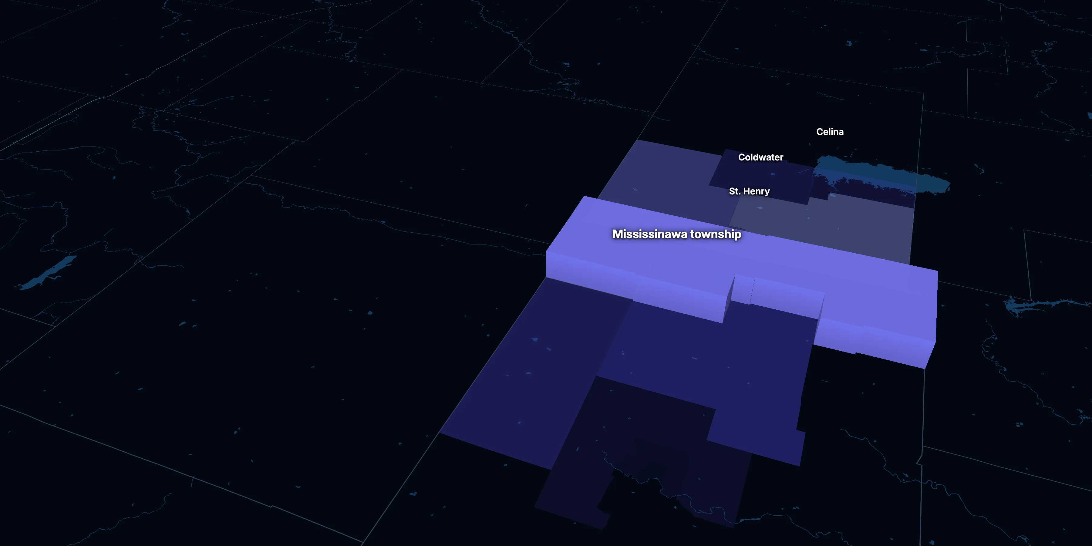
Mississinawa township, Darke County, Ohio · population, demographics and census data
Home to 541 people, the 1,480th largest of Ohio’s 1,581 townships and cities.
- Population
- 541 ±192. Rank 1,480 of 1,581 in Ohio
- Median household income
- $40,000–$105,000. Likely range
ACS 2020–2024 5-year estimates, U.S. Census Bureau
About Mississinawa township
Mississinawa township is in Darke County.
In a place of 541 residents, the American Community Survey interviews a few dozen households at most, so its figures are rough. This page gives each as the range it likely falls in and compares none of them with Ohio or the nation. It shows no highlights, rankings or change over time. Even a range can miss, and † marks a figure too uncertain to lean on.
± is each figure’s margin of error, at 90% confidence, and † marks one too uncertain to lean on. Under each percentage in the tables is the number it counts. How the margins are worked out.
FIPS code 3903750960
Over time
How Mississinawa township has changed
In a place of 541 residents, the survey interviews too few households to measure change over time, so this page doesn’t show it.
1 census tract
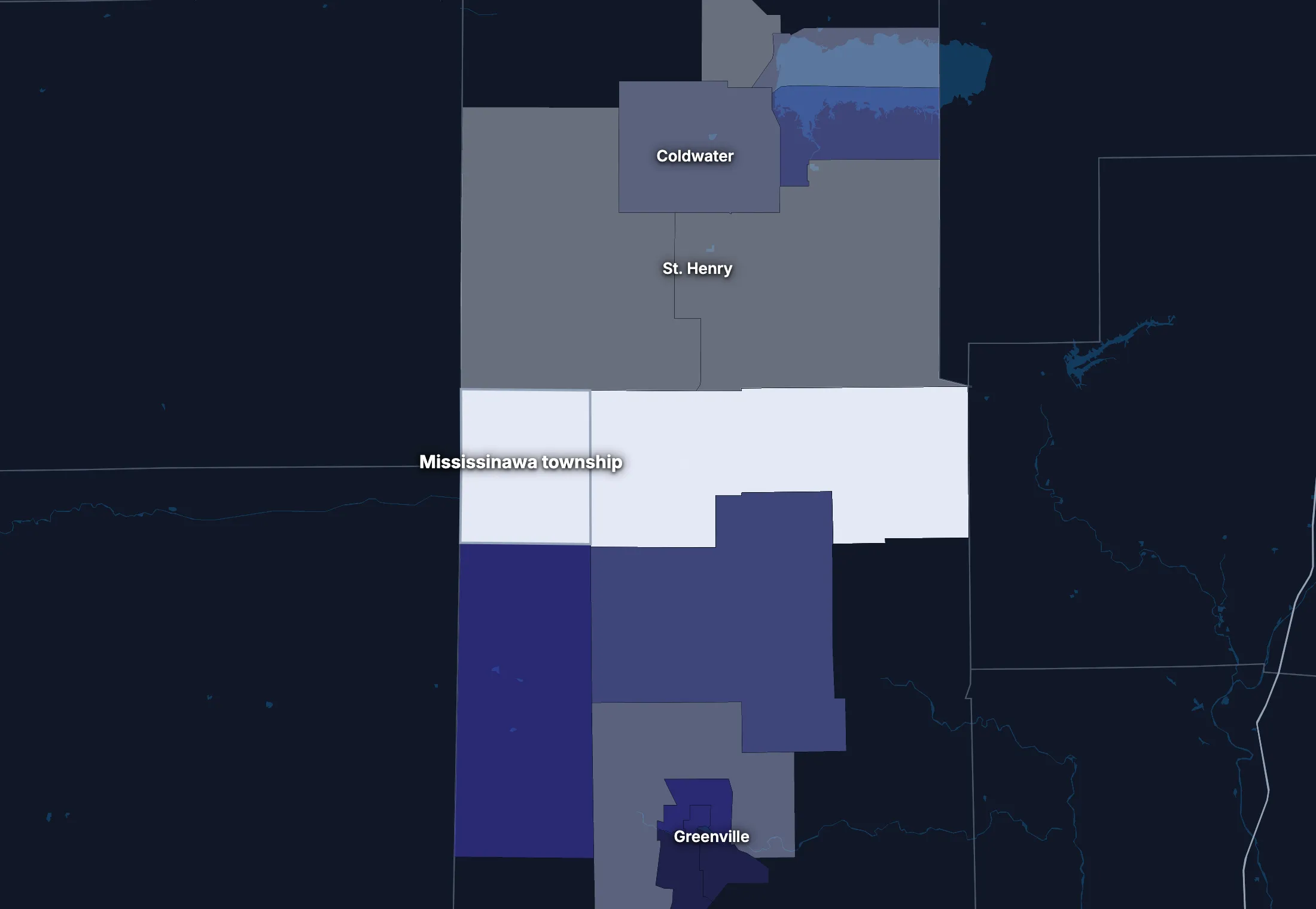
Mississinawa township on the map
Mississinawa township is smaller than a census tract, the smallest area these figures reach, so the map shows the tract it sits in, with the land around it.
People
Who lives in Mississinawa township
Too few households are surveyed here to estimate these figures closely. The table gives each with its margin of error.
For figures from many more households, see Darke County.
Age
Source: ACS 2020–2024 5-year, table A01001.
Show data
| Mississinawa township | Ohio | United States | |
|---|---|---|---|
| Under 18 | 28.1% ±9.6% , number 152 ±75 | 22.0% ±0.1% , number 2,600,150 ±7,122 | 22.0% ±<0.1% , number 73,517,834 ±38,890 |
| 18 to 24 | 10.0% ±8.1% , number 54 ±48 | 8.9% ±0.1% , number 1,047,927 ±6,632 | 9.1% ±<0.1% , number 30,597,362 ±37,780 |
| 25 to 34 | 10.7% ±5.6% , number 58 ±37 | 13.2% ±<0.1% , number 1,558,428 ±1,699 | 13.7% ±<0.1% , number 45,806,540 ±10,200 |
| 35 to 44 | 3.9% ±5.0% , number 21 ±28 | 12.5% ±0.1% , number 1,478,979 ±7,099 | 13.2% ±<0.1% , number 44,237,292 ±43,510 |
| 45 to 54 | 13.3% ±7.5% , number 72 ±48 | 12.0% ±<0.1% , number 1,413,881 ±1,543 | 12.2% ±<0.1% , number 40,743,799 ±8,564 |
| 55 to 64 | 20.5% ±9.3% , number 111 ±64 | 13.2% ±0.1% , number 1,555,351 ±7,352 | 12.7% ±<0.1% , number 42,386,044 ±41,500 |
| 65 to 74 | 6.7% ±5.5% , number 36 ±32 | 10.9% ±0.1% , number 1,291,098 ±6,692 | 10.2% ±<0.1% , number 34,092,907 ±38,800 |
| 75 and over | 6.8% ±5.6% , number 37 ±33 | 7.3% ±<0.1% , number 864,479 ±5,202 | 7.0% ±<0.1% , number 23,540,721 ±31,560 |
Embed
Race and ethnicity
Source: ACS 2020–2024 5-year, table A04001.
Show data
| Mississinawa township | Ohio | United States | |
|---|---|---|---|
| White, not Hispanic | 80.0% ±18.0% , number 433 ±182 | 75.8% ±<0.1% , number 8,955,914 ±4,654 | 57.4% ±<0.1% , number 192,214,378 ±30,950 |
| Hispanic or Latino | 0.0% ±2.4% , number 0 ±13 | 4.8% ±<0.1% , number 562,740 ±221 | 19.3% ±<0.1% , number 64,759,370 ±1,547 |
| Black, not Hispanic | 15.3% ±18.4% , number 83 ±104 | 12.0% ±<0.1% , number 1,420,878 ±5,866 | 11.9% ±<0.1% , number 39,896,127 ±46,710 |
| Asian, not Hispanic | 0.0% ±2.4% , number 0 ±13 | 2.5% ±<0.1% , number 300,274 ±2,723 | 5.9% ±<0.1% , number 19,678,814 ±22,770 |
| Other or multiracial | 4.6% ±7.7% , number 25 ±42 | 4.8% ±0.1% , number 570,487 ±7,845 | 5.5% ±<0.1% , number 18,373,810 ±69,180 |
Embed
Language spoken at home
Source: ACS 2020–2024 5-year, table C16001.
Show data
| Mississinawa township | Ohio | United States | |
|---|---|---|---|
| English only | 100.0% , number 453 ±159 | 92.0% ±0.1% , number 10,247,600 ±10,790 | 77.7% ±0.1% , number 245,767,039 ±221,000 |
| Spanish | 0.0% ±2.9% , number 0 ±13 | 2.6% ±<0.1% , number 294,716 ±4,702 | 13.6% ±<0.1% , number 42,869,908 ±143,800 |
| Other Indo-European | 0.0% ±5.7% , number 0 ±26 | 2.9% ±0.1% , number 323,580 ±7,004 | 3.9% ±<0.1% , number 12,249,474 ±54,760 |
| Asian and Pacific Island | 0.0% ±6.4% , number 0 ±29 | 1.3% ±<0.1% , number 144,672 ±4,541 | 3.6% ±<0.1% , number 11,320,253 ±40,030 |
| Arabic and other | 0.0% ±4.1% , number 0 ±18 | 1.2% ±<0.1% , number 130,182 ±5,248 | 1.2% ±<0.1% , number 3,935,874 ±33,550 |
Embed
Marital status
Source: ACS 2020–2024 5-year, table A11001.
Show data
| Mississinawa township | Ohio | United States | |
|---|---|---|---|
| Now married | 42.6% ±12.4% , number 182 ±84 | 47.0% ±0.2% , number 4,544,843 ±16,330 | 47.8% ±0.1% , number 131,199,078 ±272,700 |
| Never married | 34.0% ±13.9% , number 145 ±79 | 33.6% ±0.1% , number 3,250,653 ±12,120 | 34.4% ±0.1% , number 94,480,845 ±211,900 |
| Divorced | 9.4% ±5.7% , number 40 ±28 | 11.8% ±0.1% , number 1,144,127 ±8,915 | 10.6% ±<0.1% , number 29,074,059 ±73,390 |
| Widowed | 7.3% ±5.3% , number 31 ±25 | 6.2% ±0.1% , number 595,139 ±4,932 | 5.6% ±<0.1% , number 15,250,943 ±26,710 |
| Separated | 6.8% ±8.9% , number 29 ±39 | 1.5% ±<0.1% , number 141,297 ±3,141 | 1.7% ±<0.1% , number 4,592,038 ±29,170 |
Embed
Where people lived a year ago
Source: ACS 2020–2024 5-year, table A08001.
Show data
| Mississinawa township | Ohio | United States | |
|---|---|---|---|
| Same home | 98.9% ±1.3% , number 535 ±190 | 88.1% ±0.1% , number 10,286,774 ±16,080 | 87.7% ±0.1% , number 290,692,803 ±173,800 |
| Same county | 0.0% ±2.4% , number 0 ±13 | 6.7% ±0.1% , number 785,313 ±12,970 | 6.3% ±<0.1% , number 20,792,831 ±117,600 |
| Another county in the state | 0.0% ±2.4% , number 0 ±13 | 3.2% ±0.1% , number 373,139 ±6,714 | 3.1% ±<0.1% , number 10,316,864 ±51,200 |
| Another state | 0.0% ±2.4% , number 0 ±13 | 1.6% ±<0.1% , number 190,257 ±5,497 | 2.3% ±<0.1% , number 7,577,400 ±40,570 |
| Another country | 1.1% ±1.4% , number 6 ±8 | 0.4% ±<0.1% , number 47,384 ±2,655 | 0.6% ±<0.1% , number 2,060,087 ±23,560 |
Embed
All the numbers
| Indicator | Mississinawa township | Ohio | US | Table |
|---|---|---|---|---|
| Population | 541 ±192 | 11,810,293 | 334,922,499 | A00001 |
| People per square mile | 18 ±7 | 289 | 95 | A00002 |
| Land area (square miles) | 29 | – | – | A00002 |
| Median age | 35.9† (too uncertain to lean on) ±24.2 | 39.7 ±0.2 | 38.9 ±0.1 | A01004 |
| Under 18 | 28.1% ±9.6% , number 152 ±75 | 22.0% ±0.1% , number 2,600,150 ±7,122 | 22.0% ±<0.1% , number 73,517,834 ±38,890 | B02002 |
| 65 and over | 13.5% ±7.1% , number 73 ±46 | 18.3% ±0.1% , number 2,155,577 ±8,476 | 17.2% ±<0.1% , number 57,633,628 ±50,010 | B02002 |
| Born outside the US | 0.0%† (too uncertain to lean on) ±2.4% , number 0 ±13 | 5.2% ±0.1% , number 616,102 ±7,104 | 14.1% ±<0.1% , number 47,349,078 ±143,600 | A06001 |
| Speak a language other than English at home | 0.0%† (too uncertain to lean on) ±9.9% , number 0 ±45 | 8.0% ±0.1% , number 893,150 ±10,920 | 22.3% ±0.1% , number 70,375,509 ±162,500 | C16001 |
| Veterans (adults) | 0.0%† (too uncertain to lean on) ±3.3% , number 0 ±13 | 6.6% ±0.1% , number 605,840 ±5,765 | 6.2% ±<0.1% , number 16,185,883 ±45,250 | A16002 |
| Living with a disability | 14.2%† (too uncertain to lean on) ±9.8% , number 77 ±60 | 14.4% ±0.1% , number 1,678,429 ±9,786 | 13.3% ±<0.1% , number 43,869,797 ±68,920 | B18101 |
| Women 15–50 who had a baby in the past year | 0.0%† (too uncertain to lean on) ±12.5% , number 0 ±13 | 5.4% ±0.1% , number 144,308 ±3,283 | 5.1% ±<0.1% , number 4,009,203 ±20,900 | B13002 |
| Lived in the same home a year ago | 98.9% ±1.3% , number 535 ±190 | 88.1% ±0.1% , number 10,286,774 ±16,080 | 87.7% ±0.1% , number 290,692,803 ±173,800 | A08001 |
| White, not Hispanic | 80.0% ±18.0% , number 433 ±182 | 75.8% ±<0.1% , number 8,955,914 ±4,654 | 57.4% ±<0.1% , number 192,214,378 ±30,950 | A04001 |
| Hispanic or Latino | 0.0%† (too uncertain to lean on) ±2.4% , number 0 ±13 | 4.8% ±<0.1% , number 562,740 ±221 | 19.3% ±<0.1% , number 64,759,370 ±1,547 | A04001 |
| Black, not Hispanic | 15.3%† (too uncertain to lean on) ±18.4% , number 83 ±104 | 12.0% ±<0.1% , number 1,420,878 ±5,866 | 11.9% ±<0.1% , number 39,896,127 ±46,710 | A04001 |
| Asian, not Hispanic | 0.0%† (too uncertain to lean on) ±2.4% , number 0 ±13 | 2.5% ±<0.1% , number 300,274 ±2,723 | 5.9% ±<0.1% , number 19,678,814 ±22,770 | A04001 |
Income and work
Income and work
Its median household income is likely between $40,000 and $105,000.
For figures from many more households, see Darke County.
Household income
Source: ACS 2020–2024 5-year, table A14001.
Show data
| Mississinawa township | Ohio | United States | |
|---|---|---|---|
| Under $25,000 | 16.7% ±19.5% , number 35 ±42 | 16.3% ±0.2% , number 792,343 ±7,874 | 14.6% ±<0.1% , number 18,908,588 ±41,540 |
| $25,000 to $49,999 | 16.2% ±17.2% , number 34 ±37 | 19.1% ±0.2% , number 927,741 ±7,650 | 16.7% ±<0.1% , number 21,624,902 ±39,130 |
| $50,000 to $74,999 | 17.6% ±9.8% , number 37 ±23 | 16.9% ±0.1% , number 822,765 ±6,709 | 15.5% ±<0.1% , number 20,031,683 ±36,850 |
| $75,000 to $99,999 | 15.2% ±17.0% , number 32 ±37 | 13.1% ±0.1% , number 638,582 ±5,851 | 12.6% ±<0.1% , number 16,319,799 ±42,700 |
| $100,000 to $149,999 | 7.1% ±6.8% , number 15 ±15 | 17.1% ±0.1% , number 832,127 ±7,306 | 17.5% ±<0.1% , number 22,670,921 ±58,280 |
| $150,000 to $199,999 | 5.7% ±7.4% , number 12 ±16 | 8.3% ±0.1% , number 406,047 ±5,084 | 9.6% ±<0.1% , number 12,405,370 ±57,560 |
| $200,000 or more | 21.4% ±11.7% , number 45 ±28 | 9.1% ±0.1% , number 443,586 ±4,737 | 13.4% ±0.1% , number 17,266,233 ±82,370 |
Embed
What residents do for work
Source: ACS 2020–2024 5-year, table A17004.
Show data
| Mississinawa township | Ohio | United States | |
|---|---|---|---|
| Manufacturing | 36.0% ±21.2% , number 95 ±66 | 14.7% ±0.1% , number 838,036 ±7,666 | 9.9% ±<0.1% , number 15,940,000 ±38,890 |
| Agriculture and mining | 22.7% ±8.3% , number 60 ±31 | 0.9% ±<0.1% , number 51,851 ±1,698 | 1.6% ±<0.1% , number 2,511,442 ±17,160 |
| Education and health care | 15.9% ±10.2% , number 42 ±31 | 24.3% ±0.2% , number 1,387,462 ±10,450 | 23.5% ±0.1% , number 37,913,663 ±133,200 |
| Arts, food and lodging | 10.6% ±13.5% , number 28 ±37 | 8.4% ±0.1% , number 477,205 ±6,122 | 8.7% ±<0.1% , number 13,952,453 ±52,980 |
| Transportation and warehousing | 6.4% ±6.0% , number 17 ±17 | 6.0% ±0.1% , number 341,966 ±4,873 | 5.9% ±<0.1% , number 9,568,767 ±29,300 |
| Public administration | 5.7% ±7.7% , number 15 ±21 | 4.0% ±0.1% , number 227,189 ±4,473 | 4.7% ±<0.1% , number 7,624,243 ±43,950 |
| Construction | 2.7% ±3.7% , number 7 ±10 | 6.0% ±0.1% , number 339,983 ±5,126 | 6.9% ±<0.1% , number 11,167,040 ±57,000 |
| Wholesale trade | 0.0% ±4.9% , number 0 ±13 | 2.2% ±0.1% , number 124,660 ±3,245 | 2.2% ±<0.1% , number 3,507,744 ±16,260 |
Embed
Where workers come from and go
Mississinawa township has 62 jobs and 341 employed residents. 59 people commute in to work and 338 commute out, while 3 both live and work here. The most commuters come from Patterson township (Darke, OH).
Most commuters come from
- Patterson township (Darke, OH): 6
- Wabash township (Darke, OH): 6
- Granville township (Mercer, OH): 6
Most residents commute to
- Wayne township (Darke, OH): 37
- Jefferson township (Mercer, OH): 17
- German township (Auglaize, OH): 16
Show data
| Mississinawa township | |
|---|---|
| Live and work here | 3 |
| Work here, live elsewhere | 59 |
| Live here, work elsewhere | 338 |
Embed
All the numbers
| Indicator | Mississinawa township | Ohio | US | Table |
|---|---|---|---|---|
| Median household income | $72,143 ±$32,230 | $71,389 ±$321 | $80,734 ±$166 | A14006 |
| Income per person | $54,007 ±$25,740 | $40,552 ±$167 | $44,673 ±$122 | A14024 |
| Income inequality (Gini index) | 0.523 ±0.096 | 0.467 ±0.002 | 0.483 | A14028 |
| Living in poverty | 22.9%† (too uncertain to lean on) ±26.7% , number 124 ±151 | 13.3% ±0.2% , number 1,529,692 ±19,000 | 12.5% ±0.1% , number 40,735,661 ±275,900 | A13004 |
| Unemployment rate | 0.0%† (too uncertain to lean on) ±4.9% , number 0 ±13 | 4.8% ±0.1% , number 285,380 ±5,523 | 5.2% ±<0.1% , number 8,902,365 ±38,980 | A17005 |
| No health insurance | 7.6%† (too uncertain to lean on) ±6.0% , number 41 ±36 | 6.4% ±0.1% , number 746,399 ±9,759 | 8.4% ±<0.1% , number 27,734,911 ±158,900 | A20001 |
Education
Education
Too few households are surveyed here to estimate these figures closely. The table gives each with its margin of error.
For figures from many more households, see Darke County.
Highest level of education
Source: ACS 2020–2024 5-year, table A12001.
Show data
| Mississinawa township | Ohio | United States | |
|---|---|---|---|
| Less than high school | 10.4% ±16.9% , number 35 ±58 | 8.2% ±0.1% , number 666,517 ±7,559 | 10.4% ±<0.1% , number 23,992,410 ±82,490 |
| High school only | 58.5% ±11.8% , number 196 ±72 | 32.1% ±0.2% , number 2,618,083 ±14,490 | 26.0% ±0.1% , number 60,094,716 ±262,500 |
| Some college | 21.8% ±12.8% , number 73 ±48 | 28.3% ±0.2% , number 2,307,564 ±12,580 | 27.9% ±0.1% , number 64,356,961 ±143,900 |
| Bachelor’s degree | 6.6% ±6.6% , number 22 ±23 | 19.3% ±0.1% , number 1,574,601 ±12,010 | 21.6% ±0.1% , number 49,868,171 ±191,400 |
| Graduate degree | 2.7% ±6.5% , number 9 ±22 | 12.2% ±0.1% , number 995,451 ±9,182 | 14.1% ±0.1% , number 32,495,045 ±159,600 |
Embed
All the numbers
| Indicator | Mississinawa township | Ohio | US | Table |
|---|---|---|---|---|
| Bachelor’s degree or more | 9.3%† (too uncertain to lean on) ±9.1% , number 31 ±32 | 31.5% ±0.2% , number 2,570,052 ±15,120 | 35.7% ±0.1% , number 82,363,216 ±249,200 | A12001 |
| High school graduate or more | 89.6% ±2.0% , number 300 ±92 | 91.8% ±0.3% , number 7,495,699 ±24,430 | 89.6% ±0.2% , number 206,814,893 ±389,500 | A12001 |
Housing
Homes and what they cost
Too few households are surveyed here to estimate these figures closely. The table gives each with its margin of error.
For figures from many more households, see Darke County.
Types of homes
Source: ACS 2020–2024 5-year, table A10032.
Show data
| Mississinawa township | Ohio | United States | |
|---|---|---|---|
| Single-family, detached | 65.4% ±12.9% , number 176 ±59 | 68.8% ±0.2% , number 3,639,718 ±8,923 | 61.3% ±0.1% , number 88,075,458 ±149,800 |
| Single-family, attached | 0.0% ±4.8% , number 0 ±13 | 4.9% ±0.1% , number 260,614 ±4,183 | 6.2% ±<0.1% , number 8,955,086 ±33,580 |
| 2 to 4 units | 21.9% ±17.9% , number 59 ±51 | 7.9% ±0.1% , number 418,797 ±5,614 | 7.7% ±<0.1% , number 11,031,346 ±42,810 |
| 5 to 19 units | 0.0% ±6.8% , number 0 ±18 | 8.4% ±0.1% , number 445,829 ±6,318 | 8.8% ±<0.1% , number 12,625,154 ±51,990 |
| 20 or more units | 0.0% ±6.8% , number 0 ±18 | 6.5% ±0.1% , number 342,545 ±4,417 | 10.3% ±<0.1% , number 14,859,547 ±31,000 |
| Mobile homes and other | 12.6% ±10.6% , number 34 ±30 | 3.5% ±0.1% , number 184,888 ±3,357 | 5.7% ±<0.1% , number 8,228,764 ±48,580 |
Embed
When homes were built
Source: ACS 2020–2024 5-year, table A10055.
Show data
| Mississinawa township | Ohio | United States | |
|---|---|---|---|
| 2010 or later | 13.3% ±13.9% , number 28 ±30 | 6.8% ±0.1% , number 331,776 ±4,815 | 11.6% ±<0.1% , number 14,996,534 ±51,640 |
| 2000 to 2009 | 2.9% ±7.5% , number 6 ±16 | 10.0% ±0.1% , number 485,222 ±6,076 | 13.8% ±<0.1% , number 17,865,859 ±70,250 |
| 1980 to 1999 | 31.4% ±21.0% , number 66 ±48 | 20.6% ±0.2% , number 1,001,312 ±8,006 | 25.3% ±<0.1% , number 32,758,140 ±75,080 |
| 1960 to 1979 | 19.5% ±19.7% , number 41 ±43 | 26.0% ±0.2% , number 1,263,224 ±8,882 | 23.9% ±<0.1% , number 30,938,809 ±78,560 |
| Before 1960 | 32.9% ±20.9% , number 69 ±48 | 36.6% ±0.2% , number 1,781,657 ±10,920 | 25.3% ±<0.1% , number 32,668,154 ±83,060 |
Embed
All the numbers
| Indicator | Mississinawa township | Ohio | US | Table |
|---|---|---|---|---|
| Housing units | 269 ±73 | – | – | A10001 |
| Households | 210 ±62 | – | – | A10008 |
| People per household | 2.58 ±0.57 | 2.37 ±0.01 | 2.53 ±0.01 | A10003 |
| Households that rent | 21.9%† (too uncertain to lean on) ±18.4% , number 46 ±41 | 32.8% ±0.2% , number 1,595,287 ±11,760 | 34.8% ±0.1% , number 45,017,354 ±163,600 | A10060 |
| Vacant homes | 21.9%† (too uncertain to lean on) ±17.2% , number 59 ±49 | 8.1% ±0.2% , number 429,200 ±8,629 | 10.1% ±0.1% , number 14,547,859 ±200,400 | A10047, A10060 |
| Median gross rent | n/a | $1,034 ±$5 | $1,413 ±$2 | A18009 |
| Median home value | $119,000† (too uncertain to lean on) ±$86,550 | $214,800 ±$742 | $332,700 ±$236 | A10036 |
| Renters paying 30% or more of income | 76.1%† (too uncertain to lean on) ±70.6% , number 35 ±45 | 42.4% ±0.4% , number 676,962 ±8,101 | 47.6% ±0.2% , number 21,422,415 ±63,960 | A18002 |
| Owners paying 30% or more of income | 4.3%† (too uncertain to lean on) ±21.8% , number 7 ±36 | 17.7% ±0.2% , number 579,883 ±6,386 | 22.5% ±0.1% , number 18,961,895 ±39,930 | A10040 |
| Homes built before 1960 | 32.9% ±20.9% , number 69 ±48 | 36.6% ±0.2% , number 1,781,657 ±10,920 | 25.3% ±<0.1% , number 32,668,154 ±83,060 | A10055 |
Getting around
How people get around
The share of workers who drive alone is likely between 42% and 70%.
For figures from many more households, see Darke County.
How people get to work
Source: ACS 2020–2024 5-year, table A09005.
Show data
| Mississinawa township | Ohio | United States | |
|---|---|---|---|
| Drive alone | 56.4% ±14.0% , number 149 ±66 | 75.1% ±0.2% , number 4,210,848 ±15,080 | 68.8% ±0.1% , number 109,447,738 ±95,800 |
| Carpool | 14.8% ±14.1% , number 39 ±40 | 7.5% ±0.1% , number 422,629 ±5,955 | 8.5% ±<0.1% , number 13,569,614 ±52,500 |
| Public transit | 0.0% ±7.0% , number 0 ±18 | 1.2% ±0.1% , number 68,281 ±2,924 | 3.5% ±<0.1% , number 5,573,279 ±22,170 |
| Walk | 18.9% ±13.5% , number 50 ±40 | 2.0% ±<0.1% , number 109,647 ±2,348 | 2.4% ±<0.1% , number 3,772,609 ±17,080 |
| Work from home | 9.8% ±8.3% , number 26 ±24 | 13.0% ±0.1% , number 727,365 ±6,685 | 15.1% ±<0.1% , number 24,042,489 ±82,860 |
| Other | 0.0% ±8.5% , number 0 ±23 | 1.2% ±<0.1% , number 69,503 ±2,459 | 1.7% ±<0.1% , number 2,708,365 ±17,940 |
Embed
Time spent getting to work
Source: ACS 2020–2024 5-year, table B09001.
Show data
| Mississinawa township | Ohio | United States | |
|---|---|---|---|
| Under 10 minutes | 32.8% ±12.6% , number 78 ±44 | 14.7% ±0.1% , number 716,673 ±7,043 | 12.7% ±<0.1% , number 17,153,542 ±40,730 |
| 10 to 19 minutes | 24.8% ±20.1% , number 59 ±54 | 31.0% ±0.2% , number 1,514,050 ±10,240 | 28.7% ±<0.1% , number 38,741,521 ±54,980 |
| 20 to 29 minutes | 12.2% ±14.4% , number 29 ±36 | 24.4% ±0.2% , number 1,192,075 ±8,661 | 21.3% ±<0.1% , number 28,723,420 ±52,330 |
| 30 to 39 minutes | 22.7% ±12.7% , number 54 ±38 | 15.8% ±0.1% , number 770,097 ±7,486 | 16.9% ±<0.1% , number 22,853,044 ±46,230 |
| 40 to 59 minutes | 4.6% ±8.1% , number 11 ±20 | 9.0% ±0.1% , number 440,485 ±5,037 | 11.9% ±<0.1% , number 16,024,037 ±44,090 |
| 60 minutes or more | 2.9% ±6.8% , number 7 ±16 | 5.1% ±0.1% , number 247,528 ±4,302 | 8.6% ±<0.1% , number 11,576,041 ±36,550 |
Embed
Vehicles per household
Source: ACS 2020–2024 5-year, table A10030.
Show data
| Mississinawa township | Ohio | United States | |
|---|---|---|---|
| None | 0.0% ±8.8% , number 0 ±18 | 7.5% ±0.1% , number 363,318 ±4,866 | 8.4% ±<0.1% , number 10,793,323 ±36,450 |
| One | 23.3% ±19.3% , number 49 ±43 | 34.0% ±0.2% , number 1,652,465 ±11,230 | 33.1% ±0.1% , number 42,801,892 ±122,600 |
| Two | 53.3% ±18.4% , number 112 ±51 | 37.4% ±0.2% , number 1,818,705 ±12,390 | 36.6% ±0.1% , number 47,334,152 ±191,100 |
| Three or more | 23.3% ±17.3% , number 49 ±39 | 21.2% ±0.2% , number 1,028,703 ±7,781 | 21.9% ±0.1% , number 28,298,129 ±85,940 |
Embed
All the numbers
| Indicator | Mississinawa township | Ohio | US | Table |
|---|---|---|---|---|
| Drive to work alone | 56.4% ±14.0% , number 149 ±66 | 75.1% ±0.2% , number 4,210,848 ±15,080 | 68.8% ±0.1% , number 109,447,738 ±95,800 | A09005 |
| Take public transit | 0.0%† (too uncertain to lean on) ±7.0% , number 0 ±18 | 1.2% ±0.1% , number 68,281 ±2,924 | 3.5% ±<0.1% , number 5,573,279 ±22,170 | A09005 |
| Work from home | 9.8%† (too uncertain to lean on) ±8.3% , number 26 ±24 | 13.0% ±0.1% , number 727,365 ±6,685 | 15.1% ±<0.1% , number 24,042,489 ±82,860 | A09005 |
| Commute 30 minutes or more | 30.3% ±14.4% , number 72 ±46 | 29.9% ±0.2% , number 1,458,110 ±9,996 | 37.4% ±<0.1% , number 50,453,122 ±73,600 | B09001 |
| Households with no vehicle | 0.0%† (too uncertain to lean on) ±6.2% , number 0 ±13 | 7.5% ±0.1% , number 363,318 ±4,553 | 8.4% ±<0.1% , number 10,793,323 ±27,220 | A10030 |
Places
In and around Mississinawa township
Population, from the latest estimates available. Figures cover the whole of each place.
Places nearby
- Greenville: 12,741
- Celina: 10,903
- Coldwater: 4,191
- Minster: 3,182
- Arcanum: 2,912
- New Bremen: 2,787
- St. Henry: 2,741
- Versailles: 2,715
Its county
- Darke County: 51,594
Towns and townships like this one
- Rutherford township, IN: 1,092
- Spencer village, OH: 628
- Coloma village, WI: 549
- Bowlus city, MN: 278
Towns and townships at least a third this size, with the closest income, education, age, housing and origins.
Turn Mississinawa township into your planning report.
Social Explorer Studio builds an editable profile of any place, with tables and charts beside the county and state, and exports to Word, PDF and Excel.
Questions about Mississinawa township
What is the population of Mississinawa township, Ohio?
541 people (±192), according to the ACS 2020–2024 5-year estimates. That’s the 1,480th largest of 1,581 townships and cities in Ohio.
What is the FIPS code for Mississinawa township, Ohio?
3903750960. The first two digits, 39, are Ohio’s state code, the next three, 037, its county’s, and the last five, 50960, identify the township within it. The Census Bureau’s full geographic identifier (GEOID) is 0600000US3903750960.
What county is Mississinawa township in?
Mississinawa township is in Darke County.
What is the median household income in Mississinawa township?
Likely between $40,000 and $105,000, according to the ACS 2020–2024 5-year estimates. In a place this small they rest on few households, so treat it as a rough range.
What is the median age in Mississinawa township?
The ACS 2020–2024 5-year estimates rest on too few households here to estimate it reliably.
Where do people who work in Mississinawa township live?
3 of its 62 jobs are held by people who live here. Of those who commute in, the most come from Patterson township (Darke, OH), Wabash township (Darke, OH), Granville township (Mercer, OH).
Where does this census data come from?
The U.S. Census Bureau’s American Community Survey, through Social Explorer’s tables: the latest 1-year estimates where they exist, for the most recent numbers, and 5-year estimates otherwise. Each table lists its code, so you can find it again.
Is this data free to use?
Yes. You can read it, cite it, download the CSV and embed the charts, with no account. To map other variables, compare your own areas or build a report, see Social Explorer’s plans in a live demo.
Sources and how to cite
American Community Survey 2020–2024 5-year estimates, U.S. Census Bureau, from Social Explorer’s tables A00001, A00002, A01004, A04001, A06001, A08001, A09005, A10001, A10003, A10008, A10030, A10036, A10040, A10047, A10055, A10060, A12001, A13004, A14006, A14024, A14028, A16002, A17005, A18002, A18009, A20001, B02002, B09001, B13002, B18101, C16001. Maps by census tract use 2020–2024 5-year estimates, since the 1-year survey doesn’t cover tracts. Commuting: LEHD LODES 2023. These are estimates from a sample, each with its margin of error. Data retrieved November 14, 2026. How these profiles are made.
U.S. Census Bureau, American Community Survey 2020–2024 5-year estimates, via Social Explorer. “Mississinawa township, Ohio.” https://www.socialexplorer.com/places/ohio/mississinawa-township. Accessed November 14, 2026.