
Integrated DAta Library
All Your Public Data Sources, All in One Place
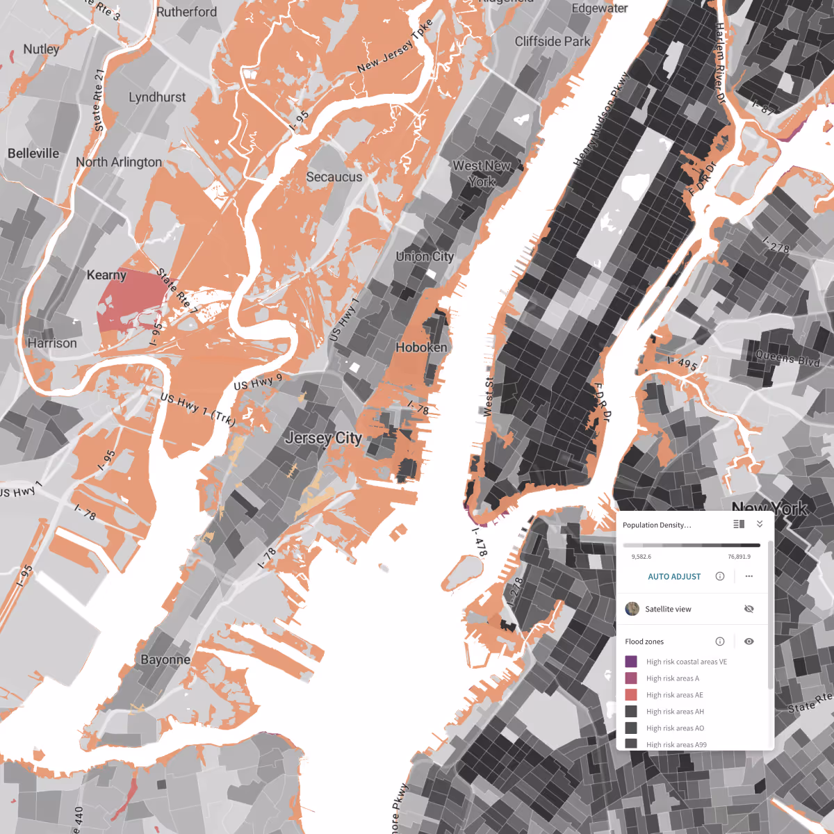
Instantly access a centralized data library of comprehensive public data with over 500,000 variables spanning consumer, crime, demographic, economic, election, environmental, equity, health, and transportation topics.
Thank you! Your submission has been received!
Oops! Something went wrong while submitting the form.
Accessible Datasets from Key Public Data Sources and More

Air Quality Index (AQI)
Source:
U.S. Environmental Protection Agency (EPA)


Public

Annual
Environmental
Urban Planning

Canadian Census
Source:
Statistics Canada
Public
Quinquennial
Cultural
Demographic
Economic
Housing

Citizen Voting Age Population Special Tabulation
Source:
U.S. Census Bureau
Public
Quinquennial
Political
Community Resilience Estimates
Source:
U.S. Census Bureau
Public
Annual
Economic
Environmental
Health

Comprehensive Housing Affordability Strategy (CHAS)
Source:
U.S. Department of Housing and Urban Development
Public
Variable
Economic
Housing
County Business Patterns
Source:
U.S. Census Bureau
Public
Annual
Consumer
Economic

County Typology Codes
Source:
U.S. Department of Agriculture
Public
Variable
Agriculture
Economic

EASI Consumer Data
Source:
EASI
Public
Annual
Consumer
Economic
Recreation
EASI Market Profile Data
Source:
EASI
Public
Annual
Economic
Consumer
EJSCREEN: Environmental Justice Screening and Mapping
Source:
U.S. Environmental Protection Agency (EPA)
Public
Quinquennial
Urban Planning
Environmental

European Statistics
Source:
Eurostat
Public
Annual
Cultural
Demographic
Environmental

Fatality Analysis Reporting System (FARS)
Source:
U.S. Department of Transportation
Public
Annual
Urban Planning
Transportation
Food Access Research Atlas
Source:
U.S. Department of Agriculture
Public
Variable
Urban Planning
Consumer
Health
Freight Analysis Framework (FAF)
Source:
U.S. Department of Transportation
Public
Annual
Economic
Transportation


IPUMS NHGIS Environmental Summaries
Source:
IPUMS
Public
Variable
Economic
Environmental
Health
Income Limits and Fair Market Rent
Source:
U.S. Department of Housing and Urban Development
Public
Annual
Consumer
Economic
Location Affordability Index
Source:
U.S. Department of Housing and Urban Development
Public
Variable
Urban Planning
Housing
Transportation
Economic
NOAA Climate Normals
Source:
National Oceanic and Atmospheric Administration (NOAA)
Public
Variable
Environmental
Agriculture

National Risk Index
Source:
Federal Emergency Management Agency (FEMA)
Public
Variable
Urban Planning
Environmental
Picture of Subsidized Households
Source:
U.S. Department of Housing and Urban Development
Public
Annual
Economic

Quarterly Census of Employment and Wages (QCEW)
Source:
Bureau of Labor Statistics
Public
Quarterly
Economic
Religion (RCMS)
Source:
Social Explorer
Public
Annual
Cultural
Demographic

Small Area Fair Market Rent
Source:
U.S. Department of Housing and Urban Development
Public
Annual
Economic
Small Area Income and Poverty Estimates (SAIPE)
Source:
U.S. Census Bureau
Public
Annual
Economic
Demographic

Social Vulnerability Index (SVI)
Source:
Centers for Disease Control and Prevention
Public
Biennial
Urban Planning
Health
Demographic
Toxics Release Inventory (TRI)
Source:
U.S. Environmental Protection Agency (EPA)
Public
Annual
Environmental
U.S. Census Data
Source:
U.S. Census Bureau
Public
Decennial
Demographic
Economic


UK Census
Source:
Office for National Statistics
Public
Decennial
Demographic
Economic
Cultural
Education
Health

ZIP Codes Business Patterns
Source:
U.S. Census Bureau
Public
Annual
Economic
Consumer
Demographic