Change geography for data display
Social Explorer allows you to examine datasets at a wide variety of geographic levels from city, county, and congressional district all the way down to school district, census tract, and block group. The amount of geographic detail adjusts automatically depending on your zoom level. However, not all geographies can be displayed automatically, some (like Census Block Groups and Zip Codes) you have to choose manually. That's very easy to do… here's how:
- Click Change geography level in the Change data menu.
- Select the geography level you want to visualize, such as County or Census Tract.
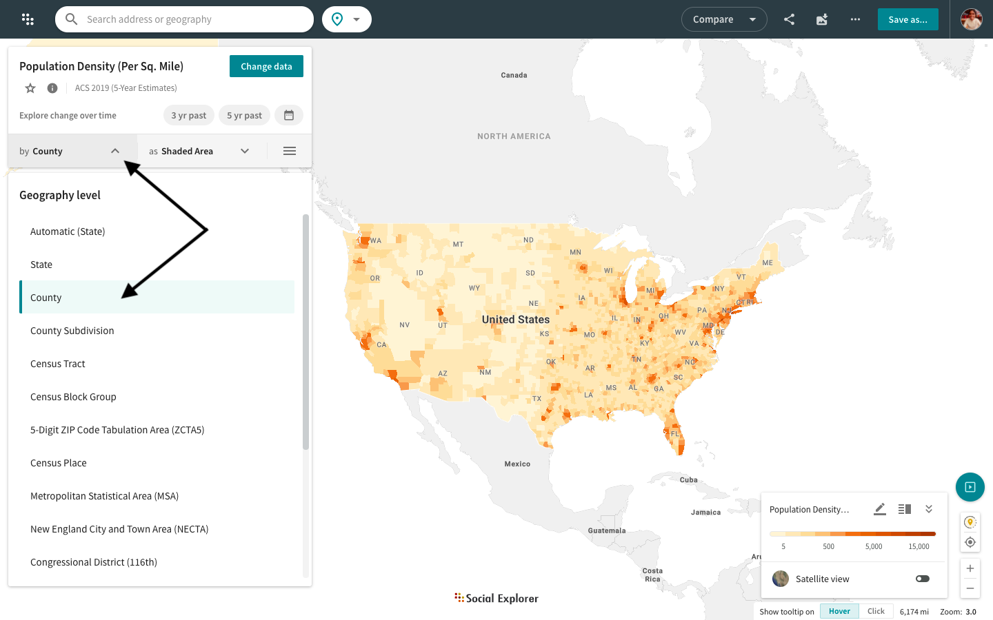
Once you set the geography manually, the selection will stay locked, so you can explore it on any zoom level. For example, you can view county-level data or even Census Tracts for the entire United States.
You can explore data by ZCTAs, School Districts (UNSD, SCSD, ELSD), Metropolitan Statistical Areas (MSA), Public Use Microdata Areas (PUMA), Congressional Districts, and many other geographic levels. Read more about these geographies:
- 5-Digit ZIP Code Tabulation Areas (ZCTA5) created by the Census Bureau are approximate area representations of U.S. Postal Service (USPS) ZIP Code service areas. Data is not available for zip codes, since it is not a census geography.
- Public Use Microdata Areas (PUMA) are Census Bureau sample tabulation areas containing at least 100,000 people. PUMAs are statistical geographic areas defined for the dissemination of Public Use Microdata Sample (PUMS) data. They are also used for disseminating American Community Survey (ACS) estimates. PUMAs are defined after each census by individual states and the Census Bureau’s Geography Division. Identified by a five-digit code (unique within each state), PUMAs are geographically contiguous and nest within states or equivalent entities.
- Metropolitan Statistical Areas contain core urban areas of 50,000 people or more. They consist of one or more counties in the core area as well as any adjacent counties which have a high degree of social and economic integration with the urban core (for example, the New York City metro contains parts of New Jersey as well).
- School Districts come in three layers: Unified School District (UNSD); Secondary School District (SCSD); and Elementary School District (ELSD).
- Census Places include incorporated places, such as cities, boroughs, towns, and villages, as well as census-designated places, like an unincorporated community or a concentration of population, housing, and commercial structures identifiable by name but not within an incorporated place. The designation and delineation of census places have evolved over time. The full history of its evolution is available here for your reference.