


| Documentation: | Census 2000 |
you are here:
choose a survey
survey
document
chapter
Publisher: U.S. Census Bureau
Survey: Census 2000
| Document: | Summary File 1 Technical Documentation |
| citation: | Social Explorer, U.S. Census Bureau; 2000 Census of Population and Housing, Summary File 1: Technical Documentation, 2001. |
Chapter Contents
There are two map series that support Census 2000 Summary File 1 data dissemination; the Census 2000 Block Map and the Census Tract Outline Map (Census 2000). The Census Bureau will produce each of these map types in 2 formats, Adobe's Portable Document Format (PDF) and Hewlett Packards Graphic Language 2 (HP-GL/2). The PDF files will be available through the Census Bureau's American FactFinder and as DVD products. These maps will also be available as paper plots, which can be ordered from the Census Bureau. All Census 2000 map products can be ordered from Customer Services, U.S. Census Bureau (301-763-INFO (4636)).
These large-scale maps depict the smallest geographic entities for which the Census Bureau presents data, census blocks. Census 2000 block maps will be produced for American Indian/Alaska Native/Hawaiian home land areas, counties, county subdivisions, and places. The maps show the boundaries, names, and codes for American Indian/Alaska Native/Hawaiian home land areas, counties, county subdivisions, places, census tracts and blocks. Base feature details, such as roads, railroads, and water features are also shown. The intent of this map series is to produce a layout of maps for each entity on the smallest possible number of map sheets at the maximum practical scale, dependent on the areal size of the entity and the density of the block pattern; the latter affects the display of block numbers and feature identifiers. Each entity will be covered by one or more parent sheets at a single scale, and when necessary, inset maps at larger scales. For entities that are mapped on two or more map sheets, an index map showing the map sheet configuration will also be produced.
These maps show the boundaries and numbers of the census tracts as well as the named features underlying the boundaries. They also show the boundaries, names and codes for American Indian/Alaska Native/Hawaiian home land areas, counties, county subdivisions, and places. The scale of the maps will be optimized to keep the number of map sheets for each area to a minimum, but the scale and number of sheets will vary by the areal size of the county and the complexity of the census tracts.
Figure F-1. Census 2000 Block Map Legend
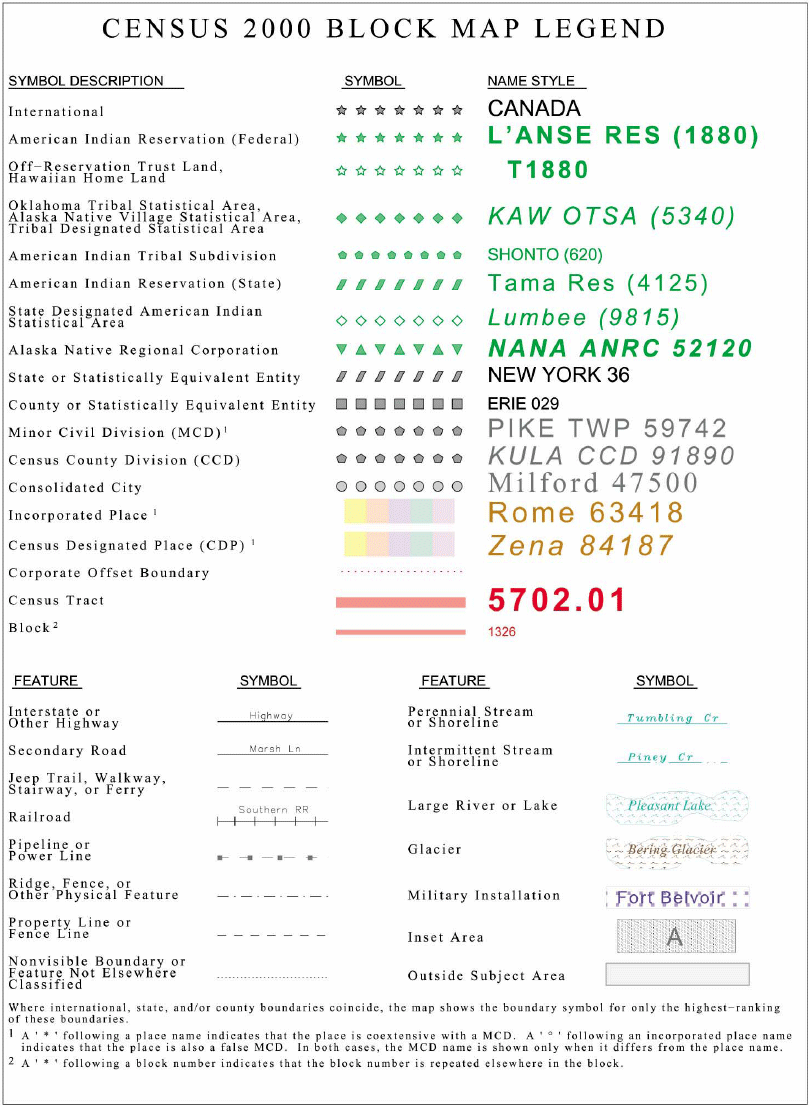
Figure F-2. Census 2000 Block Map
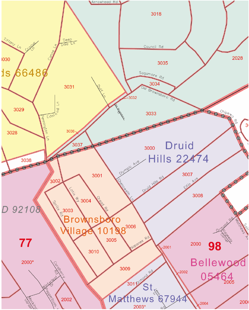
Figure F-3. Census Tract Outline Map Legend (Census 2000)
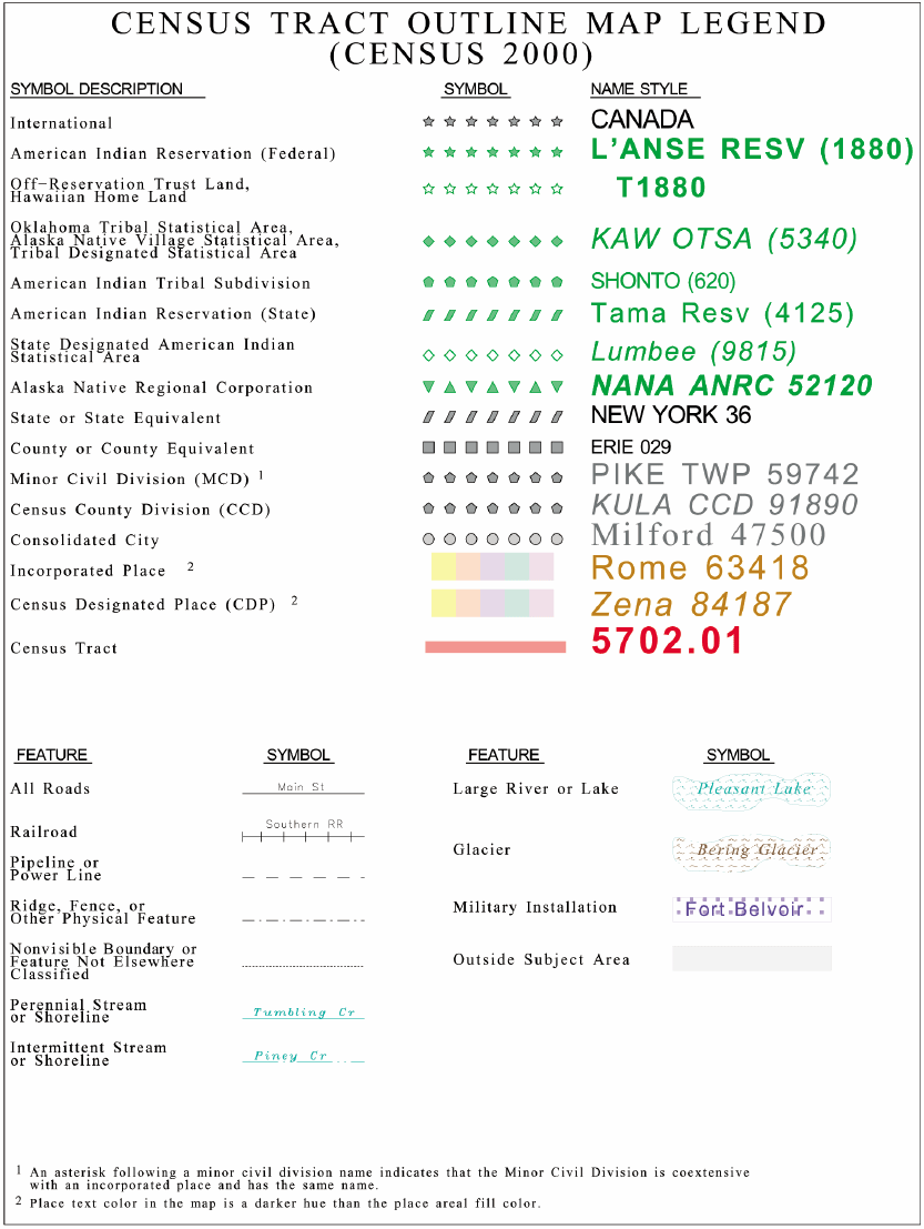
Figure F-4. Census Tract Outline Map (Census 2000)
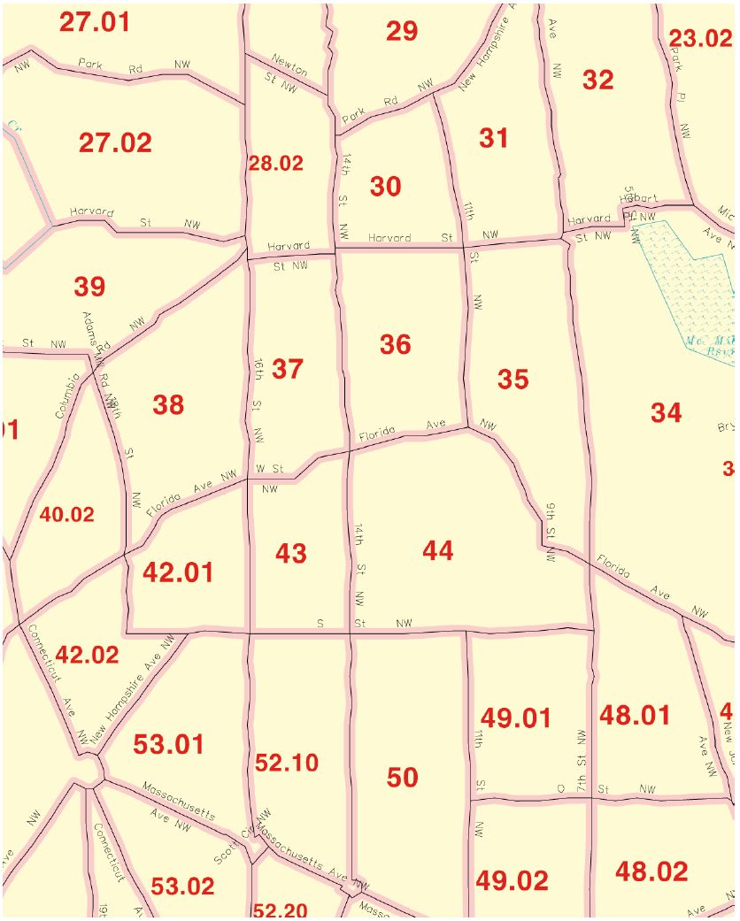
Figure F-1. Census 2000 Block Map Legend
Figure F-2. Census 2000 Block Map
Figure F-3. Census Tract Outline Map Legend (Census 2000)
Figure F-4. Census Tract Outline Map (Census 2000)

