Loading geographies from FIPS codes
You can load geography selection for a report using FIPS codes (Federal Information Processing Standard).
Each geographic area has a unique FIPS code. For example, each county in the U.S. has a unique five-digit FIPS code assigned to it by the government, while states have a two-digit code.
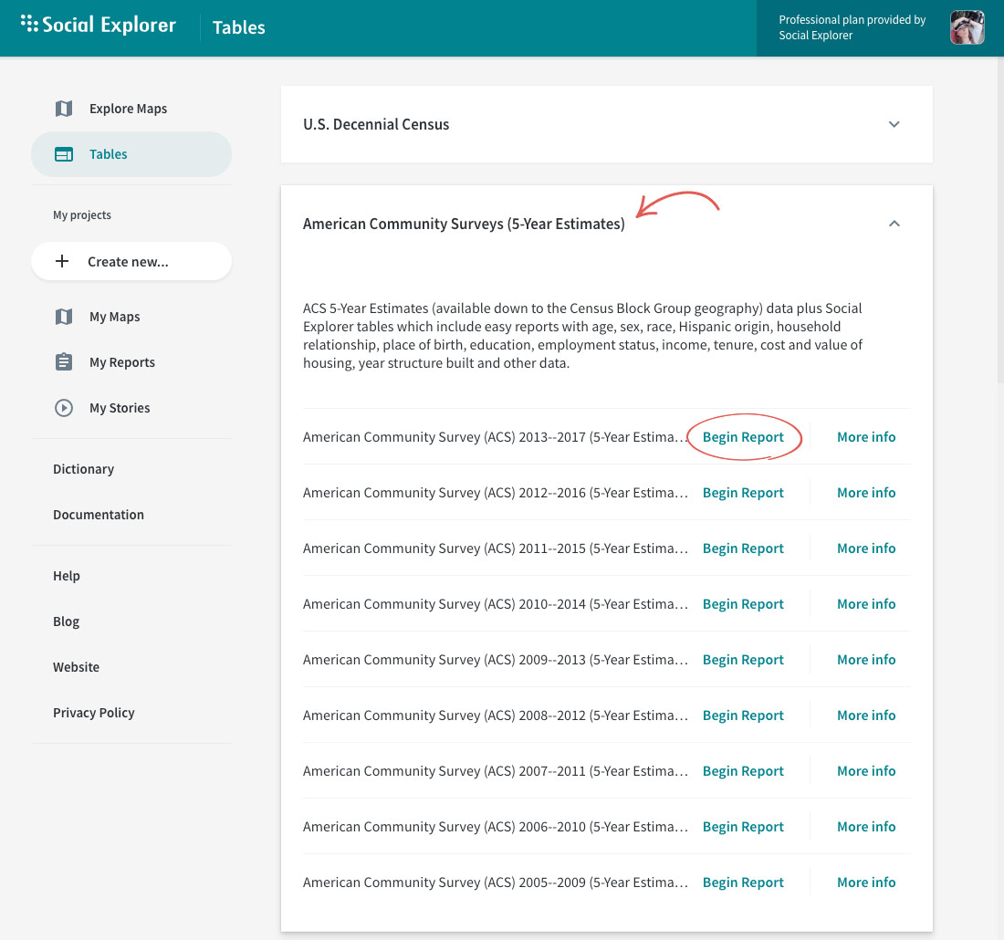
- Head over to the Tables page.
- Click Begin Report next to a survey you're interested in.
- Select the FIPS Codes tab.
- Select the geographic type you have FIPS codes for from the dropdown.
- Enter FIPS codes for one or more geographic areas and click Add.
You can enter a subset of a FIPS code to select all nested geographies. For example, if you choose County from the geo type and enter 36 as your FIPS code, you will have selected ALL counties in NY State.
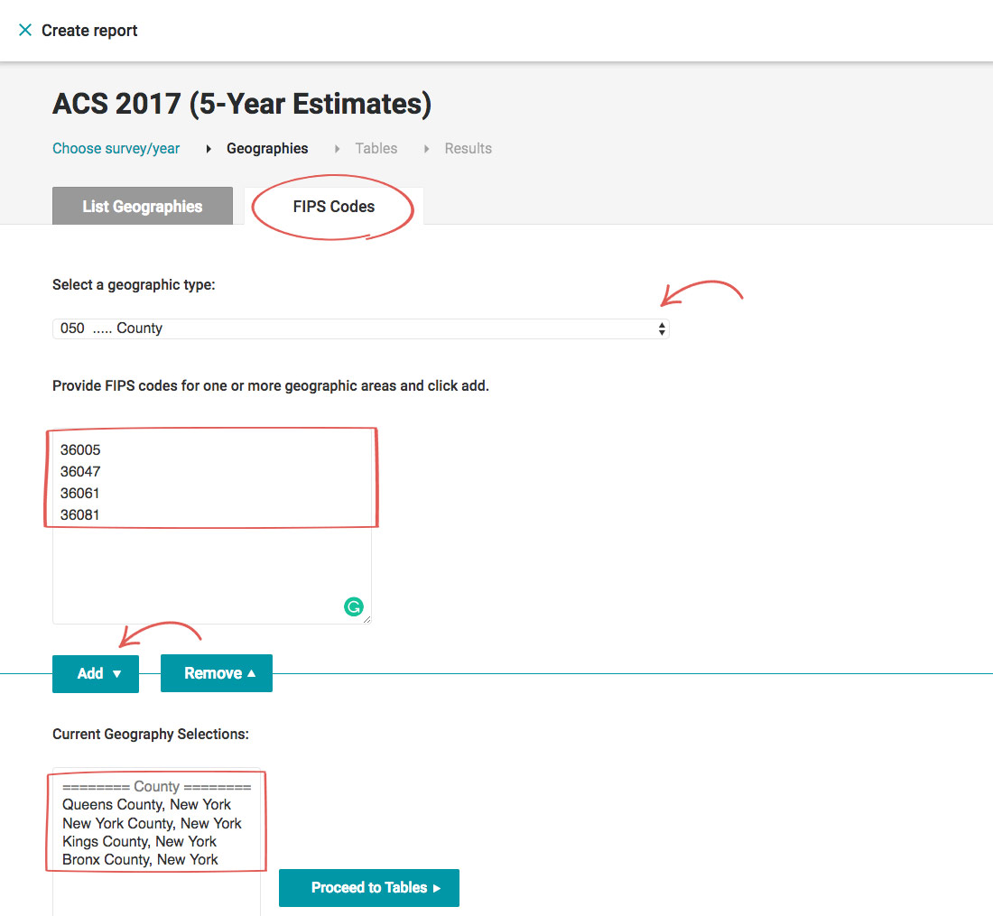
- Click Proceed to Tables.
- Select a dataset.
For certain surveys, we have included both the original, unabridged dataset and the dataset we preprocessed with the most popular variables.
- Select one or more tables and click Add.
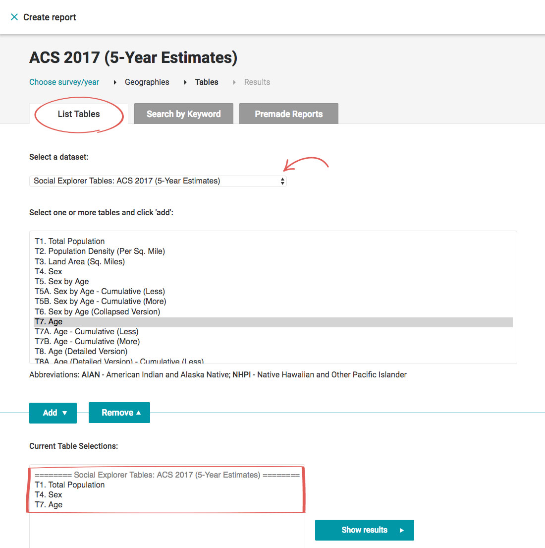
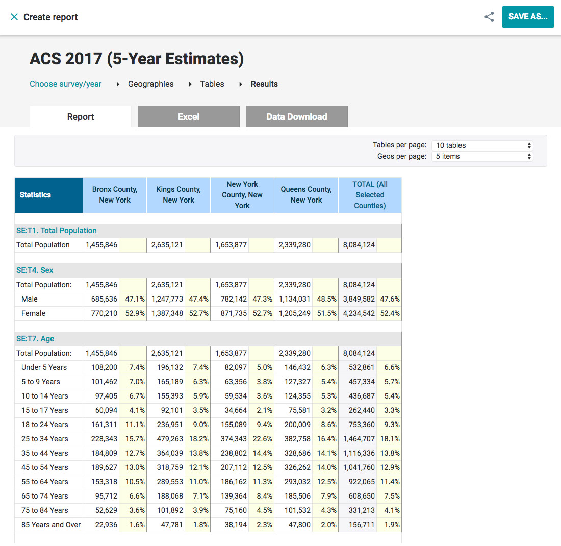
- Click Show results.