
We use cookies to understand how the website is being used and to ensure you get the best possible experience.
By continuing to use this site, you consent to this policy.
About cookies
WEDNESDAY, FEB 05, 2020
For anyone working with U.S. based location data, shapefiles—a file format for storing geographic data—are critical to the task of visualizing and analyzing spatial patterns in the data. However, finding shapefiles for U.S. geographies with well-clipped boundaries is extremely difficult, while finding them all in one place, neatly organized, and easy to download is almost impossible.
For instance, real estate analysts require land use data with accurate shorelines in order to distinguish buildable land from non-buildable land. Hence, data must be clipped to shoreline, otherwise available property build data comes across as skewed. In the absence of such a high level of accuracy in the data, analysts are often left with no choice but to draw the shorelines manually.
At Social Explorer, we are committed to helping our users do more with our platform. Therefore, Social Explorer brings to you a brand new Geodata library, a rich repository of geographic data for easy downloads.

Easily download geodata for United States geographies from 1790 to 2019 as shapefiles or in other formats. Social Explorer’s geodata library consists of a large collection of coastline clipped versions of U.S. geographies. These shapefiles, which include detailed coastlines, were created using the TIGER/Line and AREAWATER shapefiles from the U.S. Census Bureau.
The individual shapefiles were processed using specialized GIS tools and then appended together to include complete coastline coverage. Using a series of GIS operations, the Social Explorer team first created a perfect coastline for each year, and then each geography was coast clipped with the corresponding year.
As a result, the Geodata library contains high-resolution shapefiles for a wide variety of geographic levels covering the entire United States geography for all available years. Apart from shapefiles, these coastline clipped U.S. geographies are also available for download in other formats such as GeoJSON or KML on demand, as of now.
To start exploring the Geodata library, log in to your account and click on the Geodata tab in the left-hand side panel of your Social Explorer dashboard, or if you are already logged in, click here.
Explore the Geodata library by our collections, sorted into different levels of geography, or search by all datasets. Click on a collection, U.S. County 1790 – 2019 for example, then select the year for which you’d like to download a U.S. county shapefile and hit the download button next to the title of the file.
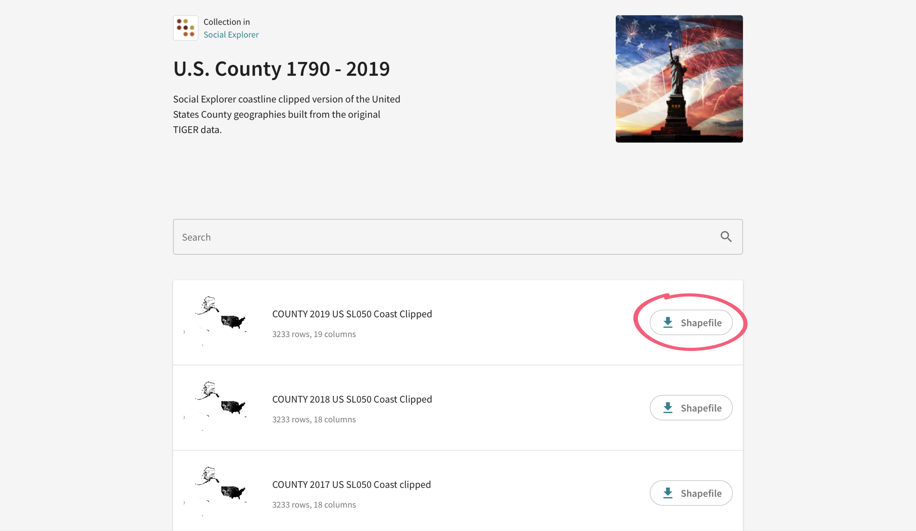
You can also click on the filename to get more information about the file such as an abstract from the U.S. Census Bureau on the original files, purpose of use, use constraints, sample data, etc.
Give it a shot!
Try out this exciting new feature on Social Explorer and tell us what you think. Also, keep an eye out for more collections to be added soon to the Geodata library. Send us your suggestions, comments, and questions to feedback@socialexplorer.com.
Author: Amrapali Saha